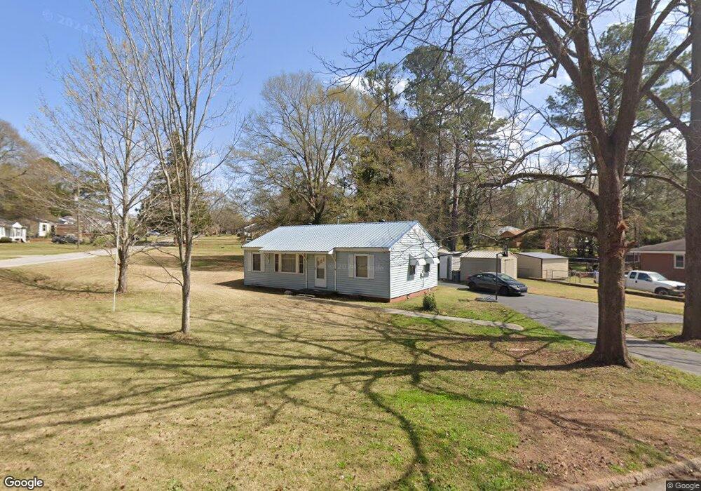
220 Rutland Cir Lagrange, GA 30241
Estimated Value: $151,000 - $209,000
3
Beds
2
Baths
1,192
Sq Ft
$148/Sq Ft
Est. Value
About This Home
This home is located at 220 Rutland Cir, Lagrange, GA 30241 and is currently estimated at $176,306, approximately $147 per square foot. 220 Rutland Cir is a home located in Troup County with nearby schools including Franklin Forest Elementary School, Hollis Hand Elementary School, and Ethel W. Kight Elementary School.
Ownership History
Date
Name
Owned For
Owner Type
Purchase Details
Closed on
Aug 27, 2020
Sold by
Carse Jon Paul
Bought by
Carse Adam Jon
Current Estimated Value
Purchase Details
Closed on
Dec 17, 1996
Sold by
Hilda Cobb King
Bought by
Carse Jon Paul and Sandra Kaye
Purchase Details
Closed on
Jan 17, 1990
Sold by
Cobb Howard Sidney
Bought by
Hilda Cobb King
Purchase Details
Closed on
Oct 1, 1984
Sold by
Cobb Howard Sidney Jr Etal
Bought by
Cobb Howard Sidney
Purchase Details
Closed on
May 8, 1957
Sold by
Jabaley Development Corp
Bought by
Cobb Howard Sidney Jr Etal
Purchase Details
Closed on
Aug 1, 1956
Sold by
Neese Elbert M
Bought by
Jabaley Development Corp
Create a Home Valuation Report for This Property
The Home Valuation Report is an in-depth analysis detailing your home's value as well as a comparison with similar homes in the area
Home Values in the Area
Average Home Value in this Area
Purchase History
| Date | Buyer | Sale Price | Title Company |
|---|---|---|---|
| Carse Adam Jon | -- | -- | |
| Carse Jon Paul | $45,000 | -- | |
| Hilda Cobb King | -- | -- | |
| Cobb Howard Sidney | -- | -- | |
| Cobb Howard Sidney Jr Etal | -- | -- | |
| Jabaley Development Corp | -- | -- |
Source: Public Records
Tax History Compared to Growth
Tax History
| Year | Tax Paid | Tax Assessment Tax Assessment Total Assessment is a certain percentage of the fair market value that is determined by local assessors to be the total taxable value of land and additions on the property. | Land | Improvement |
|---|---|---|---|---|
| 2024 | $1,202 | $46,060 | $8,000 | $38,060 |
| 2023 | $1,232 | $47,172 | $10,360 | $36,812 |
| 2022 | $1,213 | $45,452 | $10,360 | $35,092 |
| 2021 | $889 | $31,460 | $10,360 | $21,100 |
| 2020 | $889 | $31,460 | $10,360 | $21,100 |
| 2019 | $697 | $25,096 | $6,076 | $19,020 |
| 2018 | $697 | $25,096 | $6,076 | $19,020 |
| 2017 | $697 | $25,096 | $6,076 | $19,020 |
| 2016 | $679 | $24,482 | $6,076 | $18,406 |
| 2015 | $634 | $22,977 | $6,076 | $16,901 |
| 2014 | $601 | $21,856 | $6,076 | $15,780 |
| 2013 | -- | $22,856 | $6,076 | $16,780 |
Source: Public Records
Map
Nearby Homes
- 210 Hearthstone Dr
- 130 Clara Jean Ct
- 121 Ct
- 618 S Harlem Cir
- 616 S Harlem Cir
- 706 N Harlem Cir
- 305 Lenox Cir
- 5 Curran Ave
- 608 S Harlem Cir
- 226 Lenox Cir
- 606 S Harlem Cir
- 105 Lenox Cir
- 101 Lenox Cir
- 0 N Barnard Ave
- 600 S Harlem Cir
- 131 Foch St
- 121 de Groat St
- 906 Georgia Ave
- 902 Georgia Ave
- 109 Dogwood Dr
- 216 Rutland Cir
- 224 Rutland Cir
- 233 Rutland Cir
- 243 Rutland Cir
- 241 Rutland Cir
- 231 Rutland Cir
- 214 Rutland Cir
- 245 Rutland Cir
- 226 Rutland Cir
- 239 Rutland Cir
- 229 Rutland Cir
- 210 Rutland Cir
- 247 Rutland Cir
- 237 Rutland Cir
- 249 Rutland Cir
- 228 Rutland Cir
- 208 Rutland Cir
- 227 Rutland Cir
- 251 Rutland Cir
- 235 Rutland Cir