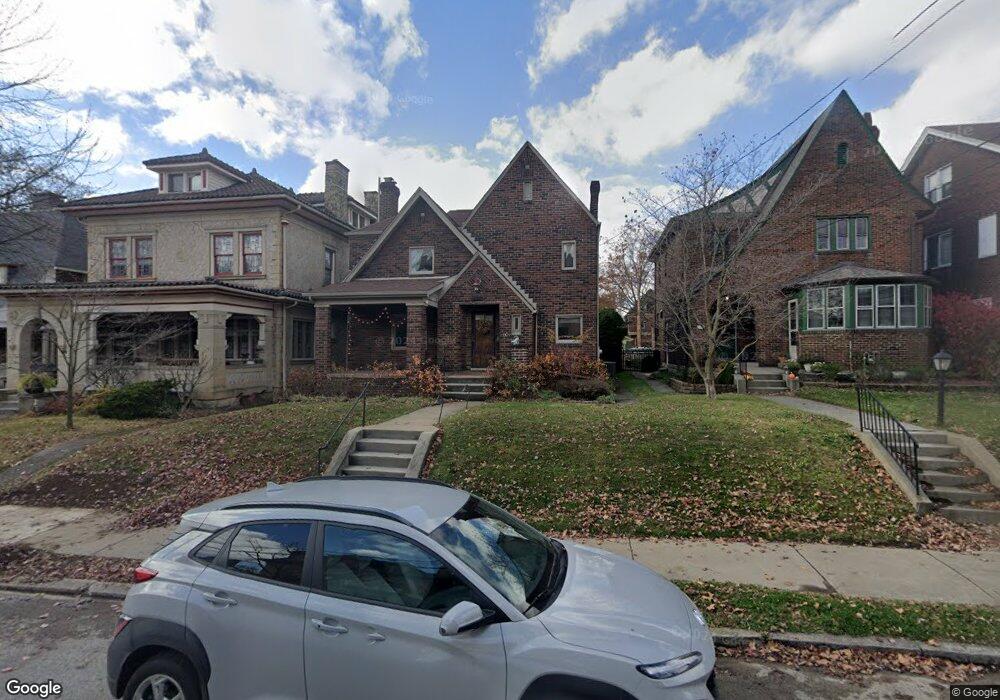
220 S Atlantic Ave Pittsburgh, PA 15224
Bloomfield NeighborhoodEstimated Value: $474,000 - $727,000
3
Beds
2
Baths
2,166
Sq Ft
$283/Sq Ft
Est. Value
About This Home
This home is located at 220 S Atlantic Ave, Pittsburgh, PA 15224 and is currently estimated at $612,570, approximately $282 per square foot. 220 S Atlantic Ave is a home located in Allegheny County with nearby schools including Pittsburgh Arsenal 6-8, Pittsburgh Woolslair K-5, and Pittsburgh Milliones 6-12.
Ownership History
Date
Name
Owned For
Owner Type
Purchase Details
Closed on
Jun 22, 2021
Sold by
Gaynor Denise L W
Bought by
Weber Michael S
Current Estimated Value
Home Financials for this Owner
Home Financials are based on the most recent Mortgage that was taken out on this home.
Original Mortgage
$480,000
Outstanding Balance
$434,580
Interest Rate
2.9%
Mortgage Type
New Conventional
Estimated Equity
$177,990
Purchase Details
Closed on
Oct 6, 1999
Sold by
Garlicki Genevieve A and Cwalinski Edward M
Bought by
Gaynor Patrick W W and Gaynor Denise L W
Create a Home Valuation Report for This Property
The Home Valuation Report is an in-depth analysis detailing your home's value as well as a comparison with similar homes in the area
Home Values in the Area
Average Home Value in this Area
Purchase History
| Date | Buyer | Sale Price | Title Company |
|---|---|---|---|
| Weber Michael S | $600,000 | -- | |
| Weber Michael S | $600,000 | Penn Bridge Land Abstract Co | |
| Gaynor Patrick W W | $82,500 | -- |
Source: Public Records
Mortgage History
| Date | Status | Borrower | Loan Amount |
|---|---|---|---|
| Open | Weber Michael S | $480,000 |
Source: Public Records
Tax History Compared to Growth
Tax History
| Year | Tax Paid | Tax Assessment Tax Assessment Total Assessment is a certain percentage of the fair market value that is determined by local assessors to be the total taxable value of land and additions on the property. | Land | Improvement |
|---|---|---|---|---|
| 2025 | $6,900 | $299,500 | $28,500 | $271,000 |
| 2024 | $6,900 | $299,500 | $28,500 | $271,000 |
| 2023 | $1,889 | $82,000 | $28,500 | $53,500 |
| 2022 | $1,865 | $82,000 | $28,500 | $53,500 |
| 2021 | $1,788 | $82,000 | $28,500 | $53,500 |
| 2020 | $1,856 | $82,000 | $28,500 | $53,500 |
| 2019 | $1,856 | $82,000 | $28,500 | $53,500 |
| 2018 | $1,396 | $82,000 | $28,500 | $53,500 |
| 2017 | $1,856 | $82,000 | $28,500 | $53,500 |
| 2016 | $388 | $82,000 | $28,500 | $53,500 |
| 2015 | $388 | $82,000 | $28,500 | $53,500 |
| 2014 | $1,815 | $82,000 | $28,500 | $53,500 |
Source: Public Records
Map
Nearby Homes
- 4903 Penn Ave
- 205 S Evaline St
- 5412 Coral St
- 5209 Penn Ave
- 365 S Evaline St
- 5217 Broad St
- 5326 Kincaid St
- 5311 Kincaid St
- 5179 Kincaid St
- 5419 Broad St
- 5339 Kincaid St
- 5402 Kincaid St
- 5433 Broad St
- 230 N Aiken Ave
- 5021 Broad St
- 425 S Winebiddle St
- 239 N Aiken Ave
- 5016 Kincaid St
- 4913 Dearborn St
- 5437 Kincaid St
- 224 S Atlantic Ave
- 218 S Atlantic Ave
- 216 S Atlantic Ave
- 228 S Atlantic Ave
- 214 S Atlantic Ave
- 230 S Atlantic Ave
- 210 S Atlantic Ave
- 208 S Atlantic Ave
- 244 S Atlantic Ave
- 204 S Atlantic Ave
- 229 S Pacific Ave
- 227 S Pacific Ave
- 231 S Pacific Ave
- 223 S Pacific Ave
- 225 S Atlantic Ave
- 223 S Atlantic Ave
- 5220 Coral St
- 233 S Pacific Ave
- 219 S Pacific Ave
- 227 S Atlantic Ave