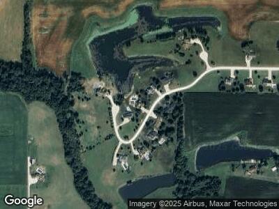
220 S Meadow Ln Concord, IL 62631
Estimated Value: $191,000 - $302,000
--
Bed
--
Bath
1,504
Sq Ft
$173/Sq Ft
Est. Value
About This Home
This home is located at 220 S Meadow Ln, Concord, IL 62631 and is currently estimated at $259,852, approximately $172 per square foot. 220 S Meadow Ln is a home located in Morgan County with nearby schools including Triopia Grade School and Triopia Junior/Senior High School.
Ownership History
Date
Name
Owned For
Owner Type
Purchase Details
Closed on
Jun 1, 2012
Sold by
Rolf Brian D and Rolf Traci L
Bought by
Miller Ryan P and Miller Abigail E
Current Estimated Value
Home Financials for this Owner
Home Financials are based on the most recent Mortgage that was taken out on this home.
Original Mortgage
$125,000
Interest Rate
3.1%
Mortgage Type
New Conventional
Purchase Details
Closed on
Sep 5, 2006
Sold by
Carls Jon R and Carls Yvonne L
Bought by
Rolf Brian D and Rolf Traci L
Home Financials for this Owner
Home Financials are based on the most recent Mortgage that was taken out on this home.
Original Mortgage
$154,000
Interest Rate
6.77%
Mortgage Type
New Conventional
Create a Home Valuation Report for This Property
The Home Valuation Report is an in-depth analysis detailing your home's value as well as a comparison with similar homes in the area
Home Values in the Area
Average Home Value in this Area
Purchase History
| Date | Buyer | Sale Price | Title Company |
|---|---|---|---|
| Miller Ryan P | $69,333 | None Available | |
| Rolf Brian D | $199,500 | None Available |
Source: Public Records
Mortgage History
| Date | Status | Borrower | Loan Amount |
|---|---|---|---|
| Open | Miller Ryan P | $150,000 | |
| Closed | Miller Ryan P | $125,000 | |
| Previous Owner | Rolf Brian D | $171,000 | |
| Previous Owner | Rolf Brian D | $154,000 | |
| Previous Owner | Carls Jon R | $164,800 | |
| Previous Owner | Carls Jon R | $51,120 | |
| Previous Owner | Carls Jon R | $35,292 | |
| Previous Owner | Carls Jon R | $93,616 | |
| Previous Owner | Carls Jon R | $15,116 |
Source: Public Records
Tax History Compared to Growth
Tax History
| Year | Tax Paid | Tax Assessment Tax Assessment Total Assessment is a certain percentage of the fair market value that is determined by local assessors to be the total taxable value of land and additions on the property. | Land | Improvement |
|---|---|---|---|---|
| 2023 | $5,160 | $73,680 | $6,670 | $67,010 |
| 2022 | $4,741 | $73,680 | $6,670 | $67,010 |
| 2021 | $5,158 | $79,380 | $7,000 | $72,380 |
| 2020 | $5,152 | $75,930 | $7,000 | $68,930 |
| 2019 | $5,031 | $75,250 | $7,000 | $68,250 |
| 2018 | $4,810 | $73,060 | $6,800 | $66,260 |
| 2017 | $4,733 | $71,630 | $6,670 | $64,960 |
| 2016 | $4,739 | $71,370 | $5,160 | $66,210 |
| 2015 | $4,073 | $59,980 | $4,340 | $55,640 |
| 2014 | $4,073 | $58,800 | $4,250 | $54,550 |
| 2013 | $3,724 | $58,800 | $4,250 | $54,550 |
Source: Public Records
Map
Nearby Homes
- 108 Arenz St
- 1867 Saint Pauls Church Rd
- 0 Hammer Rd
- 411 Congress St
- 938 Cylinder Head Rd
- 319 Superior St
- 1865 Gravel Springs Cir
- 1609 Baldwin Rd
- 523 Spunky Ridge Rd
- 4548 Upper Meredosia Rd
- 1311 McGlasson Rd
- 104 Edlen Ln
- 12843 Orchard Rd
- 13110 6 Mile Rd
- 412 Eagle Dr
- 408 Eagle Dr
- 404 Eagle Dr
- 318 Eagle Dr
- 314 Eagle Dr
- 502 Eagle Dr
