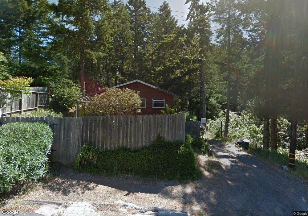
220 Seafoam Rd Whitethorn, CA 95589
Shelter Cove NeighborhoodEstimated Value: $175,000 - $319,000
--
Bed
--
Bath
--
Sq Ft
3,790
Sq Ft Lot
About This Home
This home is located at 220 Seafoam Rd, Whitethorn, CA 95589 and is currently estimated at $252,498. 220 Seafoam Rd is a home located in Humboldt County.
Ownership History
Date
Name
Owned For
Owner Type
Purchase Details
Closed on
Jul 17, 2002
Sold by
Stock John
Bought by
Smith Maureen Elizabeth
Current Estimated Value
Purchase Details
Closed on
Jan 22, 2001
Sold by
Bonham Family Trust
Bought by
Stock John
Home Financials for this Owner
Home Financials are based on the most recent Mortgage that was taken out on this home.
Original Mortgage
$60,000
Interest Rate
7.08%
Mortgage Type
Seller Take Back
Create a Home Valuation Report for This Property
The Home Valuation Report is an in-depth analysis detailing your home's value as well as a comparison with similar homes in the area
Home Values in the Area
Average Home Value in this Area
Purchase History
| Date | Buyer | Sale Price | Title Company |
|---|---|---|---|
| Smith Maureen Elizabeth | -- | -- | |
| Stock John | $67,500 | Fidelity National Title Co |
Source: Public Records
Mortgage History
| Date | Status | Borrower | Loan Amount |
|---|---|---|---|
| Previous Owner | Stock John | $60,000 |
Source: Public Records
Tax History Compared to Growth
Tax History
| Year | Tax Paid | Tax Assessment Tax Assessment Total Assessment is a certain percentage of the fair market value that is determined by local assessors to be the total taxable value of land and additions on the property. | Land | Improvement |
|---|---|---|---|---|
| 2025 | $1,394 | $108,597 | $36,196 | $72,401 |
| 2024 | $1,394 | $106,469 | $35,487 | $70,982 |
| 2023 | $1,397 | $104,383 | $34,792 | $69,591 |
| 2022 | $1,379 | $102,337 | $34,110 | $68,227 |
| 2021 | $1,336 | $100,332 | $33,442 | $66,890 |
| 2020 | $1,342 | $99,305 | $33,100 | $66,205 |
| 2019 | $1,314 | $97,358 | $32,451 | $64,907 |
| 2018 | $1,295 | $95,450 | $31,815 | $63,635 |
| 2017 | $1,175 | $93,580 | $31,192 | $62,388 |
| 2016 | $1,167 | $91,746 | $30,581 | $61,165 |
| 2015 | $1,161 | $90,369 | $30,122 | $60,247 |
| 2014 | $1,172 | $88,599 | $29,532 | $59,067 |
Source: Public Records
Map
Nearby Homes