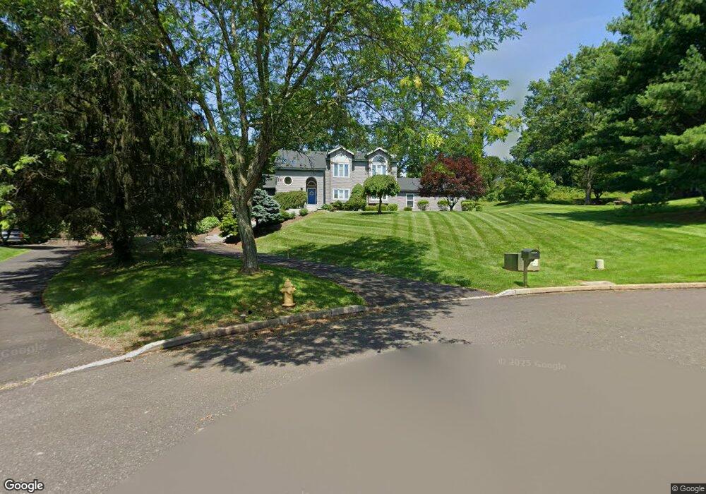
220 Southwind Dr Doylestown, PA 18901
Estimated Value: $924,827 - $1,005,000
3
Beds
3
Baths
3,803
Sq Ft
$252/Sq Ft
Est. Value
About This Home
This home is located at 220 Southwind Dr, Doylestown, PA 18901 and is currently estimated at $956,707, approximately $251 per square foot. 220 Southwind Dr is a home located in Bucks County with nearby schools including Groveland Elementary School, Tohickon Middle School, and Central Bucks High School-West.
Ownership History
Date
Name
Owned For
Owner Type
Purchase Details
Closed on
Apr 16, 2002
Sold by
Yoshpa Michael
Bought by
Ammon Rodney D and Ammon Lori B
Current Estimated Value
Home Financials for this Owner
Home Financials are based on the most recent Mortgage that was taken out on this home.
Original Mortgage
$300,700
Outstanding Balance
$127,497
Interest Rate
7.13%
Estimated Equity
$829,210
Purchase Details
Closed on
Jun 9, 1998
Sold by
Smith Deborah Carter and Martino Deborah
Bought by
Yoshpa Michael
Home Financials for this Owner
Home Financials are based on the most recent Mortgage that was taken out on this home.
Original Mortgage
$227,000
Interest Rate
7.02%
Purchase Details
Closed on
Sep 16, 1996
Sold by
Karasik Arnold M and Karasik Antonia
Bought by
Smith Deborah Carter
Create a Home Valuation Report for This Property
The Home Valuation Report is an in-depth analysis detailing your home's value as well as a comparison with similar homes in the area
Home Values in the Area
Average Home Value in this Area
Purchase History
| Date | Buyer | Sale Price | Title Company |
|---|---|---|---|
| Ammon Rodney D | $385,000 | -- | |
| Yoshpa Michael | $315,000 | Lawyers Title Insurance Corp | |
| Smith Deborah Carter | $275,000 | -- |
Source: Public Records
Mortgage History
| Date | Status | Borrower | Loan Amount |
|---|---|---|---|
| Open | Ammon Rodney D | $300,700 | |
| Previous Owner | Yoshpa Michael | $227,000 | |
| Closed | Yoshpa Michael | $56,500 | |
| Closed | Ammon Rodney D | $65,000 |
Source: Public Records
Tax History Compared to Growth
Tax History
| Year | Tax Paid | Tax Assessment Tax Assessment Total Assessment is a certain percentage of the fair market value that is determined by local assessors to be the total taxable value of land and additions on the property. | Land | Improvement |
|---|---|---|---|---|
| 2025 | $9,776 | $55,240 | $11,680 | $43,560 |
| 2024 | $9,776 | $55,240 | $11,680 | $43,560 |
| 2023 | $9,321 | $55,240 | $11,680 | $43,560 |
| 2022 | $9,217 | $55,240 | $11,680 | $43,560 |
| 2021 | $9,028 | $55,240 | $11,680 | $43,560 |
| 2020 | $8,986 | $55,240 | $11,680 | $43,560 |
| 2019 | $8,890 | $55,240 | $11,680 | $43,560 |
| 2018 | $8,862 | $55,240 | $11,680 | $43,560 |
| 2017 | $8,793 | $55,240 | $11,680 | $43,560 |
| 2016 | $8,738 | $55,240 | $11,680 | $43,560 |
| 2015 | -- | $55,240 | $11,680 | $43,560 |
| 2014 | -- | $55,240 | $11,680 | $43,560 |
Source: Public Records
Map
Nearby Homes
- 301 Windy Run Rd
- 3711 Jacob Stout Rd Unit 5
- 100 Bishops Gate Ln Unit 67
- 3723 William Daves Rd
- 194 Victoria Ct Unit 143
- 114 Blackfriars Cir
- 3765 William Daves Rd
- 4748 Bishop Cir
- 3838 Jacob Stout Rd
- 5437 Rinker Cir Unit 283
- 157 Pine Run Rd
- 3923 Ferry Rd
- 62 Constitution Ave
- 1 Gatehouse Ln
- 4 Old Colonial Dr Unit 254
- Lot 6 Henry Ct
- 90 Chapman Ave
- 418 North St
- 333 Dorset Ct Unit 333
- 4263 Kleinot Dr
- 222 Southwind Dr
- 218 Southwind Dr
- 125 N Chapman Rd
- 221 Southwind Dr
- 216 Southwind Dr
- 219 Southwind Dr
- 217 Southwind Dr
- 90 N Chapman Rd
- 98 N Chapman Rd
- 215 Southwind Dr
- 214 Southwind Dr
- 82 N Chapman Rd
- 106 N Chapman Rd
- 103 Windsong Dr
- 74 N Chapman Rd
- 101 Windsong Dr
- 105 Windsong Dr
- 212 Southwind Dr
- 213 Southwind Dr
- 114 N Chapman Rd