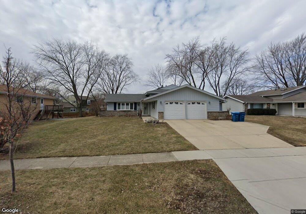
220 Wianno Ln Schaumburg, IL 60194
Hoover Park NeighborhoodEstimated Value: $408,000 - $434,080
3
Beds
2
Baths
1,268
Sq Ft
$328/Sq Ft
Est. Value
About This Home
This home is located at 220 Wianno Ln, Schaumburg, IL 60194 and is currently estimated at $415,270, approximately $327 per square foot. 220 Wianno Ln is a home located in Cook County with nearby schools including Enders-Salk Elementary School, Helen Keller Junior High School, and Schaumburg High School.
Ownership History
Date
Name
Owned For
Owner Type
Purchase Details
Closed on
Aug 20, 2014
Sold by
Sanetra Robert R and Sanetra Kathleen T
Bought by
Sanetra Kathleen T
Current Estimated Value
Purchase Details
Closed on
Feb 1, 1996
Sold by
Dzien Juliette
Bought by
Sanetra Robert R and Cook Kathleen T
Home Financials for this Owner
Home Financials are based on the most recent Mortgage that was taken out on this home.
Original Mortgage
$157,700
Interest Rate
8.1%
Create a Home Valuation Report for This Property
The Home Valuation Report is an in-depth analysis detailing your home's value as well as a comparison with similar homes in the area
Home Values in the Area
Average Home Value in this Area
Purchase History
| Date | Buyer | Sale Price | Title Company |
|---|---|---|---|
| Sanetra Kathleen T | -- | None Available | |
| Sanetra Robert R | $175,500 | -- |
Source: Public Records
Mortgage History
| Date | Status | Borrower | Loan Amount |
|---|---|---|---|
| Previous Owner | Sanetra Robert R | $157,700 |
Source: Public Records
Tax History Compared to Growth
Tax History
| Year | Tax Paid | Tax Assessment Tax Assessment Total Assessment is a certain percentage of the fair market value that is determined by local assessors to be the total taxable value of land and additions on the property. | Land | Improvement |
|---|---|---|---|---|
| 2024 | $7,755 | $29,691 | $6,143 | $23,548 |
| 2023 | $7,492 | $31,001 | $6,143 | $24,858 |
| 2022 | $7,492 | $31,001 | $6,143 | $24,858 |
| 2021 | $6,064 | $23,337 | $4,168 | $19,169 |
| 2020 | $6,027 | $23,337 | $4,168 | $19,169 |
| 2019 | $6,616 | $28,112 | $4,168 | $23,944 |
| 2018 | $5,606 | $22,115 | $3,729 | $18,386 |
| 2017 | $5,535 | $22,115 | $3,729 | $18,386 |
| 2016 | $6,283 | $25,241 | $3,729 | $21,512 |
| 2015 | $5,389 | $20,636 | $3,290 | $17,346 |
| 2014 | $5,346 | $20,636 | $3,290 | $17,346 |
| 2013 | $5,191 | $20,636 | $3,290 | $17,346 |
Source: Public Records
Map
Nearby Homes
- 1123 Stoughton Ct Unit 1664
- 421 N Braintree Dr
- 104 N Braintree Dr
- 1314 Colwyn Dr
- 501 Argyll Ln
- 225 Barcliffe Ln Unit 1011
- 1425 Colwyn Dr
- 100 Ellington Dr
- 1125 Charlene Ln
- 1321 Yarmouth Ct Unit 662
- 640 Downey St
- 365 Washington Blvd
- 320 Pleasant St
- 908 Jeffery Ct
- 645 Maywood Ln
- 585 Newark Ln
- 700 N Hundley St
- 220 Kemah Ln
- 305 Williams Dr
- 100 Westover Ln
- 224 Wianno Ln
- 216 Wianno Ln
- 221 Wickham Dr Unit 7
- 211 Wickham Dr
- 225 Wickham Dr
- 228 Wianno Ln
- 221 Wianno Ln
- 1124 Perth Dr
- 225 Wianno Ln
- 229 Wickham Dr
- 232 Wianno Ln
- 229 Wianno Ln
- 233 Wickham Dr
- 1133 Perth Dr
- 1137 Perth Dr
- 1129 Perth Dr
- 200 Wickham Dr
- 233 Wianno Ln
- 224 Patuxet Ct Unit 1491
- 222 Patuxet Ct Unit 1493