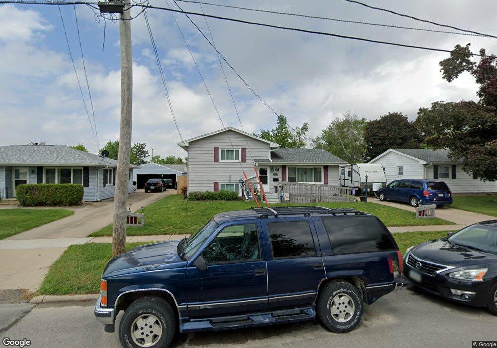
2200 Deborah Dr SW Cedar Rapids, IA 52404
Southwest Area NeighborhoodEstimated Value: $207,000 - $219,000
4
Beds
3
Baths
1,307
Sq Ft
$164/Sq Ft
Est. Value
About This Home
This home is located at 2200 Deborah Dr SW, Cedar Rapids, IA 52404 and is currently estimated at $214,587, approximately $164 per square foot. 2200 Deborah Dr SW is a home located in Linn County with nearby schools including Junction City Elementary School, Grant Elementary School, and Bruce Hall Day Treatment Center.
Ownership History
Date
Name
Owned For
Owner Type
Purchase Details
Closed on
Jun 12, 2012
Sold by
Hyde Kandy L
Bought by
Odeen Todd and Odeen Kandy
Current Estimated Value
Purchase Details
Closed on
Apr 16, 2010
Sold by
Glubka Robert S
Bought by
Hyde Kandy L
Purchase Details
Closed on
Aug 4, 2003
Sold by
Ashley James R and Ashley Tracy L
Bought by
Glubka Robert S and Hyde Kandy L
Create a Home Valuation Report for This Property
The Home Valuation Report is an in-depth analysis detailing your home's value as well as a comparison with similar homes in the area
Home Values in the Area
Average Home Value in this Area
Purchase History
| Date | Buyer | Sale Price | Title Company |
|---|---|---|---|
| Odeen Todd | -- | None Available | |
| Hyde Kandy L | -- | None Available | |
| Glubka Robert S | $115,500 | -- |
Source: Public Records
Tax History Compared to Growth
Tax History
| Year | Tax Paid | Tax Assessment Tax Assessment Total Assessment is a certain percentage of the fair market value that is determined by local assessors to be the total taxable value of land and additions on the property. | Land | Improvement |
|---|---|---|---|---|
| 2025 | $3,300 | $217,300 | $32,600 | $184,700 |
| 2024 | $3,878 | $196,900 | $32,600 | $164,300 |
| 2023 | $3,878 | $196,900 | $32,600 | $164,300 |
| 2022 | $3,502 | $192,700 | $32,600 | $160,100 |
| 2021 | $3,096 | $178,000 | $27,900 | $150,100 |
| 2020 | $3,096 | $148,900 | $24,800 | $124,100 |
| 2019 | $2,448 | $122,100 | $24,800 | $97,300 |
| 2018 | $2,376 | $122,100 | $24,800 | $97,300 |
| 2017 | $2,302 | $114,200 | $24,800 | $89,400 |
| 2016 | $2,427 | $114,200 | $24,800 | $89,400 |
| 2015 | $2,473 | $116,254 | $24,800 | $91,454 |
| 2014 | $2,288 | $116,254 | $24,800 | $91,454 |
| 2013 | $2,236 | $116,254 | $24,800 | $91,454 |
Source: Public Records
Map
Nearby Homes
- 2212 Deborah Dr SW
- 2321 Lauren Dr SW
- 2401 Victoria Dr SW
- 2601 Teresa Dr SW
- 2021 Hamilton St SW
- 186 22nd Ave SW
- 109 Evelyn Dr SW
- 1756 Mallory St SW
- 51 29th Avenue Dr SW Unit D11
- 51 29th Avenue Dr SW Unit C22
- 2818 Southland St SW
- 2955 Bowling St SW Unit E238
- 3010 Bowling St SW
- 2937 Southland St SW
- 1804 I St SW
- 42 Park Village Ave SW
- 90 29th Ave SW
- 1411 1st St SW
- 192 15th Ave SW
- 3212 Southland St SW
- 2126 Deborah Dr SW
- 2206 Deborah Dr SW
- 2201 Lauren Dr SW
- 2120 Deborah Dr SW
- 2207 Lauren Dr SW
- 2125 Lauren Dr SW
- 2213 Lauren Dr SW
- 2218 Deborah Dr SW
- 2114 Deborah Dr SW
- 2201 Deborah Dr SW
- 2219 Lauren Dr SW
- 2125 Deborah Dr SW
- 2207 Deborah Dr SW
- 2113 Lauren Dr SW
- 2115 Deborah Dr SW
- 2213 Deborah Dr SW
- 2224 Deborah Dr SW
- 2108 Deborah Dr SW
- 2225 Lauren Dr SW
- 2107 Lauren Dr SW