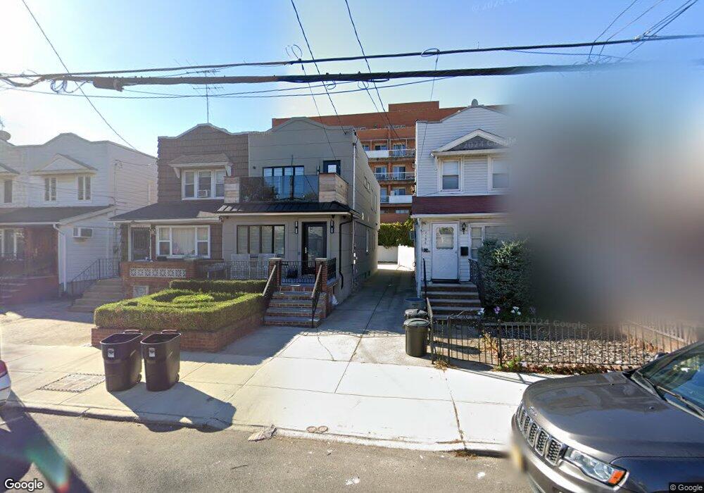
2200 E 21st St Brooklyn, NY 11229
Sheepshead Bay NeighborhoodEstimated Value: $956,837 - $1,383,000
--
Bed
--
Bath
1,344
Sq Ft
$813/Sq Ft
Est. Value
About This Home
This home is located at 2200 E 21st St, Brooklyn, NY 11229 and is currently estimated at $1,092,959, approximately $813 per square foot. 2200 E 21st St is a home located in Kings County with nearby schools including Ps 206 Joseph F Lamb, Jhs 234 Arthur W Cunningham, and St. Edmund Elementary School.
Ownership History
Date
Name
Owned For
Owner Type
Purchase Details
Closed on
Oct 16, 2013
Sold by
Ayash Ronnie
Bought by
Ayash Ronnie and Ayash Stacy
Current Estimated Value
Home Financials for this Owner
Home Financials are based on the most recent Mortgage that was taken out on this home.
Original Mortgage
$9,262
Outstanding Balance
$6,922
Interest Rate
4.36%
Mortgage Type
New Conventional
Estimated Equity
$1,086,037
Purchase Details
Closed on
Jan 25, 2005
Sold by
Sevrinsky Arlene F and Sevrinsky Phillip M
Bought by
Ayash Ronnie
Home Financials for this Owner
Home Financials are based on the most recent Mortgage that was taken out on this home.
Original Mortgage
$359,650
Interest Rate
5.83%
Mortgage Type
Purchase Money Mortgage
Create a Home Valuation Report for This Property
The Home Valuation Report is an in-depth analysis detailing your home's value as well as a comparison with similar homes in the area
Home Values in the Area
Average Home Value in this Area
Purchase History
| Date | Buyer | Sale Price | Title Company |
|---|---|---|---|
| Ayash Ronnie | -- | -- | |
| Ayash Ronnie | -- | -- | |
| Ayash Ronnie | $455,000 | -- | |
| Ayash Ronnie | $455,000 | -- |
Source: Public Records
Mortgage History
| Date | Status | Borrower | Loan Amount |
|---|---|---|---|
| Open | Ayash Ronnie | $9,262 | |
| Closed | Ayash Ronnie | $9,262 | |
| Previous Owner | Ayash Ronnie | $359,650 |
Source: Public Records
Tax History Compared to Growth
Tax History
| Year | Tax Paid | Tax Assessment Tax Assessment Total Assessment is a certain percentage of the fair market value that is determined by local assessors to be the total taxable value of land and additions on the property. | Land | Improvement |
|---|---|---|---|---|
| 2025 | $6,304 | $67,080 | $10,680 | $56,400 |
| 2024 | $6,304 | $64,140 | $10,680 | $53,460 |
| 2023 | $6,025 | $62,460 | $10,680 | $51,780 |
| 2022 | $5,664 | $55,200 | $10,680 | $44,520 |
| 2021 | $5,971 | $51,300 | $10,680 | $40,620 |
| 2020 | $2,895 | $47,880 | $10,680 | $37,200 |
| 2019 | $5,471 | $47,880 | $10,680 | $37,200 |
| 2018 | $5,039 | $24,721 | $5,971 | $18,750 |
| 2017 | $4,820 | $23,644 | $5,936 | $17,708 |
| 2016 | $4,727 | $23,644 | $6,310 | $17,334 |
| 2015 | $2,690 | $23,064 | $7,984 | $15,080 |
| 2014 | $2,690 | $21,795 | $8,528 | $13,267 |
Source: Public Records
Map
Nearby Homes
- 2249 E 21st St
- 2113 Avenue U
- 2113 Avenue V
- 2118 Gravesend Neck Rd
- 1910 Avenue V Unit 9
- 2503 Ocean Ave Unit 2B
- 2291 E 21st St
- 2171 E 18th St
- 2678 Ocean Ave Unit L4
- 2109 E 21st St
- 2471 Ocean Ave Unit 6A
- 2121 E 17th St
- 2169 E 17th St
- 2260 E 22nd St
- 2701 Ocean Ave Unit 7D
- 2146 - 2148 E 17th St
- 4215 Bedford Ave
- 2030 E 18th St
- 2443 Ocean Ave Unit 3A
- 2443 Ocean Ave Unit 2B
- 2202 E 21st St
- 2196 E 21st St
- 2204 E 21st St
- 2194 E 21st St
- 2206 E 21st St
- 2190 E 21st St
- 2210 E 21st St
- 2212 E 21st St
- 2569 Ocean Ave Unit 3A
- 2569 Ocean Ave Unit 4F
- 2569 Ocean Ave Unit 6C
- 2569 Ocean Ave Unit 6B
- 2569 Ocean Ave Unit 6A
- 2569 Ocean Ave Unit 5E
- 2569 Ocean Ave Unit 5D
- 2569 Ocean Ave Unit 5C
- 2569 Ocean Ave Unit 5B
- 2569 Ocean Ave Unit 5A
- 2569 Ocean Ave Unit 4F
- 2569 Ocean Ave Unit 4E