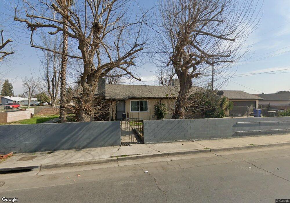
2200 Fremont St Bakersfield, CA 93304
Benton Park NeighborhoodEstimated Value: $240,000 - $284,000
3
Beds
2
Baths
1,300
Sq Ft
$208/Sq Ft
Est. Value
About This Home
This home is located at 2200 Fremont St, Bakersfield, CA 93304 and is currently estimated at $270,422, approximately $208 per square foot. 2200 Fremont St is a home located in Kern County with nearby schools including Frank West Elementary School, Curran Middle School, and South High School.
Ownership History
Date
Name
Owned For
Owner Type
Purchase Details
Closed on
May 10, 2017
Sold by
Starlite Mgmt Ix Lp
Bought by
Starlite Mgmt Ix Lp
Current Estimated Value
Home Financials for this Owner
Home Financials are based on the most recent Mortgage that was taken out on this home.
Original Mortgage
$2,204,150
Outstanding Balance
$1,826,449
Interest Rate
3.97%
Mortgage Type
Purchase Money Mortgage
Estimated Equity
-$1,556,027
Purchase Details
Closed on
Dec 7, 2016
Sold by
Woods Angela C
Bought by
Starlite Mgmt Ix Lp
Purchase Details
Closed on
Mar 22, 2002
Sold by
Woods Angela C
Bought by
Woods Angela C
Home Financials for this Owner
Home Financials are based on the most recent Mortgage that was taken out on this home.
Original Mortgage
$67,100
Interest Rate
5.5%
Mortgage Type
Purchase Money Mortgage
Create a Home Valuation Report for This Property
The Home Valuation Report is an in-depth analysis detailing your home's value as well as a comparison with similar homes in the area
Home Values in the Area
Average Home Value in this Area
Purchase History
| Date | Buyer | Sale Price | Title Company |
|---|---|---|---|
| Starlite Mgmt Ix Lp | -- | Orange Coast Title | |
| Starlite Mgmt Ix Lp | $105,600 | None Available | |
| Woods Angela C | -- | Fidelity National Title Co |
Source: Public Records
Mortgage History
| Date | Status | Borrower | Loan Amount |
|---|---|---|---|
| Open | Starlite Mgmt Ix Lp | $2,204,150 | |
| Previous Owner | Woods Angela C | $67,100 |
Source: Public Records
Tax History Compared to Growth
Tax History
| Year | Tax Paid | Tax Assessment Tax Assessment Total Assessment is a certain percentage of the fair market value that is determined by local assessors to be the total taxable value of land and additions on the property. | Land | Improvement |
|---|---|---|---|---|
| 2025 | $2,100 | $120,693 | $34,815 | $85,878 |
| 2024 | $2,051 | $118,328 | $34,133 | $84,195 |
| 2023 | $2,051 | $116,009 | $33,464 | $82,545 |
| 2022 | $1,996 | $113,735 | $32,808 | $80,927 |
| 2021 | $1,892 | $111,506 | $32,165 | $79,341 |
| 2020 | $1,857 | $110,364 | $31,836 | $78,528 |
| 2019 | $1,821 | $110,364 | $31,836 | $78,528 |
| 2018 | $1,781 | $106,080 | $30,600 | $75,480 |
| 2017 | $1,843 | $117,000 | $30,000 | $87,000 |
| 2016 | $980 | $50,315 | $7,697 | $42,618 |
| 2015 | $968 | $49,560 | $7,582 | $41,978 |
| 2014 | $936 | $48,590 | $7,434 | $41,156 |
Source: Public Records
Map
Nearby Homes
- 1920 Doolittle Ave
- 1512 Southgate Dr
- 2323 S J St
- 1920 Hodges Ave
- 1917 S J St
- 1410 Southgate Dr
- 2216 Bradley Ave
- 1807 June Ave
- 2717 S K St
- 1814 June Ave
- 1800 Hughes Ln
- 2510 Wilson Rd
- 1108 Southgate Dr
- 2120 S M St
- 1605 Sidney Dr
- 1811 Radiance Dr
- 1501 Edna St
- 1017 Curtis Dr
- 2404 Belvedere Ave
- 1212 S F St
- 1805 Custer Ave
- 1816 Le May Ave
- 1801 Custer Ave
- 1901 Custer Ave
- 1812 Le May Ave
- 1808 Le May Ave
- 2219 Fremont St
- 1808 Custer Ave
- 1725 Custer Ave
- 1905 Custer Ave
- 1804 Custer Ave
- 1812 Custer Ave
- 1905 1905 Custer Ave
- 1800 Custer Ave
- 1900 Custer Ave
- 1804 Le May Ave
- 1904 Le May Ave
- 1721 Custer Ave
- 1909 Custer Ave
- 1904 Custer Ave