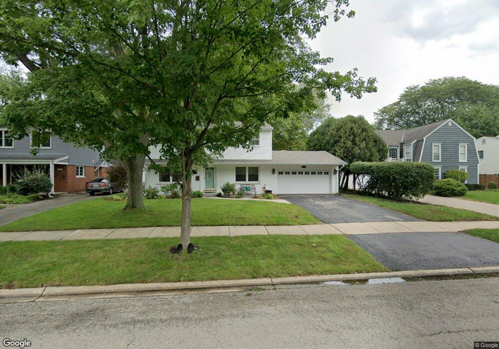
2200 Maple Ave Northbrook, IL 60062
Estimated Value: $686,000 - $824,000
4
Beds
2
Baths
1,622
Sq Ft
$475/Sq Ft
Est. Value
About This Home
This home is located at 2200 Maple Ave, Northbrook, IL 60062 and is currently estimated at $770,745, approximately $475 per square foot. 2200 Maple Ave is a home located in Cook County with nearby schools including Greenbriar Elementary School, Northbrook Junior High School, and Glenbrook North High School.
Ownership History
Date
Name
Owned For
Owner Type
Purchase Details
Closed on
Apr 9, 2001
Sold by
Hohmann Fred J
Bought by
Poupard Thomas R and Poupard Clare Z
Current Estimated Value
Home Financials for this Owner
Home Financials are based on the most recent Mortgage that was taken out on this home.
Original Mortgage
$275,000
Interest Rate
7.15%
Purchase Details
Closed on
Jan 15, 2001
Sold by
Hohmann Fred J
Bought by
Hohmann Fred J and Hohmann Survivors Trust
Purchase Details
Closed on
May 15, 2000
Sold by
Hohmann Fred J and Hohmann Susan C
Bought by
Hohmann Fred J and Hohmann Susan C
Create a Home Valuation Report for This Property
The Home Valuation Report is an in-depth analysis detailing your home's value as well as a comparison with similar homes in the area
Home Values in the Area
Average Home Value in this Area
Purchase History
| Date | Buyer | Sale Price | Title Company |
|---|---|---|---|
| Poupard Thomas R | $445,000 | -- | |
| Hohmann Fred J | -- | -- | |
| Hohmann Fred J | -- | -- |
Source: Public Records
Mortgage History
| Date | Status | Borrower | Loan Amount |
|---|---|---|---|
| Previous Owner | Poupard Thomas R | $275,000 |
Source: Public Records
Tax History Compared to Growth
Tax History
| Year | Tax Paid | Tax Assessment Tax Assessment Total Assessment is a certain percentage of the fair market value that is determined by local assessors to be the total taxable value of land and additions on the property. | Land | Improvement |
|---|---|---|---|---|
| 2024 | $12,950 | $60,000 | $15,840 | $44,160 |
| 2023 | $12,537 | $60,000 | $15,840 | $44,160 |
| 2022 | $12,537 | $60,000 | $15,840 | $44,160 |
| 2021 | $9,055 | $39,575 | $12,127 | $27,448 |
| 2020 | $8,929 | $39,575 | $12,127 | $27,448 |
| 2019 | $8,665 | $43,489 | $12,127 | $31,362 |
| 2018 | $10,182 | $46,915 | $10,642 | $36,273 |
| 2017 | $9,933 | $46,915 | $10,642 | $36,273 |
| 2016 | $9,530 | $46,915 | $10,642 | $36,273 |
| 2015 | $8,606 | $38,950 | $8,662 | $30,288 |
| 2014 | $8,233 | $38,950 | $8,662 | $30,288 |
| 2013 | $7,966 | $38,950 | $8,662 | $30,288 |
Source: Public Records
Map
Nearby Homes
- 2117 Illinois Rd
- 1455 Shermer Rd Unit 208C
- 2022 Center Ave
- 2409 Center Ave
- 2411 Woodlawn Rd
- 1060 Cedar Ln
- 1721 Elm Ave
- 1781 Tudor Ln Unit 308
- 1712 Maple Ave
- 1947 Summerton Place
- 1928 Somerset Ln Unit 54
- 1922 Lincoln Ave
- 1758 Chapel Ct
- 1746 Ellendale Dr
- 1976 Kingsley Cir
- 2005 Techny Rd
- 1181 Shermer Rd
- 1445 Pfingsten Rd
- 1179 Shermer Rd
- 1611 Pfingsten Rd
- 2170 Maple Ave
- 2208 Maple Ave
- 2144 Maple Ave
- 2216 Maple Ave
- 2140 Maple Ave
- 2224 Maple Ave
- 2201 Walters Ave
- 2201 Maple Ave
- 2147 Maple Ave
- 2136 Maple Ave
- 2207 Maple Ave
- 2147 Walters Ave
- 2143 Maple Ave
- 2211 Walters Ave
- 2143 Walters Ave
- 2215 Maple Ave
- 2132 Maple Ave
- 2230 Maple Ave
- 2139 Maple Ave
- 2137 Walters Ave