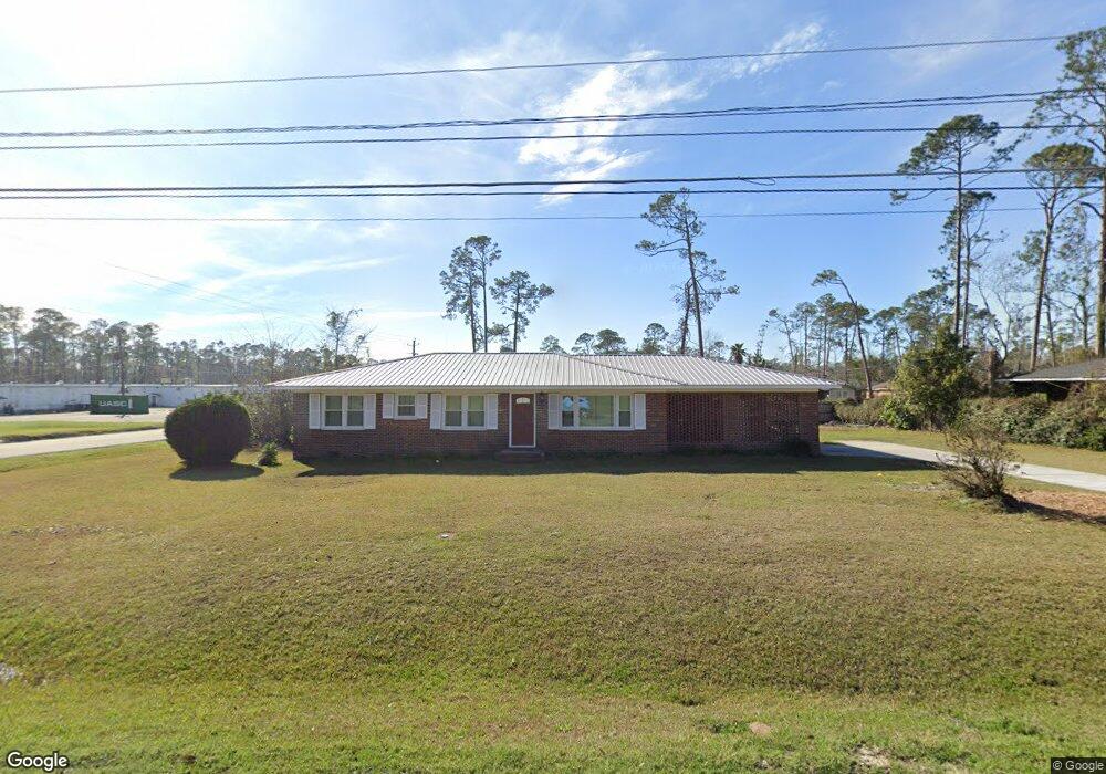
2200 N Barack Obama Blvd Valdosta, GA 31602
Estimated Value: $123,338 - $152,000
--
Bed
1
Bath
1,325
Sq Ft
$105/Sq Ft
Est. Value
About This Home
This home is located at 2200 N Barack Obama Blvd, Valdosta, GA 31602 and is currently estimated at $138,835, approximately $104 per square foot. 2200 N Barack Obama Blvd is a home with nearby schools including W.G. Nunn Elementary School, Newbern Middle School, and Valdosta High School.
Ownership History
Date
Name
Owned For
Owner Type
Purchase Details
Closed on
Mar 10, 2021
Sold by
Williams Phyllis Alane
Bought by
Johnson Phyllis Alane and Johnson Dudley Wallace
Current Estimated Value
Purchase Details
Closed on
Jan 25, 2021
Sold by
Marvin Frank Moore Revocable Living Trus
Bought by
Williams Phyllis Alane
Purchase Details
Closed on
Jul 28, 2017
Bought by
Gardner Cheryl Ann Trustee
Purchase Details
Closed on
Apr 2, 2017
Sold by
Moore Marvin F
Bought by
Moore Marvin Frank and Gardner Cheryl Ann
Purchase Details
Closed on
Nov 5, 1990
Bought by
Moore Marvin F and Moore Edna E
Create a Home Valuation Report for This Property
The Home Valuation Report is an in-depth analysis detailing your home's value as well as a comparison with similar homes in the area
Home Values in the Area
Average Home Value in this Area
Purchase History
| Date | Buyer | Sale Price | Title Company |
|---|---|---|---|
| Johnson Phyllis Alane | -- | -- | |
| Williams Phyllis Alane | -- | -- | |
| Gardner Cheryl Ann Trustee | -- | -- | |
| Moore Marvin Frank | -- | -- | |
| Moore Marvin F | -- | -- |
Source: Public Records
Tax History Compared to Growth
Tax History
| Year | Tax Paid | Tax Assessment Tax Assessment Total Assessment is a certain percentage of the fair market value that is determined by local assessors to be the total taxable value of land and additions on the property. | Land | Improvement |
|---|---|---|---|---|
| 2024 | $1,068 | $38,252 | $4,127 | $34,125 |
| 2023 | $1,068 | $38,252 | $4,127 | $34,125 |
| 2022 | $650 | $19,225 | $4,127 | $15,098 |
| 2021 | $668 | $19,225 | $4,127 | $15,098 |
| 2020 | $683 | $19,225 | $4,127 | $15,098 |
| 2019 | $682 | $19,225 | $4,127 | $15,098 |
| 2018 | $0 | $19,225 | $4,127 | $15,098 |
| 2017 | $696 | $19,225 | $4,127 | $15,098 |
| 2016 | $832 | $22,999 | $4,127 | $18,872 |
| 2015 | -- | $22,999 | $4,127 | $18,872 |
| 2014 | $776 | $22,999 | $4,127 | $18,872 |
Source: Public Records
Map
Nearby Homes
- 1507 Leone Ave
- 2310 Barack Obama Blvd
- 2202 Deborah Dr
- 1642 Lexington Cir
- 2320 Barack Obama Blvd
- 2400 Lowndes Dr
- 2311 Lowndes Dr
- 1900 N Barack Obama Blvd
- 957 McAfina Trail
- 2745 Pineview Dr
- 2713 Pineview Dr Unit A&B
- 2105 N Troup St
- 6 Prince Cove
- 2435 Muscogee Dr
- 1763 Eli Place
- 2414 Deborah Dr
- 1739 Eli Place
- 1724 Eli Place
- 1733 Ricardo St
- 1761 Hyssop Crossing
- 2220 N Forrest St
- 2218 N Forrest St
- 1505 Leone Ave
- 1604 Lexington Cir
- 2221 N Forrest St
- 1606 Lexington Cir
- 2216 N Forrest St
- 1608 Lexington Cir
- 1503 Leone Ave
- 2221 Deborah Dr
- 1610 Lexington Cir
- 1506 Leone Ave
- 2219 Deborah Dr
- 1504 Leone Ave
- 2214 N Barack Obama Blvd
- 1603 Leone Ave
- 1612 Lexington Cir
- 2214 N Forrest St
- 2301 N Forrest St
- 1501 Leone Ave