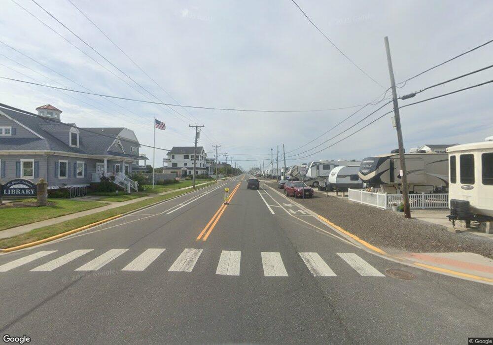
2200 S Commonwealth Ave Strathmere, NJ 08248
Estimated Value: $887,610 - $1,931,000
--
Bed
--
Bath
1,596
Sq Ft
$953/Sq Ft
Est. Value
About This Home
This home is located at 2200 S Commonwealth Ave, Strathmere, NJ 08248 and is currently estimated at $1,520,903, approximately $952 per square foot. 2200 S Commonwealth Ave is a home with nearby schools including Ocean City Primary School, Ocean City Intermediate School, and Ocean City High School.
Ownership History
Date
Name
Owned For
Owner Type
Purchase Details
Closed on
Nov 30, 2011
Sold by
Monichetti Michael Dewey and Monicheatti Michael Dewey
Bought by
Cilli Daryl and Cilli Ann E Marie
Current Estimated Value
Purchase Details
Closed on
Feb 26, 1990
Sold by
Gardner Elizabeth
Bought by
Monicheatti Michael Dewey
Purchase Details
Closed on
Jun 23, 1989
Sold by
Gardner Elizabeth
Bought by
Gardner Elizabeth
Create a Home Valuation Report for This Property
The Home Valuation Report is an in-depth analysis detailing your home's value as well as a comparison with similar homes in the area
Home Values in the Area
Average Home Value in this Area
Purchase History
| Date | Buyer | Sale Price | Title Company |
|---|---|---|---|
| Cilli Daryl | $450,000 | Foundation Title Llc | |
| Monicheatti Michael Dewey | $50,000 | -- | |
| Gardner Elizabeth | -- | -- |
Source: Public Records
Tax History Compared to Growth
Tax History
| Year | Tax Paid | Tax Assessment Tax Assessment Total Assessment is a certain percentage of the fair market value that is determined by local assessors to be the total taxable value of land and additions on the property. | Land | Improvement |
|---|---|---|---|---|
| 2025 | $10,985 | $494,600 | $308,800 | $185,800 |
| 2024 | $10,985 | $494,600 | $308,800 | $185,800 |
| 2023 | $10,431 | $494,600 | $308,800 | $185,800 |
| 2022 | $10,080 | $494,600 | $308,800 | $185,800 |
| 2021 | $7,190 | $494,600 | $308,800 | $185,800 |
| 2020 | $9,343 | $494,600 | $308,800 | $185,800 |
| 2019 | $9,115 | $494,600 | $308,800 | $185,800 |
| 2018 | $8,878 | $494,600 | $308,800 | $185,800 |
| 2017 | $8,779 | $494,600 | $308,800 | $185,800 |
| 2016 | $8,913 | $494,600 | $308,800 | $185,800 |
| 2015 | $8,675 | $494,600 | $308,800 | $185,800 |
| 2014 | $7,996 | $339,200 | $339,200 | $0 |
Source: Public Records
Map
Nearby Homes
- 117 Taylor Ave
- 10 E Winthrop Ave
- 901 S Commonwealth Ave Unit SOUTH UNIT
- 901 S Commonwealth Ave Unit South
- 104 Prescott Ave
- 18 E Randolph Ave
- 5 E Sumner Ave
- 18 E Winthrop Ave
- 123 32nd St Unit WEST
- 3400 Landis Ave Unit 203
- 3500 Boardwalk Unit 815N
- 3500 Boardwalk Unit 720N/706N
- 3500 Boardwalk Unit 607N
- 3700 Boardwalk Unit 706S
- 3700 Boardwalk Unit 403S
- 209 39th St Unit 1st Floor
- 225 39th St Unit West
- 3814 Landis Ave Unit 1
- 3900 Pleasure Ave Unit 107
- 3065 U S 9
- 2204 Commonwealth Ave
- 2204 S Commonwealth Ave
- 2208 S Commonwealth Ave
- 2124 S Commonwealth Ave
- 2116 S Commonwealth Ave
- 2116 Commonwealth Ave
- 2214 Commonwealth Ave Unit SOUTH UNIT
- 2216 S Commonwealth Ave
- 2113 S Commonwealth Ave
- 2220 S Commonwealth Ave
- 2224 S Commonwealth Ave
- 2104 S Commonwealth Ave
- 2300 S Commonwealth Ave
- 2304 S Commonwealth Ave
- 2308 S Commonwealth Ave
- 2012 S Commonwealth Ave
- 2009 S Commonwealth Ave
- 2316 S Commonwealth Ave
- 2313 S Commonwealth Ave
- 2004 S Commonwealth Ave
