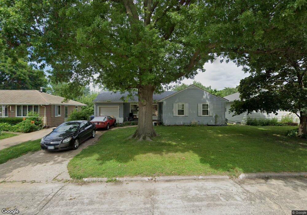
2201 Chandler St SW Cedar Rapids, IA 52404
Cleveland Area NeighborhoodEstimated Value: $146,000 - $153,000
3
Beds
1
Bath
872
Sq Ft
$171/Sq Ft
Est. Value
About This Home
This home is located at 2201 Chandler St SW, Cedar Rapids, IA 52404 and is currently estimated at $149,251, approximately $171 per square foot. 2201 Chandler St SW is a home located in Linn County with nearby schools including Cleveland Elementary School, Roosevelt Creative Corridor Business Academy, and Thomas Jefferson High School.
Ownership History
Date
Name
Owned For
Owner Type
Purchase Details
Closed on
Dec 3, 2021
Sold by
Johnson Michael David
Bought by
Johnson Jamie Anne and Siela Abraham M
Current Estimated Value
Home Financials for this Owner
Home Financials are based on the most recent Mortgage that was taken out on this home.
Original Mortgage
$52,700
Outstanding Balance
$41,224
Interest Rate
2.37%
Mortgage Type
New Conventional
Estimated Equity
$108,027
Purchase Details
Closed on
Jan 1, 2007
Sold by
Johnson Michael David
Bought by
Johnson Jamie Anne
Home Financials for this Owner
Home Financials are based on the most recent Mortgage that was taken out on this home.
Original Mortgage
$90,000
Interest Rate
5%
Mortgage Type
Seller Take Back
Purchase Details
Closed on
Aug 23, 2004
Sold by
Johnson Michael David
Bought by
Johnson Michael David
Create a Home Valuation Report for This Property
The Home Valuation Report is an in-depth analysis detailing your home's value as well as a comparison with similar homes in the area
Home Values in the Area
Average Home Value in this Area
Purchase History
| Date | Buyer | Sale Price | Title Company |
|---|---|---|---|
| Johnson Jamie Anne | $90,000 | Midwest Community Title | |
| Johnson Jamie Anne | $90,000 | None Available | |
| Johnson Michael David | -- | -- |
Source: Public Records
Mortgage History
| Date | Status | Borrower | Loan Amount |
|---|---|---|---|
| Open | Johnson Jamie Anne | $52,700 | |
| Previous Owner | Johnson Jamie Anne | $90,000 |
Source: Public Records
Tax History Compared to Growth
Tax History
| Year | Tax Paid | Tax Assessment Tax Assessment Total Assessment is a certain percentage of the fair market value that is determined by local assessors to be the total taxable value of land and additions on the property. | Land | Improvement |
|---|---|---|---|---|
| 2025 | $2,406 | $147,800 | $33,300 | $114,500 |
| 2024 | $2,596 | $138,400 | $30,300 | $108,100 |
| 2023 | $2,596 | $136,000 | $30,300 | $105,700 |
| 2022 | $2,432 | $123,100 | $25,800 | $97,300 |
| 2021 | $2,478 | $117,400 | $25,800 | $91,600 |
| 2020 | $2,478 | $112,300 | $24,200 | $88,100 |
| 2019 | $2,226 | $103,300 | $24,200 | $79,100 |
| 2018 | $1,982 | $103,300 | $24,200 | $79,100 |
| 2017 | $2,095 | $101,000 | $24,200 | $76,800 |
| 2016 | $2,095 | $98,600 | $24,200 | $74,400 |
| 2015 | $2,067 | $97,186 | $24,240 | $72,946 |
| 2014 | $1,872 | $100,257 | $24,240 | $76,017 |
| 2013 | $1,902 | $100,257 | $24,240 | $76,017 |
Source: Public Records
Map
Nearby Homes
- 2178 Chandler St SW
- Remington - Cedar Rapids Plan at Whispering Pines
- Copeland Plan at Whispering Pines
- Meadowbrook - Cedar Rapids Plan at Stags Leap Estates
- Caldwell Plan at Stags Leap Estates
- Concord - Cedar Rapids Plan at Stags Leap Estates
- Yuma Expanded Plan at Whispering Pines
- Becker II Plan at Kirkwood Village - Kirk Wood Village
- Meadowbrook - Cedar Rapids Plan at Whispering Pines
- Richland Plan at Stags Leap Estates
- Prescott - Cedar Rapids Plan at Stags Leap Estates
- Becker Plan at Kirkwood Village - Kirk Wood Village
- Bakersfield - Cedar Rapids Plan at Whispering Pines
- Cedar Plan at Stags Leap Estates
- Becker - Cedar Rapids Plan at Whispering Pines
- Becker II - Cedar Rapids Plan at Whispering Pines
- Becker II - Cedar Rapids Plan at Stags Leap Estates
- Concord - Cedar Rapids Plan at Whispering Pines
- Yuma Expanded Plan at Stags Leap Estates
- Becker - Cedar Rapids Plan at Stags Leap Estates
- 2199 Chandler St SW
- 2205 Chandler St SW
- 2195 Chandler St SW
- 2209 Chandler St SW
- 1218 20th St SW
- 1224 20th St SW
- 1212 20th St SW
- 1228 20th St SW
- 2191 Chandler St SW
- 2215 Chandler St SW
- 1206 20th St SW
- 2200 Chandler St SW
- 2208 Chandler St SW
- 1232 20th St SW
- 2198 Chandler St SW
- 2204 Chandler St SW
- 2194 Chandler St SW
- 2187 Chandler St SW
- 1200 20th St SW
- 2212 Chandler St SW