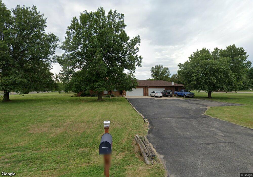
2201 N Cedar Crest Dr Wichita, KS 67223
Northwest Wichita NeighborhoodEstimated Value: $426,000 - $472,828
3
Beds
3
Baths
2,041
Sq Ft
$220/Sq Ft
Est. Value
About This Home
This home is located at 2201 N Cedar Crest Dr, Wichita, KS 67223 and is currently estimated at $449,414, approximately $220 per square foot. 2201 N Cedar Crest Dr is a home located in Sedgwick County with nearby schools including Vermillion Elementary School, Maize South Elementary School, and Pray-Woodman Elementary.
Ownership History
Date
Name
Owned For
Owner Type
Purchase Details
Closed on
Sep 27, 2000
Sold by
Zimmerman Daniel J and Zimmerman Christy R
Bought by
Kitchen Robert M and Kitchen Catherine L
Current Estimated Value
Purchase Details
Closed on
Feb 12, 1999
Sold by
Evans Richard E and Evans Patricia A
Bought by
Zimmerman Daniel J and Zimmerman Christy R
Home Financials for this Owner
Home Financials are based on the most recent Mortgage that was taken out on this home.
Original Mortgage
$198,000
Interest Rate
6.78%
Create a Home Valuation Report for This Property
The Home Valuation Report is an in-depth analysis detailing your home's value as well as a comparison with similar homes in the area
Home Values in the Area
Average Home Value in this Area
Purchase History
| Date | Buyer | Sale Price | Title Company |
|---|---|---|---|
| Kitchen Robert M | -- | Orourke Title Company | |
| Zimmerman Daniel J | -- | -- |
Source: Public Records
Mortgage History
| Date | Status | Borrower | Loan Amount |
|---|---|---|---|
| Previous Owner | Zimmerman Daniel J | $198,000 |
Source: Public Records
Tax History Compared to Growth
Tax History
| Year | Tax Paid | Tax Assessment Tax Assessment Total Assessment is a certain percentage of the fair market value that is determined by local assessors to be the total taxable value of land and additions on the property. | Land | Improvement |
|---|---|---|---|---|
| 2025 | $4,770 | $44,471 | $7,441 | $37,030 |
| 2023 | $4,770 | $39,779 | $5,463 | $34,316 |
| 2022 | $4,550 | $37,134 | $5,152 | $31,982 |
| 2021 | $4,287 | $35,029 | $4,577 | $30,452 |
| 2020 | $3,965 | $32,430 | $4,577 | $27,853 |
| 2019 | $3,738 | $30,590 | $4,577 | $26,013 |
| 2018 | $3,589 | $29,417 | $5,221 | $24,196 |
| 2017 | $3,504 | $0 | $0 | $0 |
| 2016 | $3,503 | $0 | $0 | $0 |
| 2015 | $3,568 | $0 | $0 | $0 |
| 2014 | $3,518 | $0 | $0 | $0 |
Source: Public Records
Map
Nearby Homes
- 2006 N Sunridge St
- 11926 W Cornelison Ct
- 2345 N Parkridge Ct
- 11926 W Bella Vista Cir
- 11838 W Neville Ct
- 2343 N Covington Ct
- 2517 N Covington Cir
- 1930 N Cardington St
- 1917 N Covington St
- 1774 N Forestview Ct
- 1634 N Forestview St
- 1630 N Forestview St
- 2121 N Rutgers St
- 2004 N Shefford St
- 3125 N Pine Grove Cir
- 1605 N Nickelton Cir
- 11021 W Westport St
- 1462 N Parkridge St
- 2134 N Parkdale Ct
- 1644 N Parkdale St
- 2211 N Cedar Crest Dr
- 2200 N Cedar Crest Dr
- 2221 N Cedar Crest Dr
- 2220 N Cedar Crest Dr
- 12510 W Cornelison St
- 12506 W Cornelison St
- 12502 W Cornelison St
- 12630 W 21st St N
- 2135 N Teal Brook Ct
- 2131 N Teal Brook Ct
- 12410 W Cornelison St
- 2210 N Cedar Downs Ln
- 2300 N Cedar Crest Dr
- 2301 N Cedar Crest Dr
- 12406 W Cornelison St
- 12511 W Cornelison St
- 2139 N Teal Brook Ct
- 12507 W Cornelison St
- 2127 N Teal Brook Ct
- 12503 W Cornelison St