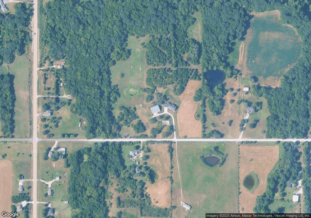
22014 Loring Rd Linwood, KS 66052
Estimated Value: $352,000 - $1,103,406
4
Beds
3
Baths
1,200
Sq Ft
$630/Sq Ft
Est. Value
About This Home
This home is located at 22014 Loring Rd, Linwood, KS 66052 and is currently estimated at $756,469, approximately $630 per square foot. 22014 Loring Rd is a home located in Leavenworth County with nearby schools including Linwood Elementary School, Basehor-Linwood Middle School, and Basehor-Linwood High School.
Ownership History
Date
Name
Owned For
Owner Type
Purchase Details
Closed on
Sep 6, 2019
Sold by
Shar Construction And Real Estate Llc
Bought by
Strahm Family Living Trust
Current Estimated Value
Home Financials for this Owner
Home Financials are based on the most recent Mortgage that was taken out on this home.
Original Mortgage
$425,000
Interest Rate
3.7%
Mortgage Type
Construction
Purchase Details
Closed on
Aug 19, 2016
Sold by
Hummelgaard Audria O
Bought by
Shar Construction & Real Estate Llc
Create a Home Valuation Report for This Property
The Home Valuation Report is an in-depth analysis detailing your home's value as well as a comparison with similar homes in the area
Home Values in the Area
Average Home Value in this Area
Purchase History
| Date | Buyer | Sale Price | Title Company |
|---|---|---|---|
| Strahm Family Living Trust | -- | New Title Company Name | |
| Shar Construction & Real Estate Llc | -- | Kansas Secured Title |
Source: Public Records
Mortgage History
| Date | Status | Borrower | Loan Amount |
|---|---|---|---|
| Closed | Strahm Family Living Trust | $425,000 |
Source: Public Records
Tax History Compared to Growth
Tax History
| Year | Tax Paid | Tax Assessment Tax Assessment Total Assessment is a certain percentage of the fair market value that is determined by local assessors to be the total taxable value of land and additions on the property. | Land | Improvement |
|---|---|---|---|---|
| 2025 | $11,990 | $91,446 | $9,575 | $81,871 |
| 2024 | $10,989 | $104,483 | $6,121 | $98,362 |
| 2023 | $10,989 | $101,452 | $6,122 | $95,330 |
| 2022 | $10,257 | $90,259 | $5,028 | $85,231 |
| 2021 | $9,055 | $79,541 | $4,567 | $74,974 |
| 2020 | $7,134 | $61,373 | $6,828 | $54,545 |
| 2019 | $2,527 | $21,834 | $6,576 | $15,258 |
| 2018 | $534 | $4,895 | $4,448 | $447 |
| 2017 | $494 | $4,555 | $3,964 | $591 |
| 2016 | $892 | $7,893 | $3,648 | $4,245 |
| 2015 | $889 | $7,863 | $3,618 | $4,245 |
| 2014 | $885 | $7,850 | $3,582 | $4,268 |
Source: Public Records
Map
Nearby Homes
- 13139 222nd St
- 21535 Loring Rd
- 22090 Linwood Rd
- 21881 Cantrell Rd
- 12314 222nd St
- Lot 5 206th St
- 00000 Lot 9 South 206th St
- 00000 Lot 8 South 206th St
- 00000 Lot 2 North 206th St
- Lot 5 238th St
- 00000 Cantrell Rd
- Lot 1 Cantrell Rd
- Lot 9 Cantrell Rd
- Lot 10 Cantrell Rd
- Lot 11 Cantrell Rd
- Lot 12 Cantrell Rd
- Lot 8 Cantrell Rd
- 0 Golden Rd Unit HMS2559950
- 0 Golden Rd Unit 23524027
- 22201 Woodend Rd
- 22049 Loring Rd
- 21898 Loring Rd
- 13262 222nd St
- 22125 Loring Rd
- 13234 222nd St
- 13302 222nd St
- 13132 222nd St
- 13102 222nd St
- 21809 Loring Rd
- 13103 222nd St
- 13036 222nd St
- 12988 222nd St
- 21734 Loring Rd
- 22281 Loring Rd
- 13021 222nd St
- 22309 Loring Rd
- 13405 222nd St
- 21658 Loring Rd
- 13502 222nd St
- 22471 Loring Rd
