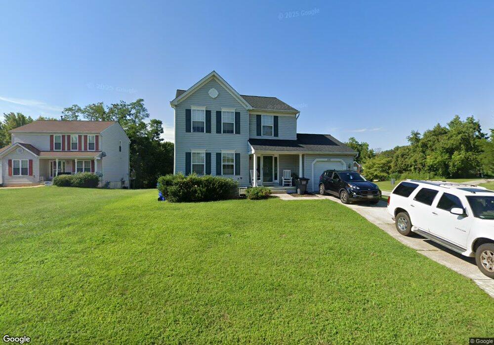
2202 Jason Ct Bryans Road, MD 20616
Estimated Value: $354,000 - $399,000
Studio
3
Baths
1,544
Sq Ft
$243/Sq Ft
Est. Value
About This Home
This home is located at 2202 Jason Ct, Bryans Road, MD 20616 and is currently estimated at $375,530, approximately $243 per square foot. 2202 Jason Ct is a home located in Charles County with nearby schools including J.C. Parks Elementary School, Matthew Henson Middle School, and Henry E. Lackey High School.
Ownership History
Date
Name
Owned For
Owner Type
Purchase Details
Closed on
May 13, 2005
Sold by
Florence Walter and Florence Thelma
Bought by
Florence Walter M
Current Estimated Value
Home Financials for this Owner
Home Financials are based on the most recent Mortgage that was taken out on this home.
Original Mortgage
$193,500
Outstanding Balance
$103,899
Interest Rate
7.45%
Mortgage Type
Adjustable Rate Mortgage/ARM
Estimated Equity
$271,631
Purchase Details
Closed on
Dec 16, 1996
Sold by
Southampton Corp The
Bought by
Florence Walter and Florence Thelma
Create a Home Valuation Report for This Property
The Home Valuation Report is an in-depth analysis detailing your home's value as well as a comparison with similar homes in the area
Home Values in the Area
Average Home Value in this Area
Purchase History
| Date | Buyer | Sale Price | Title Company |
|---|---|---|---|
| Florence Walter M | -- | -- | |
| Florence Walter | $146,090 | -- |
Source: Public Records
Mortgage History
| Date | Status | Borrower | Loan Amount |
|---|---|---|---|
| Open | Florence Walter M | $193,500 | |
| Closed | Florence Walter | -- |
Source: Public Records
Tax History
| Year | Tax Paid | Tax Assessment Tax Assessment Total Assessment is a certain percentage of the fair market value that is determined by local assessors to be the total taxable value of land and additions on the property. | Land | Improvement |
|---|---|---|---|---|
| 2025 | $9,398 | $302,900 | $72,200 | $230,700 |
| 2024 | $4,007 | $279,833 | $0 | $0 |
| 2023 | $3,669 | $256,767 | $0 | $0 |
| 2022 | $3,345 | $233,700 | $70,200 | $163,500 |
| 2021 | $3,141 | $227,633 | $0 | $0 |
| 2020 | $3,141 | $221,567 | $0 | $0 |
| 2019 | $3,045 | $215,500 | $60,200 | $155,300 |
| 2018 | $2,924 | $209,367 | $0 | $0 |
| 2017 | $2,836 | $203,233 | $0 | $0 |
| 2016 | -- | $197,100 | $0 | $0 |
| 2015 | $2,594 | $197,100 | $0 | $0 |
| 2014 | $2,594 | $197,100 | $0 | $0 |
Source: Public Records
Map
Nearby Homes
- 6551 Cornell Rd
- 2883 Chippewa St
- 6528 Jousting Ct
- 2647 Longbow Ct
- 5829 Monmouth Ct
- 2863 Chippewa St
- 2978 Knight Ct
- 2860 Chippewa St
- 6649 Brooky Place
- 6336 S S Lake Ct Unit 6336
- 2907 Galahad Ct
- 5521 Auburn Ct
- 6838 Matthews Rd
- 5855 Wolsey Ct
- 2609 Larissa Ct
- 0 Farragut Dr
- 6761 Stapleford Place
- 6788 Stapleford Place
- 6767 Stapleford Place
- 6954 Farragut Dr
- 2205 Jason Ct
- 2380 S Hampton Dr
- 2209 Jason Ct
- 2200 Jason Ct
- 2384 S Hampton Dr
- 2213 Jason Ct
- 2204 Jason Ct
- 2208 Jason Ct
- 5415 Sir Douglas Dr
- 5419 Sir Douglas Dr
- 6501 Wooster Rd
- 5139 New Stead Ct
- 5424 Sir Douglas Dr
- 5143 New Stead Ct
- 5135 New Stead Ct
- 2671 Dakota St
- 5131 New Stead Ct
- 6539 Cornell Rd
- 2375 S Hampton Dr
- 2669 Dakota St
Your Personal Tour Guide
Ask me questions while you tour the home.