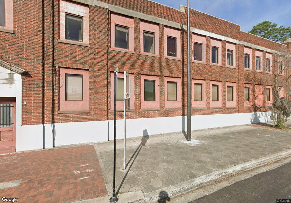
2202 N Main St Jacksonville, FL 32206
Springfield Neighborhood
Studio
9
Baths
22,146
Sq Ft
18,731
Sq Ft Lot
About This Home
This home is located at 2202 N Main St, Jacksonville, FL 32206. 2202 N Main St is a home located in Duval County with nearby schools including Andrew A. Robinson Elementary School, Matthew W. Gilbert Middle School, and William M. Raines High School.
Ownership History
Date
Name
Owned For
Owner Type
Purchase Details
Closed on
Oct 29, 2019
Sold by
Screen Process Printers Inc
Bought by
Springfield Community Development Llc10
Home Financials for this Owner
Home Financials are based on the most recent Mortgage that was taken out on this home.
Original Mortgage
$385,000
Outstanding Balance
$336,456
Interest Rate
3.7%
Mortgage Type
Commercial
Create a Home Valuation Report for This Property
The Home Valuation Report is an in-depth analysis detailing your home's value as well as a comparison with similar homes in the area
Home Values in the Area
Average Home Value in this Area
Purchase History
| Date | Buyer | Sale Price | Title Company |
|---|---|---|---|
| Springfield Community Development Llc10 | $515,000 | Attorney |
Source: Public Records
Mortgage History
| Date | Status | Borrower | Loan Amount |
|---|---|---|---|
| Open | Springfield Community Development Llc10 | $385,000 |
Source: Public Records
Tax History
| Year | Tax Paid | Tax Assessment Tax Assessment Total Assessment is a certain percentage of the fair market value that is determined by local assessors to be the total taxable value of land and additions on the property. | Land | Improvement |
|---|---|---|---|---|
| 2026 | $10,773 | $554,001 | -- | -- |
| 2025 | $8,516 | $459,431 | $127,564 | $331,867 |
| 2024 | $8,490 | $457,853 | $114,076 | $343,777 |
| 2023 | $8,490 | $458,334 | $104,775 | $353,559 |
| 2022 | $7,337 | $411,893 | $104,775 | $307,118 |
| 2021 | $6,870 | $373,315 | $104,775 | $268,540 |
| 2020 | $6,683 | $360,436 | $104,775 | $255,661 |
| 2019 | $6,630 | $352,857 | $104,775 | $248,082 |
| 2018 | $6,594 | $347,765 | $104,775 | $242,990 |
| 2017 | $6,573 | $342,640 | $104,400 | $238,240 |
| 2016 | $6,409 | $327,689 | $0 | $0 |
| 2015 | $6,689 | $336,784 | $0 | $0 |
| 2014 | $6,935 | $346,066 | $0 | $0 |
Source: Public Records
Map
Nearby Homes
- 40 W 11th St
- 131 Cottage Ave
- 34 La Main Ct
- 238 W 11th St
- 110 E 15th St
- 1954 Hubbard St
- 1923 Hubbard St
- 206 W 16th St
- 112 W 17th St
- 2047 N Market St
- 2068 Redwing + (2 Unit Duplex) St
- 2048 Redwing St
- 151 W 17th St
- 1951 N Market St Unit 9
- 2622 N Market St
- 135 E 17th St
- 347 Cottage Ave Unit 347 & 349
- 2002 N Liberty St
- 1855 N Market St
- 234 E 9th St
Your Personal Tour Guide
Ask me questions while you tour the home.