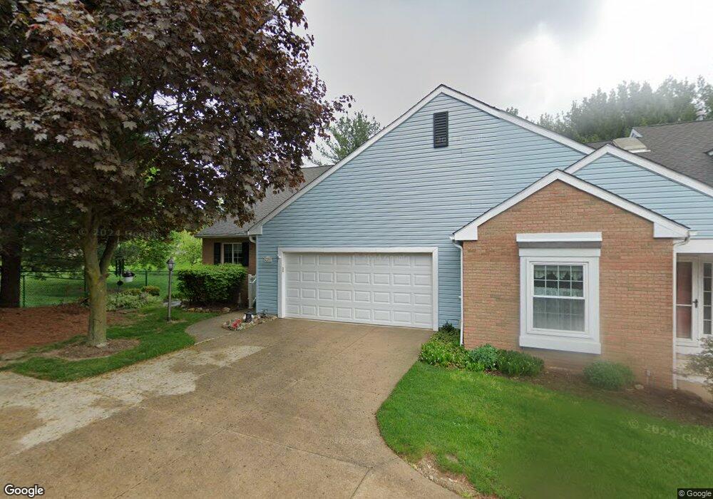
2203 Devon Ct Akron, OH 44312
Ellet NeighborhoodEstimated Value: $216,000 - $226,290
2
Beds
2
Baths
1,504
Sq Ft
$147/Sq Ft
Est. Value
About This Home
This home is located at 2203 Devon Ct, Akron, OH 44312 and is currently estimated at $220,823, approximately $146 per square foot. 2203 Devon Ct is a home located in Summit County with nearby schools including Ellet High School, Summit Academy Akron Elementary School, and Akron Preparatory school.
Ownership History
Date
Name
Owned For
Owner Type
Purchase Details
Closed on
Nov 19, 1996
Sold by
Ricks Beverly J
Bought by
Campbell David C and Campbell Helen F
Current Estimated Value
Home Financials for this Owner
Home Financials are based on the most recent Mortgage that was taken out on this home.
Original Mortgage
$119,200
Interest Rate
7.25%
Mortgage Type
New Conventional
Create a Home Valuation Report for This Property
The Home Valuation Report is an in-depth analysis detailing your home's value as well as a comparison with similar homes in the area
Home Values in the Area
Average Home Value in this Area
Purchase History
| Date | Buyer | Sale Price | Title Company |
|---|---|---|---|
| Campbell David C | $149,000 | -- |
Source: Public Records
Mortgage History
| Date | Status | Borrower | Loan Amount |
|---|---|---|---|
| Previous Owner | Campbell David C | $119,200 |
Source: Public Records
Tax History
| Year | Tax Paid | Tax Assessment Tax Assessment Total Assessment is a certain percentage of the fair market value that is determined by local assessors to be the total taxable value of land and additions on the property. | Land | Improvement |
|---|---|---|---|---|
| 2024 | $3,192 | $59,889 | $6,475 | $53,414 |
| 2023 | $3,192 | $59,889 | $6,475 | $53,414 |
| 2022 | $3,060 | $45,105 | $4,869 | $40,236 |
| 2021 | $2,413 | $45,105 | $4,869 | $40,236 |
| 2020 | $2,376 | $45,110 | $4,870 | $40,240 |
| 2019 | $2,574 | $44,580 | $4,870 | $39,710 |
| 2018 | $2,538 | $44,580 | $4,870 | $39,710 |
| 2017 | $2,181 | $44,580 | $4,870 | $39,710 |
| 2016 | $2,183 | $38,950 | $4,870 | $34,080 |
| 2015 | $2,181 | $38,950 | $4,870 | $34,080 |
| 2014 | $2,208 | $38,950 | $4,870 | $34,080 |
| 2013 | $2,222 | $41,120 | $4,870 | $36,250 |
Source: Public Records
Map
Nearby Homes
- 640 Plainfield Rd
- 2138 Forest Oak Dr
- 2226 Quayle Dr
- 590 & 592 Herbert Rd
- 2511 Ogden Ave
- 805 Utica Ave
- 465 Canton Rd Unit 11C
- 282 Schrop Ave
- 260 Prairie Dr
- 586 Hillman Rd
- 490 Stephens Rd
- 472 Stephens Rd
- 443 Fulmer Ave
- 545 Fulmer Ave
- 2331 E Market St
- 1876 Harding Ave
- 2323 Mingo Trail
- 572 Cora Ave
- 931 Crestline Dr
- 228 Hawk Ave
- 2207 Devon Ct Unit 20
- 2211 Devon Ct Unit 19
- 2213 Devon Ct
- 2241 Cottonwood Cir
- 2206 Devon Ct
- 2329 Edmund Ave
- 2210 Devon Ct
- 2217 Devon Ct
- 2217 Devon Ct Unit 17
- 2214 Devon Ct Unit 22
- 2326 Edmund Ave
- 2235 Cottonwood Cir
- 2321 Edmund Ave
- 2201 Kelty Ct
- 2227 Abbey Rd
- 2197 Kelty Ct
- 2197 Kelty Ct Unit 28
- 2246 Cottonwood Cir
- 2212 Abbey Rd Unit 25
- 2231 Abbey Rd Unit 10
Your Personal Tour Guide
Ask me questions while you tour the home.