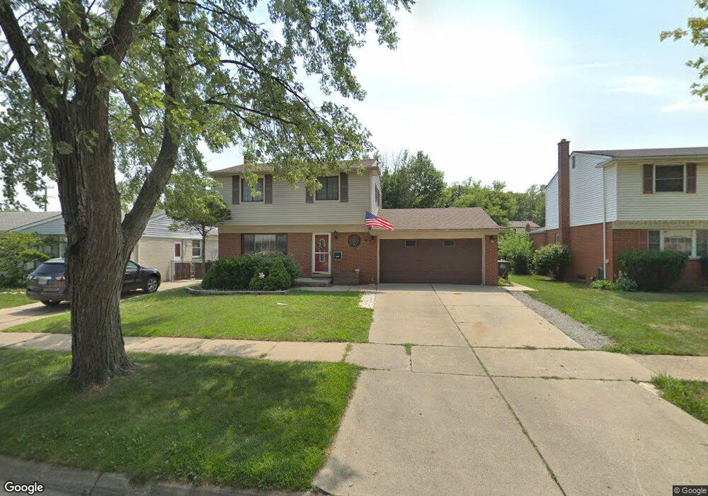
22031 Harmon St Taylor, MI 48180
Estimated Value: $257,221 - $273,000
Studio
1
Bath
1,518
Sq Ft
$174/Sq Ft
Est. Value
About This Home
This home is located at 22031 Harmon St, Taylor, MI 48180 and is currently estimated at $264,805, approximately $174 per square foot. 22031 Harmon St is a home located in Wayne County with nearby schools including Kinyon Elementary School, Robert J. West Middle School, and Taylor Preparatory High School.
Ownership History
Date
Name
Owned For
Owner Type
Purchase Details
Closed on
Apr 12, 2023
Sold by
Haas Dolores
Bought by
Brewer Sandra Lee and Brewer Joshua
Current Estimated Value
Home Financials for this Owner
Home Financials are based on the most recent Mortgage that was taken out on this home.
Original Mortgage
$10,000
Outstanding Balance
$9,683
Interest Rate
6.27%
Estimated Equity
$255,122
Purchase Details
Closed on
Jun 18, 2007
Sold by
Brazier David G and Brazier Mary Ellen
Bought by
Haas Dolores
Create a Home Valuation Report for This Property
The Home Valuation Report is an in-depth analysis detailing your home's value as well as a comparison with similar homes in the area
Home Values in the Area
Average Home Value in this Area
Purchase History
| Date | Buyer | Sale Price | Title Company |
|---|---|---|---|
| Brewer Sandra Lee | $224,500 | None Listed On Document | |
| Haas Dolores | $140,000 | Lawyers Title Insurance Co |
Source: Public Records
Mortgage History
| Date | Status | Borrower | Loan Amount |
|---|---|---|---|
| Open | Brewer Sandra Lee | $10,000 | |
| Open | Brewer Sandra Lee | $220,433 |
Source: Public Records
Tax History
| Year | Tax Paid | Tax Assessment Tax Assessment Total Assessment is a certain percentage of the fair market value that is determined by local assessors to be the total taxable value of land and additions on the property. | Land | Improvement |
|---|---|---|---|---|
| 2025 | $4,848 | $113,700 | $0 | $0 |
| 2024 | $4,694 | $108,200 | $0 | $0 |
| 2023 | $2,880 | $97,200 | $0 | $0 |
| 2022 | $3,203 | $87,700 | $0 | $0 |
| 2021 | $4,959 | $80,100 | $0 | $0 |
| 2020 | $3,381 | $72,000 | $0 | $0 |
| 2019 | $443,045 | $60,700 | $0 | $0 |
| 2018 | $2,812 | $50,800 | $0 | $0 |
| 2017 | $1,072 | $47,600 | $0 | $0 |
| 2016 | $3,813 | $46,200 | $0 | $0 |
| 2015 | $4,460 | $45,500 | $0 | $0 |
| 2013 | $4,440 | $46,100 | $0 | $0 |
| 2012 | $2,873 | $44,800 | $12,800 | $32,000 |
Source: Public Records
Map
Nearby Homes
- 22243 Kinyon St Unit 3
- 22243 Kinyon St Unit 1
- 9883 Roosevelt St
- 6445 Pardee Rd
- 9942 Lincoln St
- 11119 Dudley St
- 22155 Maplelawn Ave
- 22675 Goddard Rd
- 22150 Haig St
- 11187 Pardee Rd
- 9640 Dudley St
- 9814 Cass Ave
- 10769 Birch St
- 9651 Blaty St
- 10219 Island Lake Dr
- 9560 Sylvester St
- 22185 Wick Rd
- 23319 Haig St
- 22311 Wick Rd
- 22327 Wick Rd
- 22019 Harmon St
- 22043 Harmon St
- 22055 Harmon St
- 22032 Bernard St
- 22007 Harmon St
- 22044 Bernard St
- 22020 Bernard St
- 22056 Bernard St
- 22008 Bernard St
- 22067 Harmon St
- 22030 Harmon St
- 22042 Harmon St
- 22018 Harmon St
- 22068 Bernard St
- 22054 Harmon St
- 22006 Harmon St
- 22079 Harmon St
- 22080 Bernard St
- 22035 Bernard St Unit Bldg-Unit
- 22035 Bernard St
Your Personal Tour Guide
Ask me questions while you tour the home.