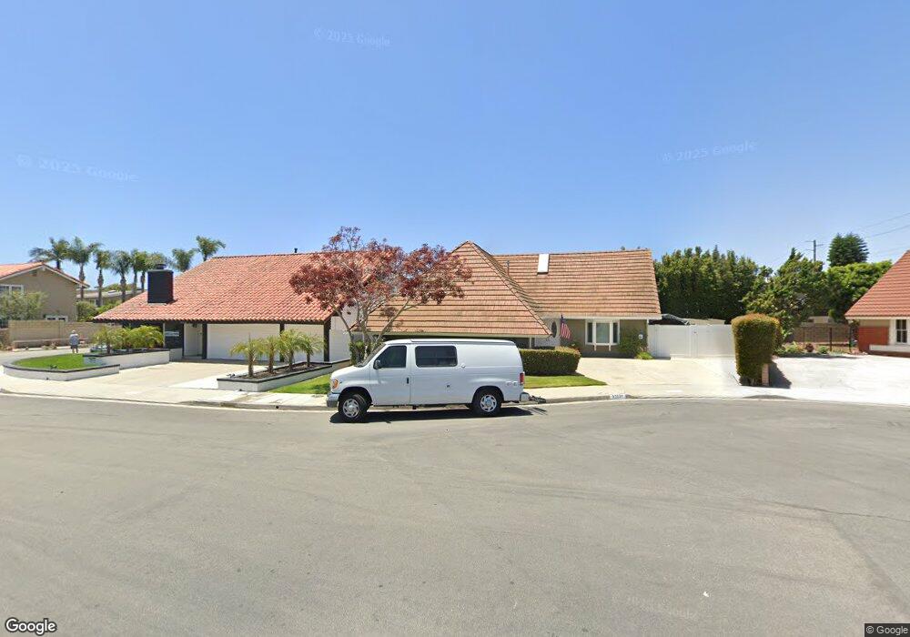
22031 Jonesport Ln Huntington Beach, CA 92646
Southeast NeighborhoodEstimated Value: $1,918,000 - $2,171,000
4
Beds
3
Baths
2,370
Sq Ft
$859/Sq Ft
Est. Value
About This Home
This home is located at 22031 Jonesport Ln, Huntington Beach, CA 92646 and is currently estimated at $2,035,525, approximately $858 per square foot. 22031 Jonesport Ln is a home located in Orange County with nearby schools including John H. Eader Elementary School, Isaac L. Sowers Middle School, and Edison High School.
Ownership History
Date
Name
Owned For
Owner Type
Purchase Details
Closed on
Apr 6, 2009
Sold by
Coffman David M and Coffman Kathleen S
Bought by
Coffman David Michael and Coffman Kathleen Susan
Current Estimated Value
Purchase Details
Closed on
Oct 17, 2006
Sold by
Vrooman Jeffrey L
Bought by
Coffman David M and Coffman Kathleen S
Purchase Details
Closed on
Jun 23, 2006
Sold by
Vrooman Jeffrey L
Bought by
Vrooman Jeffrey L and Jeanne L Vrooman Special Needs Trust
Purchase Details
Closed on
Dec 23, 1998
Sold by
Vrooman Gene L and Vrooman Marcine A
Bought by
Vrooman Gene L and Vrooman Marcine A
Create a Home Valuation Report for This Property
The Home Valuation Report is an in-depth analysis detailing your home's value as well as a comparison with similar homes in the area
Home Values in the Area
Average Home Value in this Area
Purchase History
| Date | Buyer | Sale Price | Title Company |
|---|---|---|---|
| Coffman David Michael | -- | None Available | |
| Coffman David M | $880,000 | Orange Coast Title | |
| Vrooman Jeffrey L | -- | Orange Coast Title | |
| Vrooman Jeffrey L | -- | None Available | |
| Vrooman Gene L | -- | -- |
Source: Public Records
Tax History Compared to Growth
Tax History
| Year | Tax Paid | Tax Assessment Tax Assessment Total Assessment is a certain percentage of the fair market value that is determined by local assessors to be the total taxable value of land and additions on the property. | Land | Improvement |
|---|---|---|---|---|
| 2025 | $13,059 | $1,179,008 | $978,270 | $200,738 |
| 2024 | $13,059 | $1,155,891 | $959,089 | $196,802 |
| 2023 | $12,769 | $1,133,227 | $940,283 | $192,944 |
| 2022 | $12,434 | $1,111,007 | $921,846 | $189,161 |
| 2021 | $12,201 | $1,089,223 | $903,771 | $185,452 |
| 2020 | $12,122 | $1,078,055 | $894,504 | $183,551 |
| 2019 | $11,975 | $1,056,917 | $876,965 | $179,952 |
| 2018 | $11,788 | $1,036,194 | $859,770 | $176,424 |
| 2017 | $11,017 | $961,000 | $811,166 | $149,834 |
| 2016 | $10,727 | $961,000 | $811,166 | $149,834 |
| 2015 | $9,907 | $881,000 | $731,166 | $149,834 |
| 2014 | $9,079 | $807,000 | $657,166 | $149,834 |
Source: Public Records
Map
Nearby Homes
- 21861 Vacation Ln
- 22102 Wood Island Ln
- 21941 Oceanview Ln
- 9552 Castine Dr
- 21722 Hilaria Cir
- 21662 Brookhurst St Unit D
- 9121 Christine Dr
- 9112 Playa Dr
- 21382 Lemontree Ln
- 21621 Kaneohe Ln
- 21361 Lemontree Ln
- 9171 Regatta Dr
- 9581 Chevy Chase Dr
- 9021 Niguel Cir
- 1269 Westreef
- 9802 Effingham Dr
- 1 Starfish Ct Unit 40
- 5 Sand Dollar Ct Unit 16
- 1789 Nantucket Place
- 1872 Parkview Cir
- 22041 Jonesport Ln
- 22032 Rockport Ln
- 22022 Rockport Ln
- 22042 Rockport Ln
- 9671 Melinda Cir
- 9682 Melinda Cir
- 9681 Melinda Cir
- 9631 Port Clyde Dr
- 22061 Jonesport Ln
- 22062 Rockport Ln
- 9681 Allison Cir
- 9692 Melinda Cir
- 9691 Melinda Cir
- 9622 Port Clyde Dr
- 9621 Port Clyde Dr
- 22071 Jonesport Ln
- 9691 Allison Cir
- 22072 Rockport Ln
- 9702 Melinda Cir
- 9701 Melinda Cir