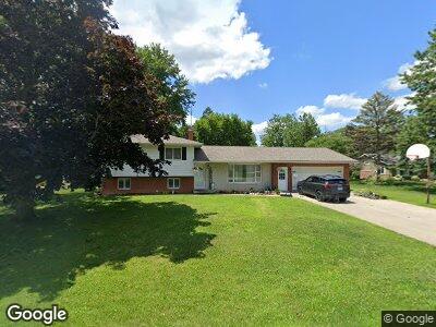
22037 State Route 2 Unit 1 Stryker, OH 43557
Estimated Value: $247,179 - $315,000
3
Beds
2
Baths
1,716
Sq Ft
$157/Sq Ft
Est. Value
About This Home
This home is located at 22037 State Route 2 Unit 1, Stryker, OH 43557 and is currently estimated at $269,295, approximately $156 per square foot. 22037 State Route 2 Unit 1 is a home located in Williams County with nearby schools including Stryker Elementary School and Stryker High School.
Ownership History
Date
Name
Owned For
Owner Type
Purchase Details
Closed on
May 18, 2010
Sold by
Mitchey Scott T
Bought by
Graber Isaac M
Current Estimated Value
Home Financials for this Owner
Home Financials are based on the most recent Mortgage that was taken out on this home.
Original Mortgage
$108,000
Interest Rate
5.14%
Mortgage Type
Purchase Money Mortgage
Purchase Details
Closed on
Oct 1, 2008
Sold by
Mitchey Ann and Silva Anna A
Bought by
Mitchey Scott T
Purchase Details
Closed on
Oct 17, 2002
Sold by
Cuellar Tammy J
Bought by
Mitchey Scott T and Silva Anna A
Purchase Details
Closed on
Aug 6, 1997
Sold by
Cuellar Raul Iii And
Bought by
Cuellar Tammy J
Purchase Details
Closed on
Jul 2, 1993
Bought by
Cuellar Raul Iii And
Create a Home Valuation Report for This Property
The Home Valuation Report is an in-depth analysis detailing your home's value as well as a comparison with similar homes in the area
Home Values in the Area
Average Home Value in this Area
Purchase History
| Date | Buyer | Sale Price | Title Company |
|---|---|---|---|
| Graber Isaac M | $135,000 | None Available | |
| Mitchey Scott T | -- | None Available | |
| Mitchey Scott T | $131,500 | -- | |
| Cuellar Tammy J | -- | -- | |
| Cuellar Raul Iii And | $5,000 | -- |
Source: Public Records
Mortgage History
| Date | Status | Borrower | Loan Amount |
|---|---|---|---|
| Open | Graber Isaac M | $90,300 | |
| Closed | Graber Isaac M | $108,000 | |
| Previous Owner | Mitchey Scott T | $108,300 |
Source: Public Records
Tax History Compared to Growth
Tax History
| Year | Tax Paid | Tax Assessment Tax Assessment Total Assessment is a certain percentage of the fair market value that is determined by local assessors to be the total taxable value of land and additions on the property. | Land | Improvement |
|---|---|---|---|---|
| 2024 | $2,927 | $73,120 | $5,010 | $68,110 |
| 2023 | $2,927 | $59,430 | $5,110 | $54,320 |
| 2022 | $2,643 | $59,430 | $5,110 | $54,320 |
| 2021 | $2,641 | $59,430 | $5,110 | $54,320 |
| 2020 | $2,341 | $49,530 | $4,270 | $45,260 |
| 2019 | $2,309 | $49,530 | $4,270 | $45,260 |
| 2018 | $2,226 | $49,530 | $4,270 | $45,260 |
| 2017 | $2,218 | $47,880 | $4,550 | $43,330 |
| 2016 | $2,143 | $47,880 | $4,550 | $43,330 |
| 2015 | $2,065 | $47,880 | $4,550 | $43,330 |
| 2014 | $2,065 | $43,510 | $4,130 | $39,380 |
| 2013 | $2,086 | $43,510 | $4,130 | $39,380 |
Source: Public Records
Map
Nearby Homes
- 103 King St
- 301 Horton St
- 0 Westfield Dr
- 803 W Holland St
- 800 W Holland St
- 0 Lafayette St
- 22227 Us Highway 20a
- 229 Burke St
- 312 Park Place Unit 312
- 1208 Lindau St
- 200 Pleasant St
- 506 Ditto St
- 000 W Jackson
- 17738 County Rd E
- 400 West St
- 303 Murbach St
- 216 E Holland St
- 808 West St
- 201 E Rings St
- 606 W North St
- 22037 State Route 2 Unit 1
- 22037 State Route 2
- 22037 State Route 2 Unit 3
- 22037 State Route 2 Unit 4
- 22037 State Route 2 Unit 5
- 22037 State Route 2 Unit 6
- 21611 Ohio 2
- 21611 State Route 2
- 22060 State Route 2
- 22060 State Route 2
- 21601 State Route 2
- 22037 Ohio 2
- 21559 State Route 2
- 21362 State Route 2
- 7778 County Road 21n
- 21229 State Route 2
- 21195 State Route 2
- 7503 County Road 2275
- 21177 State Route 2
- 22064 County Road H