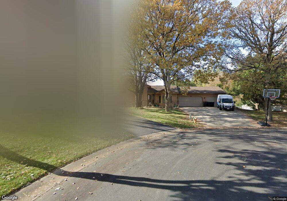
2204 131st Ln NW Coon Rapids, MN 55448
Estimated Value: $406,000 - $421,000
4
Beds
2
Baths
2,206
Sq Ft
$188/Sq Ft
Est. Value
About This Home
This home is located at 2204 131st Ln NW, Coon Rapids, MN 55448 and is currently estimated at $414,882, approximately $188 per square foot. 2204 131st Ln NW is a home located in Anoka County with nearby schools including Lucile Bruner Elementary School, Morris Bye Elementary School, and Laughlin Junior/Senior High School.
Ownership History
Date
Name
Owned For
Owner Type
Purchase Details
Closed on
Dec 28, 2018
Sold by
Jacob Barbara B
Bought by
Spiess Derek S and Spiess Amy M
Current Estimated Value
Home Financials for this Owner
Home Financials are based on the most recent Mortgage that was taken out on this home.
Original Mortgage
$290,496
Outstanding Balance
$260,413
Interest Rate
5.62%
Mortgage Type
FHA
Estimated Equity
$154,469
Create a Home Valuation Report for This Property
The Home Valuation Report is an in-depth analysis detailing your home's value as well as a comparison with similar homes in the area
Home Values in the Area
Average Home Value in this Area
Purchase History
| Date | Buyer | Sale Price | Title Company |
|---|---|---|---|
| Spiess Derek S | $300,000 | All American Title Co Inc |
Source: Public Records
Mortgage History
| Date | Status | Borrower | Loan Amount |
|---|---|---|---|
| Open | Spiess Derek S | $290,496 |
Source: Public Records
Tax History Compared to Growth
Tax History
| Year | Tax Paid | Tax Assessment Tax Assessment Total Assessment is a certain percentage of the fair market value that is determined by local assessors to be the total taxable value of land and additions on the property. | Land | Improvement |
|---|---|---|---|---|
| 2025 | $3,968 | $380,700 | $104,000 | $276,700 |
| 2024 | $3,968 | $375,900 | $100,500 | $275,400 |
| 2023 | $3,709 | $364,300 | $83,200 | $281,100 |
| 2022 | $3,309 | $376,300 | $83,200 | $293,100 |
| 2021 | $3,259 | $301,400 | $64,700 | $236,700 |
| 2020 | $3,310 | $290,500 | $64,700 | $225,800 |
| 2019 | $3,177 | $283,000 | $64,700 | $218,300 |
| 2018 | $2,829 | $264,900 | $0 | $0 |
| 2017 | $2,490 | $231,600 | $0 | $0 |
| 2016 | $2,540 | $202,900 | $0 | $0 |
| 2015 | -- | $202,900 | $52,500 | $150,400 |
| 2014 | -- | $170,600 | $37,200 | $133,400 |
Source: Public Records
Map
Nearby Homes
- 13416 Swallow St NW
- 12760 Raven St NW
- 13182 Zion St NW
- 13519 Partridge Cir NW
- 1776 133rd Ave NW
- 1930 127th Cir NW
- 1687 131st Ln NW
- 2740 132nd Ln NW
- 2147 125th Ln NW
- 2270 137th Ln NW
- 2675 128th Ave NW
- 2068 124th Ln NW
- 1520 129th Ave NW
- 12554 Grouse St NW
- 1593 126th Ln NW
- 2201 139th Ave NW
- 12365 Jay St NW
- 12796 Bluebird St NW
- 1450 126th Ln NW
- 13624 Gladiola St NW
- 2170 131st Ln NW
- 2207 131st Ln NW
- 2203 131st Ave NW
- 2175 131st Ln NW
- 2149 131st Ave NW
- 2209 131st Ave NW
- 2165 131st Ln NW
- 2150 131st Ln NW
- 2231 131st Ave NW
- 2143 131st Ave NW
- 2155 131st Ln NW
- 2139 131st Ave NW
- 2239 131st Ave NW
- 2140 131st Ln NW
- 2145 131st Ln NW
- 2208 131st Ave NW
- 2134 131st Ln NW
- 2206 132nd Ave NW
- 13168 Quinn St NW
- 2158 131st Ave NW