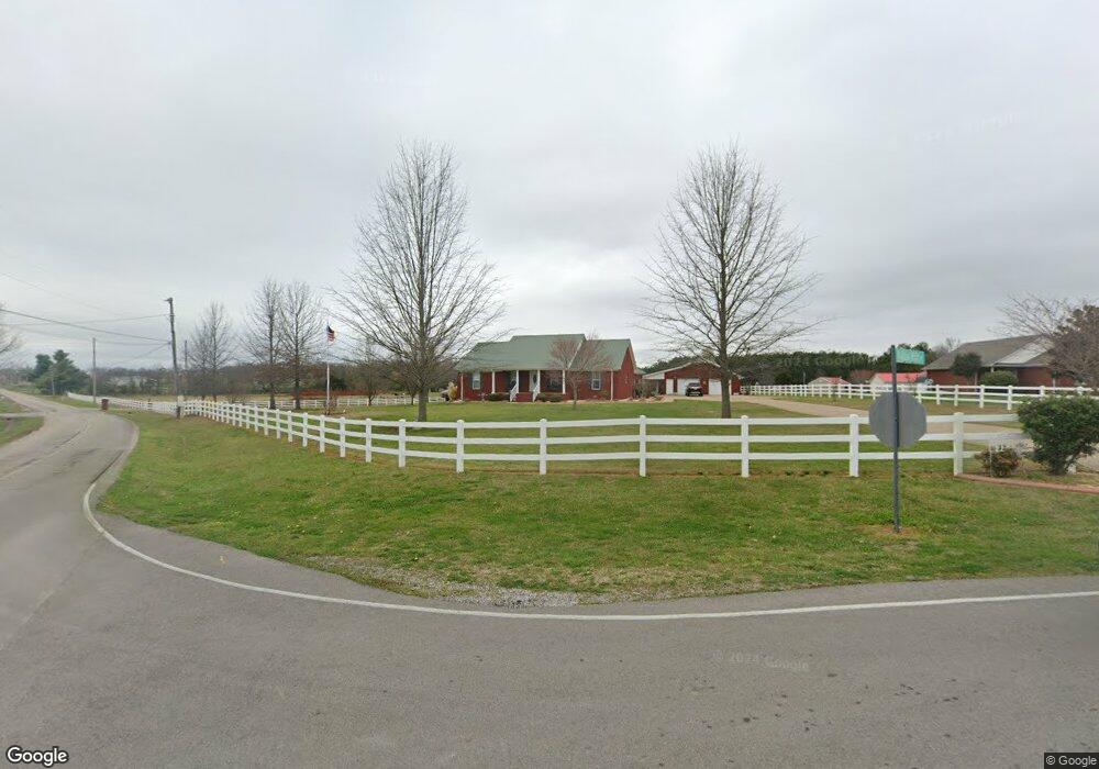
22045 Austin Whitt Rd Ardmore, TN 38449
Estimated Value: $342,000 - $525,000
--
Bed
4
Baths
2,220
Sq Ft
$199/Sq Ft
Est. Value
About This Home
This home is located at 22045 Austin Whitt Rd, Ardmore, TN 38449 and is currently estimated at $441,591, approximately $198 per square foot. 22045 Austin Whitt Rd is a home located in Giles County with nearby schools including Elkton Elementary School and Giles County High School.
Ownership History
Date
Name
Owned For
Owner Type
Purchase Details
Closed on
Feb 27, 2024
Sold by
Crosson Kenneth and Crosson Patricia
Bought by
Mitchell Joe and Mitchell Penny
Current Estimated Value
Purchase Details
Closed on
Dec 18, 2017
Sold by
Lewis Carol D
Bought by
Crosson Kenneth and Crosson Patricia
Purchase Details
Closed on
Feb 3, 2014
Sold by
Crabtree Raymond
Bought by
Crosson Kenneth A and Crosson Patricia O
Purchase Details
Closed on
Nov 5, 2012
Purchase Details
Closed on
Dec 15, 2006
Sold by
Reuter Paulua Ann
Bought by
Crosson Kenneth
Purchase Details
Closed on
Jun 10, 2005
Sold by
Crosson Kenneth Ete Ux
Bought by
Reuter Paulua Ann
Create a Home Valuation Report for This Property
The Home Valuation Report is an in-depth analysis detailing your home's value as well as a comparison with similar homes in the area
Home Values in the Area
Average Home Value in this Area
Purchase History
| Date | Buyer | Sale Price | Title Company |
|---|---|---|---|
| Mitchell Joe | -- | None Listed On Document | |
| Mitchell Joe | -- | None Listed On Document | |
| Crosson Kenneth | $6,000 | None Available | |
| Crosson Kenneth A | $6,000 | -- | |
| -- | $8,000 | -- | |
| Crosson Kenneth | $15,500 | -- | |
| Reuter Paulua Ann | $15,500 | -- |
Source: Public Records
Tax History Compared to Growth
Tax History
| Year | Tax Paid | Tax Assessment Tax Assessment Total Assessment is a certain percentage of the fair market value that is determined by local assessors to be the total taxable value of land and additions on the property. | Land | Improvement |
|---|---|---|---|---|
| 2025 | $2,252 | $104,925 | $0 | $0 |
| 2024 | $2,252 | $104,925 | $10,000 | $94,925 |
| 2023 | $2,252 | $104,925 | $10,000 | $94,925 |
| 2022 | $2,252 | $104,925 | $10,000 | $94,925 |
| 2021 | $2,390 | $77,975 | $6,225 | $71,750 |
| 2020 | $2,390 | $77,975 | $6,225 | $71,750 |
| 2019 | $2,197 | $77,975 | $6,225 | $71,750 |
| 2018 | $2,382 | $77,775 | $6,025 | $71,750 |
| 2017 | $2,385 | $77,775 | $6,025 | $71,750 |
| 2016 | $2,283 | $71,100 | $6,250 | $64,850 |
| 2015 | $2,141 | $71,100 | $6,250 | $64,850 |
| 2014 | $2,141 | $71,101 | $0 | $0 |
Source: Public Records
Map
Nearby Homes
- 0 Union Hill Rd Unit RTC3066715
- 0 Union Hill Rd Unit RTC3066716
- 0 Union Hill Rd Unit RTC3066714
- 0 Union Hill Rd Unit RTC3066717
- 25668 Main St
- 30065 Bankston Rd
- 30740 Mill Race Dr
- 26081 Pheasant Run
- 25230 Union Hill Rd
- 26210 Stateline Rd
- 30679 Ardmore Ridge Rd
- 26651 1st St
- 29847 1st Ave W
- 29385 Mooresville Rd
- 30518 Fort Hampton St
- 99+/- Acres Hobbs Loop
- 30176 Highway 110
- 30A Stevenson Rd
- 30acres Stevenson Rd
- 29238 1st Ave W
- 22051 Austin Whitt Rd
- 24584 Union Hill Rd
- 22055 Austin Whitt Rd
- 22059 Austin Whitt Rd
- 25385 Main St
- 0 Union Hill Rd Unit RTC2067517
- 0 Union Hill Rd Unit RTC2562220
- 3.5 Acres Union Hill Rd
- 0 Union Hill Rd Unit RTC2557326
- 10 +/- Acres Union Hill Rd
- 0 Union Hill Rd Unit 1124977
- 0 Union Hill Rd Unit 1149698
- 03 Union Hill Rd
- 0 Union Hill Rd Unit RTC2473521
- 0 Union Hill Rd Unit RTC2358686
- 0 Union Hill Rd Unit RTC2415829
- 0 Union Hill Rd Unit RTC2352300
- 0 Union Hill Rd Unit RTC2176288
- 0 Union Hill Rd Unit 2271166
- 000 Union Hill Rd