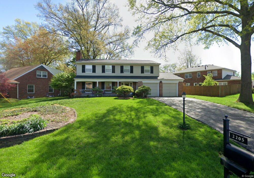
2205 Westridge Rd Louisville, KY 40242
North Central Jefferson County NeighborhoodEstimated Value: $380,917 - $405,000
2
Beds
3
Baths
2,420
Sq Ft
$164/Sq Ft
Est. Value
About This Home
This home is located at 2205 Westridge Rd, Louisville, KY 40242 and is currently estimated at $397,729, approximately $164 per square foot. 2205 Westridge Rd is a home located in Jefferson County with nearby schools including Wilder Elementary School, Zachary Taylor Elementary School, and Norton Elementary School.
Ownership History
Date
Name
Owned For
Owner Type
Purchase Details
Closed on
May 19, 2005
Sold by
Madden John M and Madden Judith A
Bought by
Clark Adam S and Clark Piper A
Current Estimated Value
Home Financials for this Owner
Home Financials are based on the most recent Mortgage that was taken out on this home.
Original Mortgage
$165,600
Outstanding Balance
$86,567
Interest Rate
5.88%
Mortgage Type
Purchase Money Mortgage
Estimated Equity
$311,162
Create a Home Valuation Report for This Property
The Home Valuation Report is an in-depth analysis detailing your home's value as well as a comparison with similar homes in the area
Home Values in the Area
Average Home Value in this Area
Purchase History
| Date | Buyer | Sale Price | Title Company |
|---|---|---|---|
| Clark Adam S | $207,000 | None Available |
Source: Public Records
Mortgage History
| Date | Status | Borrower | Loan Amount |
|---|---|---|---|
| Open | Clark Adam S | $165,600 |
Source: Public Records
Tax History Compared to Growth
Tax History
| Year | Tax Paid | Tax Assessment Tax Assessment Total Assessment is a certain percentage of the fair market value that is determined by local assessors to be the total taxable value of land and additions on the property. | Land | Improvement |
|---|---|---|---|---|
| 2024 | $3,144 | $281,980 | $37,440 | $244,540 |
| 2023 | $3,237 | $281,980 | $37,440 | $244,540 |
| 2022 | $3,248 | $234,530 | $35,000 | $199,530 |
| 2021 | $2,920 | $234,530 | $35,000 | $199,530 |
| 2020 | $2,714 | $234,530 | $35,000 | $199,530 |
| 2019 | $2,659 | $234,530 | $35,000 | $199,530 |
| 2018 | $2,628 | $234,530 | $35,000 | $199,530 |
| 2017 | $2,461 | $234,530 | $35,000 | $199,530 |
| 2013 | $2,070 | $207,000 | $37,000 | $170,000 |
Source: Public Records
Map
Nearby Homes
- 9209 Aylesbury Dr
- 8612 Wintergreen Ct Unit 104
- 8822 Staghorn Dr
- 8612 Locust Ct Unit 36
- 2513 Savannah Rd
- 2103 Redleaf Dr
- 9309 Tiverton Way
- 1851 Washington Blvd
- 1853 Washington Blvd
- 1855 Washington Blvd
- Mitchell Plan at Lyndon Green
- Hampton Plan at Lyndon Green
- Aspire Plan at Lyndon Green
- 1857 Washington Blvd
- 1852 Washington Blvd
- 1861 Washington Blvd
- 1863 Washington Blvd
- 1865 Washington Blvd
- 1867 Washington Blvd
- 1850 Washington Blvd
- 2209 Westridge Rd
- 9001 Cardiff Rd
- 9003 Cardiff Rd
- 2215 Westridge Rd
- 9005 Cardiff Rd
- 2204 Westridge Rd
- 2206 Westridge Rd
- 8919 Cardiff Rd
- 9000 Trentham Ln
- 2210 Westridge Rd
- 9000 Cardiff Rd
- 2214 Stonehurst Dr
- 2208 Westridge Rd
- 9007 Cardiff Rd
- 9002 Cardiff Rd
- 9002 Trentham Ln
- 9004 Cardiff Rd
- 8918 Cardiff Rd
- 2117 Westridge Rd
- 9009 Cardiff Rd