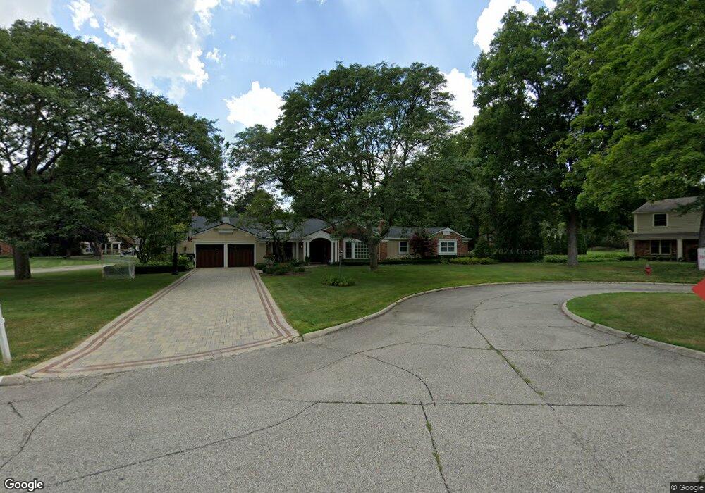
22050 Allen a Dale Ct Franklin, MI 48025
Estimated Value: $728,000 - $978,000
3
Beds
3
Baths
2,508
Sq Ft
$345/Sq Ft
Est. Value
About This Home
This home is located at 22050 Allen a Dale Ct, Franklin, MI 48025 and is currently estimated at $864,728, approximately $344 per square foot. 22050 Allen a Dale Ct is a home located in Oakland County with nearby schools including Bingham Farms Elementary School, Wylie E. Groves High School, and Berkshire Middle School.
Ownership History
Date
Name
Owned For
Owner Type
Purchase Details
Closed on
May 24, 2010
Sold by
Murphy Alison J
Bought by
Callaghan Colin M and Callaghan Amy S
Current Estimated Value
Purchase Details
Closed on
May 20, 2010
Sold by
Murphy James M
Bought by
Murphy Alison J
Purchase Details
Closed on
Jun 9, 2000
Sold by
Wilke Ralph F
Bought by
Murphy James M
Home Financials for this Owner
Home Financials are based on the most recent Mortgage that was taken out on this home.
Original Mortgage
$252,700
Interest Rate
8.66%
Purchase Details
Closed on
Aug 27, 1999
Sold by
Gerring John A
Bought by
Wilke Ralph F
Purchase Details
Closed on
Mar 1, 1996
Sold by
Fisher James W
Bought by
Gerring John A
Create a Home Valuation Report for This Property
The Home Valuation Report is an in-depth analysis detailing your home's value as well as a comparison with similar homes in the area
Home Values in the Area
Average Home Value in this Area
Purchase History
| Date | Buyer | Sale Price | Title Company |
|---|---|---|---|
| Callaghan Colin M | $335,000 | Capital Title Ins Agency | |
| Murphy Alison J | -- | None Available | |
| Murphy James M | $360,000 | -- | |
| Wilke Ralph F | $352,450 | -- | |
| Gerring John A | $263,000 | -- |
Source: Public Records
Mortgage History
| Date | Status | Borrower | Loan Amount |
|---|---|---|---|
| Previous Owner | Murphy James M | $252,700 |
Source: Public Records
Tax History Compared to Growth
Tax History
| Year | Tax Paid | Tax Assessment Tax Assessment Total Assessment is a certain percentage of the fair market value that is determined by local assessors to be the total taxable value of land and additions on the property. | Land | Improvement |
|---|---|---|---|---|
| 2024 | $8,604 | $402,360 | $0 | $0 |
| 2023 | $8,255 | $382,400 | $0 | $0 |
| 2022 | $8,954 | $350,780 | $0 | $0 |
| 2021 | $9,027 | $339,750 | $0 | $0 |
| 2020 | $7,562 | $334,940 | $0 | $0 |
| 2019 | $5,974 | $327,320 | $0 | $0 |
| 2018 | $8,551 | $261,890 | $0 | $0 |
| 2017 | $7,571 | $261,890 | $0 | $0 |
| 2016 | $6,462 | $225,130 | $0 | $0 |
| 2015 | -- | $194,590 | $0 | $0 |
| 2014 | -- | $172,920 | $0 | $0 |
| 2011 | -- | $135,080 | $0 | $0 |
Source: Public Records
Map
Nearby Homes
- 22025 Orchard Way
- 32326 Spruce Ln Unit 31
- 21850 Dover Ct Unit 7
- 000 Beverly Rd
- 32533 Robinhood Dr
- 31111 Lahser Rd
- 31065 Old Stage Rd
- 21700 W 13 Mile Rd
- 31264 Coachlight Ln
- 1850 Orchard Ln
- 7400 Melody Ln
- 0000 Woodlynne Dr
- 7244 Lahser Rd
- 23301 W 14 Mile Rd
- 21622 Riverview Dr
- 30372 Georgetown Dr
- 7357 W Greenwich Dr
- 22601 Highbank Dr
- 24066 Bingham Pointe Dr Unit 11
- 30915 Timberbrook Ln
- 22070 Nottingham Dr
- 22040 Allen a Dale Ct
- 22057 Nottingham Dr
- 22033 Nottingham Dr
- 22114 Archers Ln
- 22026 Allen a Dale Ct
- 22114 Allen a Dale Ct
- 22069 Nottingham Dr
- 22011 Nottingham Dr
- 22105 Nottingham Dr
- 22126 Archers Ln
- 22113 Orchard Way
- 22113 Orchard Way Unit 46
- 22175 Orchard Way
- 22044 Camelot Ct
- 22066 Camelot Ct
- 32075 Spruce Ln
- 0 Lahser Unit 4972816
- 0 Lahser Unit 215019901
- 0 Lahser Unit R2210030507