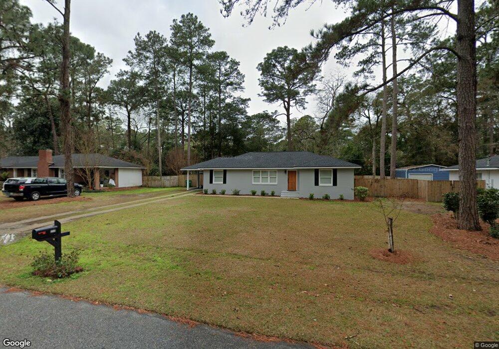
2206 Glynndale Dr Valdosta, GA 31602
Estimated Value: $220,823 - $246,000
3
Beds
3
Baths
2,110
Sq Ft
$110/Sq Ft
Est. Value
About This Home
This home is located at 2206 Glynndale Dr, Valdosta, GA 31602 and is currently estimated at $231,956, approximately $109 per square foot. 2206 Glynndale Dr is a home located in Lowndes County with nearby schools including S.L. Mason Elementary School, Valdosta Middle School, and Valdosta High School.
Ownership History
Date
Name
Owned For
Owner Type
Purchase Details
Closed on
Mar 11, 2024
Sold by
Ten Ring Properties Llc
Bought by
Smith Dean M and Smith Laura D
Current Estimated Value
Purchase Details
Closed on
Oct 22, 2020
Sold by
Yerbey Gary
Bought by
Ten Ring Properties Llc
Home Financials for this Owner
Home Financials are based on the most recent Mortgage that was taken out on this home.
Original Mortgage
$140,000
Interest Rate
2.9%
Mortgage Type
New Conventional
Purchase Details
Closed on
Nov 15, 2019
Sold by
First United Methodist Church
Bought by
Yerbey Gary
Create a Home Valuation Report for This Property
The Home Valuation Report is an in-depth analysis detailing your home's value as well as a comparison with similar homes in the area
Home Values in the Area
Average Home Value in this Area
Purchase History
| Date | Buyer | Sale Price | Title Company |
|---|---|---|---|
| Smith Dean M | -- | -- | |
| Ten Ring Properties Llc | $87,872 | -- | |
| Yerbey Gary | $77,000 | -- |
Source: Public Records
Mortgage History
| Date | Status | Borrower | Loan Amount |
|---|---|---|---|
| Previous Owner | Ten Ring Properties Llc | $140,000 |
Source: Public Records
Tax History Compared to Growth
Tax History
| Year | Tax Paid | Tax Assessment Tax Assessment Total Assessment is a certain percentage of the fair market value that is determined by local assessors to be the total taxable value of land and additions on the property. | Land | Improvement |
|---|---|---|---|---|
| 2024 | $2,255 | $80,753 | $8,000 | $72,753 |
| 2023 | $2,255 | $80,753 | $8,000 | $72,753 |
| 2022 | $2,372 | $70,188 | $8,000 | $62,188 |
| 2021 | $1,222 | $57,172 | $8,000 | $49,172 |
| 2020 | $1,094 | $44,384 | $3,947 | $40,437 |
| 2019 | $1,473 | $44,394 | $3,947 | $40,447 |
| 2018 | $0 | $44,394 | $3,947 | $40,447 |
| 2017 | $0 | $44,394 | $3,947 | $40,447 |
| 2016 | $0 | $44,394 | $3,947 | $40,447 |
| 2015 | -- | $44,394 | $3,947 | $40,447 |
| 2014 | -- | $37,065 | $36,553 | $512 |
Source: Public Records
Map
Nearby Homes
- 2206 White Oak Dr
- 2211 Jerry Jones Dr
- 2217 Brighton Place
- 68 Pineridge Dr
- 5 Dellwood Cir
- 604 Azalea Cir
- 2105 Jerry Jones Dr
- 1104 Linda Dr
- 908 Maplewood Dr
- 2325 White Oak Dr
- 903 Gornto Rd
- 2112 Azalea Dr
- 817 W Cranford Ave
- 1108 Kimberly Dr
- 2208 Dogwood Dr
- 814 W Alden Ave
- 1205 Mcree Dr
- 1 Fox Hollow Cir
- 1212 Dellwood Dr
- 1811 Canterbury Dr
- 2204 Glynndale Dr
- 2208 Glynndale Dr
- 0 Glynndale Dr Unit 7638636
- 2207 Jerry Jones Dr
- 2205 Jerry Jones Dr
- 2209 Jerry Jones Dr
- 2209 Glynndale Dr
- 2210 Glynndale Dr
- 2202 Glynndale Dr
- 2207 Glynndale Dr
- 2211 Glynndale Dr
- 2203 Jerry Jones Dr
- 2203 Jerry Jones Dr
- 2213 Glynndale Dr
- 2205 Glynndale Dr
- 2212 Glynndale Dr
- * Unit 6
- 2213 Jerry Jones Dr
- 2210 White Oak Dr
- 2200 Glynndale Dr