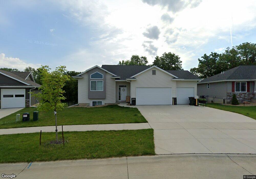
2206 Snapdragon Cir SW Cedar Rapids, IA 52404
Estimated Value: $377,812 - $400,000
4
Beds
3
Baths
2,242
Sq Ft
$172/Sq Ft
Est. Value
About This Home
This home is located at 2206 Snapdragon Cir SW, Cedar Rapids, IA 52404 and is currently estimated at $386,453, approximately $172 per square foot. 2206 Snapdragon Cir SW is a home located in Linn County with nearby schools including Junction City Elementary School, Perryville Elementary School, and Van Buren Elementary School.
Ownership History
Date
Name
Owned For
Owner Type
Purchase Details
Closed on
Jul 28, 2021
Sold by
Cook Anthony R and Cook Natalie E
Bought by
Hotz Thomas J and Hotz Melissa R
Current Estimated Value
Home Financials for this Owner
Home Financials are based on the most recent Mortgage that was taken out on this home.
Original Mortgage
$279,000
Outstanding Balance
$253,811
Interest Rate
2.93%
Mortgage Type
New Conventional
Estimated Equity
$132,642
Purchase Details
Closed on
Jan 2, 2018
Sold by
Martin Combs Custom Homes Llc
Bought by
Cook Anthony R and Cook Natalie E
Home Financials for this Owner
Home Financials are based on the most recent Mortgage that was taken out on this home.
Original Mortgage
$234,000
Interest Rate
3.94%
Mortgage Type
New Conventional
Purchase Details
Closed on
Oct 27, 2016
Sold by
Morris Wood Enterprises Llc
Bought by
Martin Comb Custom Homes Llc
Create a Home Valuation Report for This Property
The Home Valuation Report is an in-depth analysis detailing your home's value as well as a comparison with similar homes in the area
Home Values in the Area
Average Home Value in this Area
Purchase History
| Date | Buyer | Sale Price | Title Company |
|---|---|---|---|
| Hotz Thomas J | $310,000 | None Available | |
| Cook Anthony R | $260,000 | None Available | |
| Martin Comb Custom Homes Llc | -- | None Available |
Source: Public Records
Mortgage History
| Date | Status | Borrower | Loan Amount |
|---|---|---|---|
| Open | Hotz Thomas J | $279,000 | |
| Previous Owner | Cook Anthony R | $234,000 |
Source: Public Records
Tax History Compared to Growth
Tax History
| Year | Tax Paid | Tax Assessment Tax Assessment Total Assessment is a certain percentage of the fair market value that is determined by local assessors to be the total taxable value of land and additions on the property. | Land | Improvement |
|---|---|---|---|---|
| 2025 | $6,136 | $356,500 | $81,900 | $274,600 |
| 2024 | $6,298 | $346,700 | $73,300 | $273,400 |
| 2023 | $6,298 | $346,700 | $73,300 | $273,400 |
| 2022 | $5,470 | $298,600 | $64,600 | $234,000 |
| 2021 | $5,936 | $273,000 | $64,600 | $208,400 |
| 2020 | $5,936 | $277,600 | $56,000 | $221,600 |
| 2019 | $5,762 | $275,800 | $47,400 | $228,400 |
| 2018 | $5,780 | $275,800 | $47,400 | $228,400 |
| 2017 | $126 | $5,800 | $5,800 | $0 |
| 2016 | $0 | $0 | $0 | $0 |
Source: Public Records
Map
Nearby Homes
- 2126 Snapdragon Cir SW
- 2105 Milligan Ct SW
- 2150 Rockford Rd SW
- 2420 Lori Dr SW
- 2025 18th St SW
- 1960 Rockford Rd SW Unit 45
- 1801 Shady Grove Rd SW
- 2825 18th St SW
- 2207 Shady Grove Rd SW
- 1806 Holly Meadow Ave SW
- 1824 Holly Meadow Ave SW
- 1812 Holly Meadow Ave SW
- 2404 25th St SW
- 1818 Holly Meadow Ave SW
- 1332 Wilson Ave SW
- Remington - Cedar Rapids Plan at Whispering Pines
- Copeland Plan at Whispering Pines
- Meadowbrook - Cedar Rapids Plan at Stags Leap Estates
- Caldwell Plan at Stags Leap Estates
- Concord - Cedar Rapids Plan at Stags Leap Estates
- 2200 Snapdragon Cir SW
- 2212 Snapdragon Cir SW
- 2207 Snapdragon Cir SW
- 2121 Snapdragon Cir SW
- 2120 Snapdragon Cir SW
- 2224 Snapdragon Cir SW
- 2117 Snapdragon Cir SW
- 2113 Snapdragon Cir SW
- 2309 Snapdragon Cir SW
- 2115 Snapdragon Cir SW
- 2114 Snapdragon Cir SW
- 2302 Snapdragon Cir SW
- 2109 Snapdragon Cir SW
- 2401 Snapdragon Cir SW
- 2307 Snapdragon Cir SW
- 2421 Snapdragon Cir SW
- 2419 Snapdragon Cir SW
- 2403 Snapdragon Cir SW
- 2108 Snapdragon Cir SW
- 2308 Snapdragon Cir SW