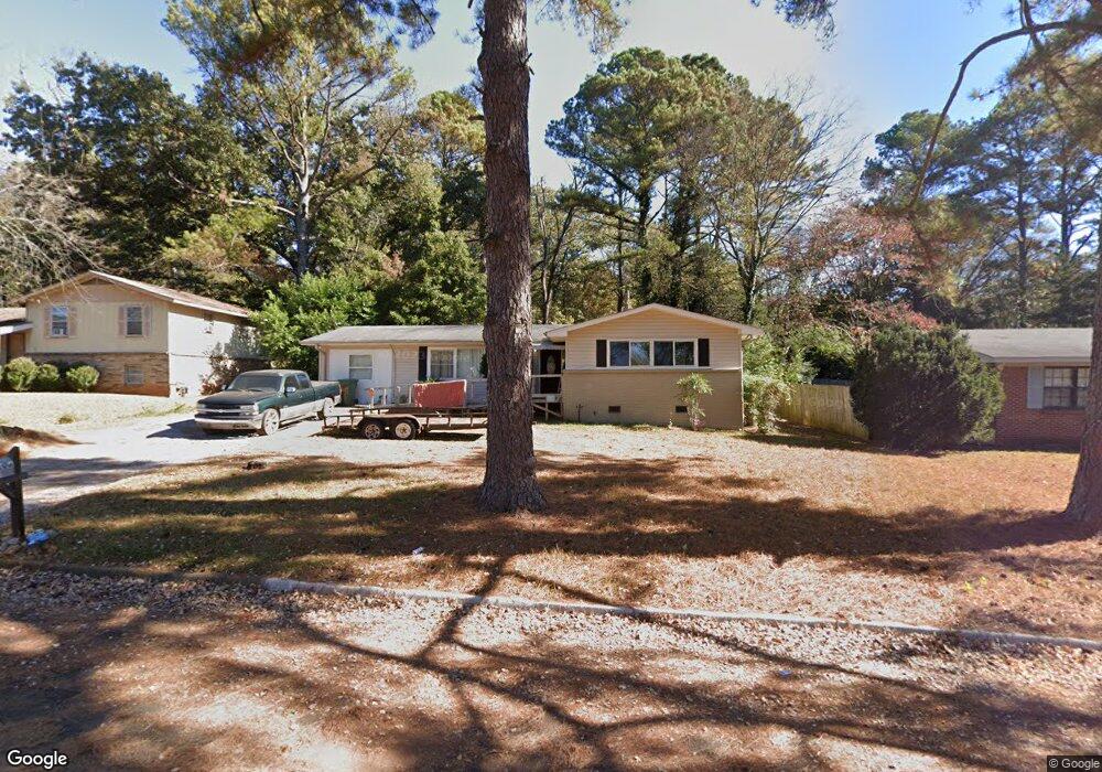
2206 Viscount Dr NW Huntsville, AL 35810
Mastin Lake Park NeighborhoodEstimated Value: $160,971 - $178,000
--
Bed
--
Bath
1,677
Sq Ft
$102/Sq Ft
Est. Value
About This Home
This home is located at 2206 Viscount Dr NW, Huntsville, AL 35810 and is currently estimated at $171,743, approximately $102 per square foot. 2206 Viscount Dr NW is a home with nearby schools including Montview Elementary School, Chapman Middle School, and Lee High School.
Ownership History
Date
Name
Owned For
Owner Type
Purchase Details
Closed on
Aug 28, 2023
Sold by
Moore Hassie
Bought by
Moore Ralph
Current Estimated Value
Purchase Details
Closed on
Sep 29, 2006
Sold by
Swafford Charles N and Mccormick Edward L
Bought by
Moore Hassie
Home Financials for this Owner
Home Financials are based on the most recent Mortgage that was taken out on this home.
Original Mortgage
$80,078
Interest Rate
6.46%
Mortgage Type
New Conventional
Create a Home Valuation Report for This Property
The Home Valuation Report is an in-depth analysis detailing your home's value as well as a comparison with similar homes in the area
Home Values in the Area
Average Home Value in this Area
Purchase History
| Date | Buyer | Sale Price | Title Company |
|---|---|---|---|
| Moore Ralph | $141,100,000 | None Listed On Document | |
| Moore Ralph | $126,250 | None Listed On Document | |
| Moore Hassie | -- | -- |
Source: Public Records
Mortgage History
| Date | Status | Borrower | Loan Amount |
|---|---|---|---|
| Previous Owner | Moore Hassie | $80,078 |
Source: Public Records
Tax History Compared to Growth
Tax History
| Year | Tax Paid | Tax Assessment Tax Assessment Total Assessment is a certain percentage of the fair market value that is determined by local assessors to be the total taxable value of land and additions on the property. | Land | Improvement |
|---|---|---|---|---|
| 2024 | $1,750 | $28,220 | $6,380 | $21,840 |
| 2023 | $1,637 | $11,000 | $2,280 | $8,720 |
| 2022 | $0 | $9,920 | $2,280 | $7,640 |
| 2021 | $353 | $8,440 | $1,200 | $7,240 |
| 2020 | $353 | $7,960 | $1,190 | $6,770 |
| 2019 | $353 | $7,270 | $1,190 | $6,080 |
| 2018 | $327 | $6,780 | $0 | $0 |
| 2017 | $327 | $6,780 | $0 | $0 |
| 2016 | $327 | $6,780 | $0 | $0 |
| 2015 | $295 | $6,160 | $0 | $0 |
| 2014 | $251 | $5,300 | $0 | $0 |
Source: Public Records
Map
Nearby Homes
- 2202 Viscount Dr NW
- 2510 Pulaski Pike NW
- 2800 Cave Ave NW
- 2818 Gus Grissom Dr NW
- 2209 Hill St NW
- 2703 Cave Ave NW
- 2217 Linde St NW
- 2506 Skyline Dr NW
- 1723 Laverne Dr NW
- 3605 Sparkman Dr NW
- 2904 Pulaski Pike NW
- 2710 Monticello Dr NW
- 3.92 Acres Sparkman Dr NW
- 3702 Broadmor Rd NW
- 2603 Bonnie View Dr
- 2906 Sparkman Dr NW
- 2111 Shady Lane Cir NW
- 3129 Millbrook Dr NW
- 3911 Sparkman Dr NW
- 2901 Greenhill Dr NW
- 2208 Viscount Dr NW
- 2204 Viscount Dr NW
- 2210 Viscount Dr NW
- 2205 Viscount Dr NW
- 2203 Viscount Dr NW
- 2207 Viscount Dr NW
- 2212 Viscount Dr NW
- 2209 Viscount Dr NW
- 2804 Mallory Ave NW
- 2900 Mallory Ave NW
- 2211 Viscount Dr NW
- 2802 Mallory Ave NW
- 2800 Mallory Ave NW
- 2902 Mallory Ave NW
- 2904 Mallory Ave NW
- 2213 Viscount Dr NW
- 2400 Pulaski Pike NW
- 2204 La Salle Rd NW
- 2216 Viscount Dr NW
- 2901 Mallory Ave NW