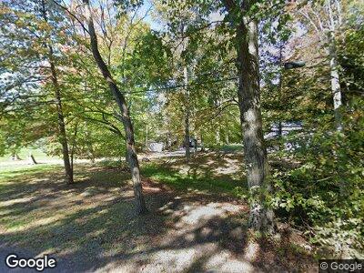
2207 Laurel Creek Rd Mount Pleasant, PA 15666
Mount Pleasant Township NeighborhoodEstimated Value: $185,000 - $314,894
--
Bed
--
Bath
1,296
Sq Ft
$190/Sq Ft
Est. Value
About This Home
This home is located at 2207 Laurel Creek Rd, Mount Pleasant, PA 15666 and is currently estimated at $246,724, approximately $190 per square foot. 2207 Laurel Creek Rd is a home located in Westmoreland County with nearby schools including Mount Pleasant Area High School.
Ownership History
Date
Name
Owned For
Owner Type
Purchase Details
Closed on
Dec 5, 2003
Sold by
Stahl Robert and Stahl Laura L
Bought by
Govern Robin W
Current Estimated Value
Home Financials for this Owner
Home Financials are based on the most recent Mortgage that was taken out on this home.
Original Mortgage
$137,655
Interest Rate
5.9%
Mortgage Type
Purchase Money Mortgage
Purchase Details
Closed on
Feb 6, 2001
Sold by
Miller James H
Bought by
Stahl Robert and Stahl Laura L
Home Financials for this Owner
Home Financials are based on the most recent Mortgage that was taken out on this home.
Original Mortgage
$94,250
Interest Rate
7.13%
Mortgage Type
FHA
Create a Home Valuation Report for This Property
The Home Valuation Report is an in-depth analysis detailing your home's value as well as a comparison with similar homes in the area
Home Values in the Area
Average Home Value in this Area
Purchase History
| Date | Buyer | Sale Price | Title Company |
|---|---|---|---|
| Govern Robin W | $144,900 | -- | |
| Stahl Robert | $95,000 | -- |
Source: Public Records
Mortgage History
| Date | Status | Borrower | Loan Amount |
|---|---|---|---|
| Open | Govern Robin W | $192,000 | |
| Closed | Govern Robin W | $22,491 | |
| Closed | Govern Robin W | $160,866 | |
| Closed | Govern Robin W | $136,450 | |
| Closed | Govern Robin W | $50,000 | |
| Closed | Govern Robin W | $50,000 | |
| Closed | Govern Robin W | $137,655 | |
| Previous Owner | Stahl Robert | $94,250 |
Source: Public Records
Tax History Compared to Growth
Tax History
| Year | Tax Paid | Tax Assessment Tax Assessment Total Assessment is a certain percentage of the fair market value that is determined by local assessors to be the total taxable value of land and additions on the property. | Land | Improvement |
|---|---|---|---|---|
| 2025 | $2,908 | $23,130 | $810 | $22,320 |
| 2024 | $2,885 | $23,130 | $810 | $22,320 |
| 2023 | $2,700 | $23,130 | $810 | $22,320 |
| 2022 | $2,700 | $23,130 | $810 | $22,320 |
| 2021 | $2,654 | $23,130 | $810 | $22,320 |
| 2020 | $2,654 | $23,130 | $810 | $22,320 |
| 2019 | $2,642 | $23,130 | $810 | $22,320 |
| 2018 | $2,642 | $23,130 | $810 | $22,320 |
| 2017 | $2,591 | $23,130 | $810 | $22,320 |
| 2016 | $2,477 | $23,130 | $810 | $22,320 |
| 2015 | $2,477 | $23,130 | $810 | $22,320 |
| 2014 | $2,387 | $23,130 | $810 | $22,320 |
Source: Public Records
Map
Nearby Homes
- 1863 State Route 982
- 175 Mt Joy Rd
- 240 Birch Rd
- 97 A & B United Rd
- Lot 5 State St
- TBD Deer Creek Dr
- 227 Alice Rd
- 0 Hecla Rd Unit 1692620
- TBD N Route 819
- 194 Horse Shoe Bend Rd
- LOT 23 Horse Shoe Bend Rd
- 4 Horse Shoe Bend Rd
- 141 Chestnut Ridge Rd
- Lot 463 Spruce Peak Rd
- Lot 1735 Cottonwood Rd
- 0 Cottonwood Rd
- 385 Kreinbrook Hill Rd
- 4205 Slope Hill Rd
- 142 Mellingertown Rd
- 773 Kreinbrook Hill Rd
- 2207 Laurel Creek Rd
- 2206 Laurel Creek Rd
- 115 Mennonite Camp Rd
- 131 Mennonite Camp Rd
- 135 Mennonite Camp Rd
- 2006 Sr
- 520 Creekside Ln
- 516 Off Rte Ln
- 106 Mennonite Camp Rd
- 524 Creekside Ln
- 1834 State Route 982
- 523 Creekside Ln
- 2006 Sr
- 982 Sr
- 533 Creekside Ln
- 1828 State Route 982
- 2291 Ridgeview Rd
- 2281 Ridgeview Rd
- 102 Solarhouse
- U-101 Solarhouse
