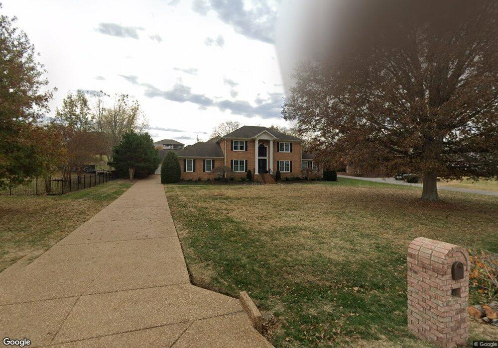
2208 Barnes Dr Lebanon, TN 37087
Estimated Value: $625,122 - $792,000
--
Bed
3
Baths
3,315
Sq Ft
$223/Sq Ft
Est. Value
About This Home
This home is located at 2208 Barnes Dr, Lebanon, TN 37087 and is currently estimated at $738,531, approximately $222 per square foot. 2208 Barnes Dr is a home located in Wilson County with nearby schools including Castle Heights Elementary School, Winfree Bryant Middle School, and Lebanon High School.
Ownership History
Date
Name
Owned For
Owner Type
Purchase Details
Closed on
May 8, 2015
Sold by
Kelsh Feron D
Bought by
Walden David W and Walden Amanda P
Current Estimated Value
Home Financials for this Owner
Home Financials are based on the most recent Mortgage that was taken out on this home.
Original Mortgage
$300,000
Outstanding Balance
$231,695
Interest Rate
3.75%
Mortgage Type
New Conventional
Estimated Equity
$506,836
Purchase Details
Closed on
Aug 5, 2003
Sold by
Phillip Teal and Phillip Lynn B
Bought by
Kelsh Feron D
Home Financials for this Owner
Home Financials are based on the most recent Mortgage that was taken out on this home.
Original Mortgage
$221,600
Interest Rate
5.24%
Purchase Details
Closed on
May 31, 1991
Bought by
Teal Phillip
Purchase Details
Closed on
Jun 18, 1990
Bought by
Watson Anthony Tr & Nancy
Purchase Details
Closed on
Apr 4, 1904
Bought by
Watson Anthony Tr
Create a Home Valuation Report for This Property
The Home Valuation Report is an in-depth analysis detailing your home's value as well as a comparison with similar homes in the area
Home Values in the Area
Average Home Value in this Area
Purchase History
| Date | Buyer | Sale Price | Title Company |
|---|---|---|---|
| Walden David W | $375,000 | -- | |
| Kelsh Feron D | $277,000 | -- | |
| Teal Phillip | $200,000 | -- | |
| Watson Anthony Tr & Nancy | -- | -- | |
| Watson Anthony Tr | -- | -- |
Source: Public Records
Mortgage History
| Date | Status | Borrower | Loan Amount |
|---|---|---|---|
| Open | Walden David W | $300,000 | |
| Previous Owner | Watson Anthony Tr | $221,600 |
Source: Public Records
Tax History Compared to Growth
Tax History
| Year | Tax Paid | Tax Assessment Tax Assessment Total Assessment is a certain percentage of the fair market value that is determined by local assessors to be the total taxable value of land and additions on the property. | Land | Improvement |
|---|---|---|---|---|
| 2024 | $2,318 | $105,100 | $17,500 | $87,600 |
| 2022 | $3,038 | $105,100 | $17,500 | $87,600 |
| 2021 | $3,039 | $105,100 | $17,500 | $87,600 |
| 2020 | $3,402 | $105,100 | $17,500 | $87,600 |
| 2019 | $776 | $90,525 | $16,250 | $74,275 |
| 2018 | $3,176 | $90,525 | $16,250 | $74,275 |
| 2017 | $3,000 | $85,500 | $16,250 | $69,250 |
| 2016 | $3,000 | $85,500 | $16,250 | $69,250 |
| 2015 | $3,102 | $85,500 | $16,250 | $69,250 |
| 2014 | $2,778 | $76,586 | $0 | $0 |
Source: Public Records
Map
Nearby Homes
- 108 Southfork Dr
- 2019 Arlington Rd
- 0 Palmer Rd
- 523 Medwyk Dr
- 3006 Hedgelawn Dr
- 1930 Arlington Rd
- 1063 River Oaks Blvd
- 119 Fister Dr
- 2008 Hedgelawn Dr
- 1920 Hampton Dr
- 1925 Vicksburg Ln
- 1915 Appomattox Dr
- 0 Horn Springs Rd Unit RTC2822257
- 0 Horn Springs Rd Unit RTC2822266
- 0 Horn Springs Rd Unit RTC2780684
- 3 Horn Springs Rd
- 1107 River Oaks Blvd
- The McGinnis Plan at Stratford Station
- The Langford Plan at Stratford Station
- The Palmer Plan at Stratford Station
- 2210 Barnes Dr
- 401 Amarillo Dr
- 2214 Barnes Dr
- 2213 Cartel Dr
- 2211 Cartel Dr
- 405 Amarillo Dr
- 2211 Barnes Dr
- 2216 Barnes Dr
- 2207 Cartel Dr
- 2213 Barnes Dr
- 2209 Barnes Dr
- 2209 Cartel Dr
- 2205 Cartel Dr
- 2215 Barnes Dr
- 400 Amarillo Dr
- 402 Amarillo Dr
- 2205 Barnes Dr
- 2219 Barnes Dr
- 304 Barnes Dr
- 212 Southfork Dr