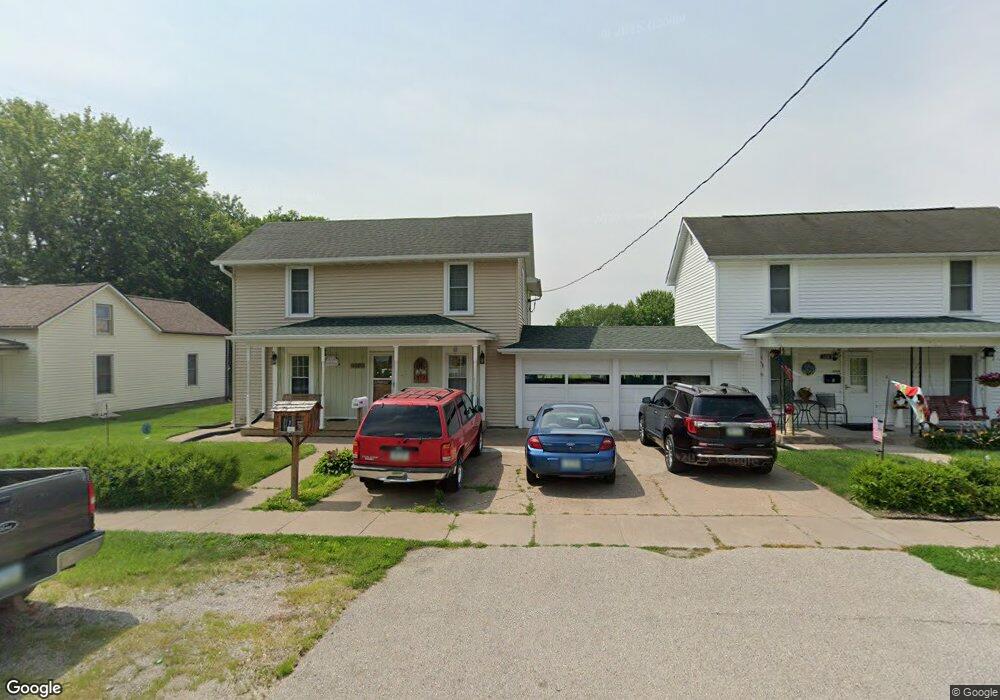
2208 New Hampshire St Muscatine, IA 52761
Estimated Value: $118,000 - $144,000
4
Beds
1
Bath
1,612
Sq Ft
$83/Sq Ft
Est. Value
About This Home
This home is located at 2208 New Hampshire St, Muscatine, IA 52761 and is currently estimated at $134,572, approximately $83 per square foot. 2208 New Hampshire St is a home located in Muscatine County with nearby schools including Franklin Elementary School, Susan Clark Junior High School, and Muscatine High School.
Ownership History
Date
Name
Owned For
Owner Type
Purchase Details
Closed on
Oct 10, 2005
Sold by
Dusenberry Douglas J and Dusenberry Rhonda L
Bought by
Hubbard Kevin J and Hubbard Lori
Current Estimated Value
Home Financials for this Owner
Home Financials are based on the most recent Mortgage that was taken out on this home.
Original Mortgage
$250,000
Outstanding Balance
$134,822
Interest Rate
5.88%
Mortgage Type
Purchase Money Mortgage
Estimated Equity
-$250
Purchase Details
Closed on
Feb 18, 2005
Sold by
Dusenberry Douglas J and Dusenberry Rhonda L
Bought by
Hubbard Kevin J and Hubbard Lori
Home Financials for this Owner
Home Financials are based on the most recent Mortgage that was taken out on this home.
Original Mortgage
$250,000
Interest Rate
5.78%
Mortgage Type
Purchase Money Mortgage
Create a Home Valuation Report for This Property
The Home Valuation Report is an in-depth analysis detailing your home's value as well as a comparison with similar homes in the area
Home Values in the Area
Average Home Value in this Area
Purchase History
| Date | Buyer | Sale Price | Title Company |
|---|---|---|---|
| Hubbard Kevin J | $15,500 | None Available | |
| Hubbard Kevin J | $15,500 | None Available |
Source: Public Records
Mortgage History
| Date | Status | Borrower | Loan Amount |
|---|---|---|---|
| Open | Hubbard Kevin J | $250,000 | |
| Previous Owner | Hubbard Kevin J | $250,000 |
Source: Public Records
Tax History Compared to Growth
Tax History
| Year | Tax Paid | Tax Assessment Tax Assessment Total Assessment is a certain percentage of the fair market value that is determined by local assessors to be the total taxable value of land and additions on the property. | Land | Improvement |
|---|---|---|---|---|
| 2025 | $1,610 | $120,150 | $9,250 | $110,900 |
| 2024 | $1,610 | $112,710 | $9,250 | $103,460 |
| 2023 | $1,920 | $114,109 | $9,275 | $104,834 |
| 2022 | $1,838 | $104,340 | $8,750 | $95,590 |
| 2021 | $1,838 | $99,010 | $8,750 | $90,260 |
| 2020 | $1,526 | $94,010 | $8,750 | $85,260 |
| 2019 | $1,682 | $84,670 | $0 | $0 |
| 2018 | $1,646 | $84,230 | $0 | $0 |
| 2017 | $1,764 | $86,620 | $0 | $0 |
| 2016 | $1,762 | $86,620 | $0 | $0 |
| 2015 | $1,762 | $84,170 | $0 | $0 |
| 2014 | $1,718 | $84,170 | $0 | $0 |
Source: Public Records
Map
Nearby Homes
- 111 Gilbert St
- 1903 Hershey Ave
- 1827 Hershey Ave
- 2108 Breese Ave
- LOTS 30-34 Evans St
- 609 Liberty St
- 208 Fletcher Ave
- 2207 Lucas St
- 0 Parcel 1302108019 (Busch St)
- 1603 Lucas St
- 0 High Street Parcel
- 1143 Logan St
- 900 W 3rd St
- 836 Newell Ave
- 1708 Schley Ave
- 613 W 5th St
- 2109 Americana Ave
- 1619 Devitt Ave
- 511 W 7th St
- 701 W Mississippi Dr
- 2206 New Hampshire St
- 2210 New Hampshire St
- 2204 New Hampshire St
- 2212 New Hampshire St
- 2214 New Hampshire St
- 2202 New Hampshire St
- 2216 New Hampshire St
- 2207 New Hampshire St
- 2205 New Hampshire St
- 209 Grover St
- 2209 New Hampshire St
- 2203 New Hampshire St
- 2218 New Hampshire St
- 2211 New Hampshire St
- 109 Grover St
- 2215 New Hampshire St
- 215 Grover St
- 204 Grover St
- 202 Grover St
- 210 Grover St