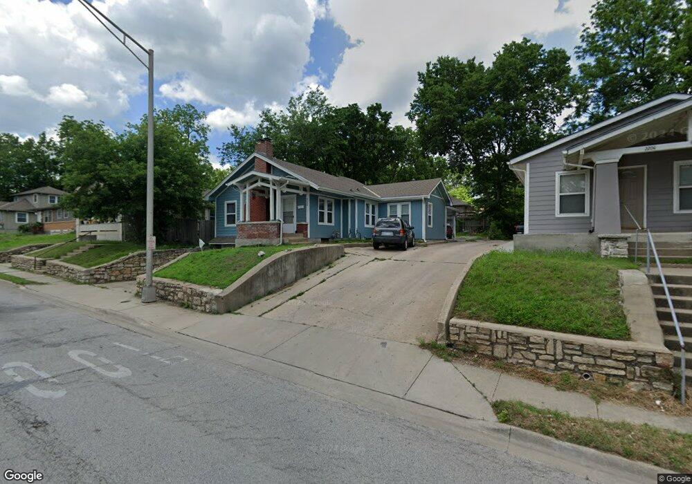
2208 State Ave Kansas City, KS 66102
Kensington NeighborhoodEstimated Value: $187,670 - $243,000
3
Beds
2
Baths
1,482
Sq Ft
$142/Sq Ft
Est. Value
About This Home
This home is located at 2208 State Ave, Kansas City, KS 66102 and is currently estimated at $209,918, approximately $141 per square foot. 2208 State Ave is a home located in Wyandotte County with nearby schools including Mark Twain Elementary, Central Middle School, and Wyandotte High School.
Ownership History
Date
Name
Owned For
Owner Type
Purchase Details
Closed on
Jan 24, 2009
Sold by
Maderos Jose A and Maderos Maria M
Bought by
Estrada Jose Luis and Flores Martha
Current Estimated Value
Home Financials for this Owner
Home Financials are based on the most recent Mortgage that was taken out on this home.
Original Mortgage
$48,000
Outstanding Balance
$23,073
Interest Rate
5.09%
Mortgage Type
Purchase Money Mortgage
Estimated Equity
$186,845
Purchase Details
Closed on
Aug 24, 2004
Sold by
Merick Frank L
Bought by
Ameriquest Mortgage Co
Purchase Details
Closed on
Apr 1, 2004
Sold by
Vaca Miguel and Vaca Elaine G
Bought by
Merick Frank L
Create a Home Valuation Report for This Property
The Home Valuation Report is an in-depth analysis detailing your home's value as well as a comparison with similar homes in the area
Home Values in the Area
Average Home Value in this Area
Purchase History
| Date | Buyer | Sale Price | Title Company |
|---|---|---|---|
| Estrada Jose Luis | -- | Kansas Title Insurance Corp | |
| Ameriquest Mortgage Co | -- | None Available | |
| Merick Frank L | -- | -- |
Source: Public Records
Mortgage History
| Date | Status | Borrower | Loan Amount |
|---|---|---|---|
| Open | Estrada Jose Luis | $48,000 |
Source: Public Records
Tax History Compared to Growth
Tax History
| Year | Tax Paid | Tax Assessment Tax Assessment Total Assessment is a certain percentage of the fair market value that is determined by local assessors to be the total taxable value of land and additions on the property. | Land | Improvement |
|---|---|---|---|---|
| 2024 | $2,505 | $17,238 | $2,755 | $14,483 |
| 2023 | $2,193 | $13,927 | $2,621 | $11,306 |
| 2022 | $1,537 | $9,841 | $2,249 | $7,592 |
| 2021 | $1,345 | $8,303 | $1,911 | $6,392 |
| 2020 | $1,244 | $7,698 | $1,442 | $6,256 |
| 2019 | $1,158 | $7,189 | $1,452 | $5,737 |
| 2018 | $1,034 | $6,477 | $1,159 | $5,318 |
| 2017 | $944 | $5,888 | $1,159 | $4,729 |
| 2016 | $1,011 | $6,222 | $1,159 | $5,063 |
| 2015 | $1,023 | $6,222 | $1,159 | $5,063 |
| 2014 | $619 | $5,983 | $1,328 | $4,655 |
Source: Public Records
Map
Nearby Homes
- 1309 Hoel Pkwy
- 2005 Washington Ave
- 1421 N 27th St
- 2638 Armstrong Ave
- 1301 N 18th St
- 1712 Washington Ave
- 1800 Oakland Ave
- 1810 Freeman Ave
- 1920 Sandusky Ave
- 627 N 29th St
- 531 Westvale Rd
- 2828 Tauromee Ave
- 616 N 29th St
- 520 Westvale Rd
- 1814 Walker Ave
- 449 N 18th St
- 1828 N 19th St
- 340 N 33 St
- 340 N 26th St
- 1834 N 18th St
- 2210 State Ave
- 2204 State Ave
- 2211 Nebraska Ave
- 2200 State Ave
- 2215 Nebraska Ave
- 2214 State Ave
- 2201 Nebraska Ave
- 2219 Nebraska Ave
- 1029 N 22nd St
- 2220 State Ave
- 2221 Nebraska Ave
- 1025 N 22nd St
- 2130 State Ave
- 2224 State Ave
- 2119 Nebraska Ave
- 1032 N 21st Place
- 1023 N 22nd St
- 2225 Nebraska Ave
- 1200 N 22nd St
- 1028 N 21st Place