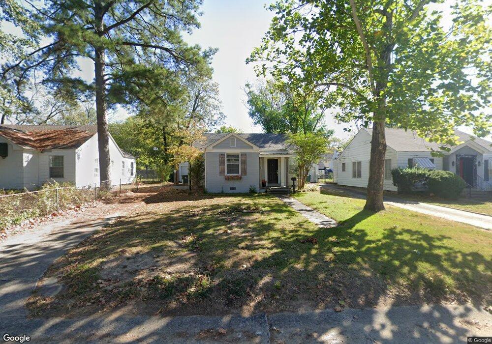
2209 N Arthur St Little Rock, AR 72207
Heights NeighborhoodEstimated Value: $275,000 - $327,577
--
Bed
1
Bath
1,049
Sq Ft
$290/Sq Ft
Est. Value
About This Home
This home is located at 2209 N Arthur St, Little Rock, AR 72207 and is currently estimated at $304,394, approximately $290 per square foot. 2209 N Arthur St is a home located in Pulaski County with nearby schools including Jefferson Elementary School, Pulaski Heights Middle School, and Central High School.
Ownership History
Date
Name
Owned For
Owner Type
Purchase Details
Closed on
Dec 3, 2021
Sold by
Woods Kristen
Bought by
Woods Kristen and Woods Stephen
Current Estimated Value
Purchase Details
Closed on
Feb 1, 2005
Sold by
Blalock Shannon E
Bought by
Briggs David F
Home Financials for this Owner
Home Financials are based on the most recent Mortgage that was taken out on this home.
Original Mortgage
$113,050
Interest Rate
5%
Mortgage Type
Adjustable Rate Mortgage/ARM
Purchase Details
Closed on
Jun 7, 2002
Sold by
Rogers James W
Bought by
Blalock Shannon E
Home Financials for this Owner
Home Financials are based on the most recent Mortgage that was taken out on this home.
Original Mortgage
$95,000
Interest Rate
5.75%
Create a Home Valuation Report for This Property
The Home Valuation Report is an in-depth analysis detailing your home's value as well as a comparison with similar homes in the area
Home Values in the Area
Average Home Value in this Area
Purchase History
| Date | Buyer | Sale Price | Title Company |
|---|---|---|---|
| Woods Kristen | $60,000 | None Listed On Document | |
| Briggs David F | $119,000 | Lenders Title Co | |
| Blalock Shannon E | $95,000 | Lenders Title Company |
Source: Public Records
Mortgage History
| Date | Status | Borrower | Loan Amount |
|---|---|---|---|
| Previous Owner | Briggs David F | $113,050 | |
| Previous Owner | Blalock Shannon E | $95,000 |
Source: Public Records
Tax History Compared to Growth
Tax History
| Year | Tax Paid | Tax Assessment Tax Assessment Total Assessment is a certain percentage of the fair market value that is determined by local assessors to be the total taxable value of land and additions on the property. | Land | Improvement |
|---|---|---|---|---|
| 2025 | $2,541 | $71,405 | $36,600 | $34,805 |
| 2024 | $2,178 | $71,405 | $36,600 | $34,805 |
| 2023 | $2,178 | $71,405 | $36,600 | $34,805 |
| 2022 | $1,997 | $71,405 | $36,600 | $34,805 |
| 2021 | $1,829 | $44,230 | $35,100 | $9,130 |
| 2020 | $1,269 | $44,230 | $35,100 | $9,130 |
| 2019 | $1,269 | $44,230 | $35,100 | $9,130 |
| 2018 | $1,644 | $44,230 | $35,100 | $9,130 |
| 2017 | $1,448 | $44,230 | $35,100 | $9,130 |
| 2016 | $1,363 | $29,990 | $16,000 | $13,990 |
| 2015 | $1,509 | $23,491 | $16,000 | $7,491 |
| 2014 | $1,509 | $21,531 | $16,000 | $5,531 |
Source: Public Records
Map
Nearby Homes
- 2115 N Mckinley St
- 6320 Cantrell Rd
- 6612 Hawthorne Rd
- 6223 Cantrell Rd
- 6700 Hawthorne Rd
- 107 Normandy Rd
- 6224 Brentwood Rd
- 2715 N Grant St
- 109 Schoolwood Ln
- 5520 Hawthorne Rd
- 6021 Longwood Rd
- 2 Shannon Dr
- 1701 N University Ave
- 2800 N Pierce St
- 6119 Kenwood Rd
- 6613 Brentwood Rd
- 2219 & 2221 Blackwood Rd
- 6717 Kavanaugh Place
- 1824 N Hughes St
- 6300 Kenwood Rd
- 2207 N Arthur St
- 2211 N Arthur St
- 2205 N Arthur St
- 2213 N Arthur St
- 2212 N Garfield St
- 2203 N Arthur St
- 2208 N Garfield St
- 2206 N Garfield St
- 2304 N Garfield St
- 2216 N Arthur St
- 2215 N Arthur St
- 2220 N Arthur St
- 2212 N Arthur St
- 2201 N Arthur St
- 2300 N Arthur St
- 2208 N Arthur St
- 2306 N Garfield St
- N Arthur
- 2204 N Garfield St
- 2204 N Arthur St