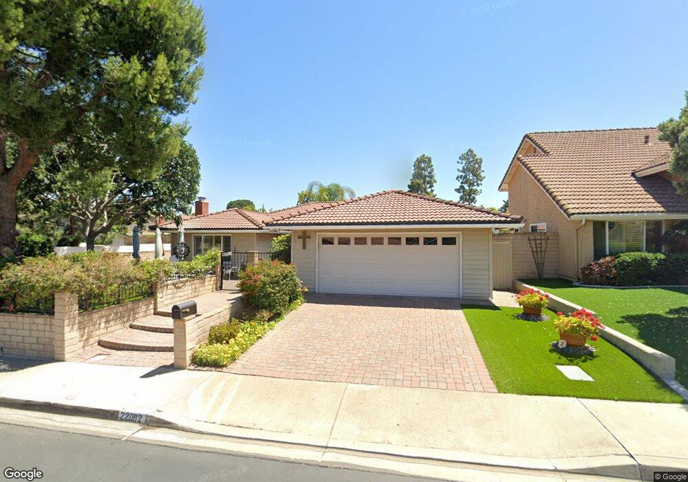
22092 Apache Dr Lake Forest, CA 92630
Estimated Value: $1,096,000 - $1,308,000
3
Beds
3
Baths
2,022
Sq Ft
$593/Sq Ft
Est. Value
About This Home
This home is located at 22092 Apache Dr, Lake Forest, CA 92630 and is currently estimated at $1,198,988, approximately $592 per square foot. 22092 Apache Dr is a home located in Orange County with nearby schools including La Madera Elementary School, Serrano Intermediate School, and El Toro High School.
Ownership History
Date
Name
Owned For
Owner Type
Purchase Details
Closed on
Sep 16, 2016
Sold by
Paxton Michael and Paxton Mozelle
Bought by
Paxton Michael and Paxton Mozelle
Current Estimated Value
Home Financials for this Owner
Home Financials are based on the most recent Mortgage that was taken out on this home.
Original Mortgage
$306,500
Interest Rate
3.45%
Mortgage Type
New Conventional
Create a Home Valuation Report for This Property
The Home Valuation Report is an in-depth analysis detailing your home's value as well as a comparison with similar homes in the area
Home Values in the Area
Average Home Value in this Area
Purchase History
| Date | Buyer | Sale Price | Title Company |
|---|---|---|---|
| Paxton Michael | -- | First American Title Company |
Source: Public Records
Mortgage History
| Date | Status | Borrower | Loan Amount |
|---|---|---|---|
| Closed | Paxton Michael | $306,500 |
Source: Public Records
Tax History
| Year | Tax Paid | Tax Assessment Tax Assessment Total Assessment is a certain percentage of the fair market value that is determined by local assessors to be the total taxable value of land and additions on the property. | Land | Improvement |
|---|---|---|---|---|
| 2025 | $1,356 | $138,401 | $43,209 | $95,192 |
| 2024 | $1,356 | $135,688 | $42,362 | $93,326 |
| 2023 | $1,323 | $133,028 | $41,531 | $91,497 |
| 2022 | $1,298 | $130,420 | $40,717 | $89,703 |
| 2021 | $1,270 | $127,863 | $39,918 | $87,945 |
| 2020 | $1,258 | $126,552 | $39,508 | $87,044 |
| 2019 | $1,232 | $124,071 | $38,733 | $85,338 |
| 2018 | $1,208 | $121,639 | $37,974 | $83,665 |
| 2017 | $1,182 | $119,254 | $37,229 | $82,025 |
| 2016 | $1,161 | $116,916 | $36,499 | $80,417 |
| 2015 | $1,146 | $115,160 | $35,950 | $79,210 |
| 2014 | $1,119 | $112,905 | $35,246 | $77,659 |
Source: Public Records
Map
Nearby Homes
- 25396 Shawnee Dr
- 25582 Hazelnut Ln
- 25152 Mammoth Cir
- 25011 Mammoth Cir
- 24931 Timberwood Way
- 25631 Mont Pointe Unit 7D
- 24882 Timberwood Way
- 25614 Mont Pointe Unit 3D
- 25671 Le Parc Unit 59
- 25652 Rimgate Dr Unit 6H
- 25712 Le Parc Unit 41
- 25761 Le Parc Unit 82
- 25701 View Pointe Unit 8C
- 25728 View Pointe Unit 4G
- 21991 143 Rimhurst
- 21931 Rimhurst Dr Unit K
- 21921 Rimhurst Dr Unit 130-G
- 25801 Chapel Hill Dr
- 21466 Cypresswood
- 22722 Malaga Way
- 22112 Apache Dr
- 22091 Comanche Rd
- 22072 Apache Dr
- 22122 Apache Dr
- 22101 Comanche Rd
- 22091 Apache Dr
- 22111 Apache Dr
- 22061 Comanche Rd
- 22062 Apache Dr
- 22121 Apache Dr
- 22071 Apache Dr
- 22132 Apache Dr
- 22111 Comanche Rd
- 22051 Comanche Rd
- 22131 Apache Dr
- 22061 Apache Dr
- 25352 Shoshone Dr
- 22042 Apache Dr
- 22142 Apache Dr
- 22121 Comanche Rd
Your Personal Tour Guide
Ask me questions while you tour the home.