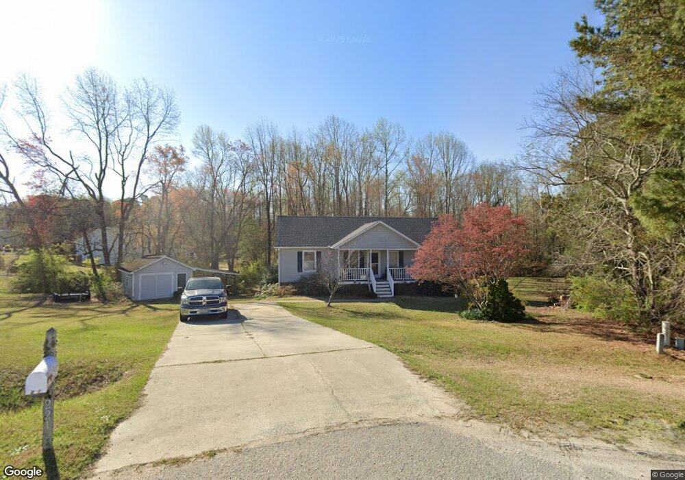
221 Brookfield Ct Willow Spring, NC 27592
Pleasant Grove NeighborhoodEstimated Value: $350,000 - $369,000
3
Beds
2
Baths
2,016
Sq Ft
$179/Sq Ft
Est. Value
About This Home
This home is located at 221 Brookfield Ct, Willow Spring, NC 27592 and is currently estimated at $360,677, approximately $178 per square foot. 221 Brookfield Ct is a home located in Johnston County with nearby schools including Dixon Road Elementary School, McGee's Crossroads Middle School, and West Johnston High School.
Ownership History
Date
Name
Owned For
Owner Type
Purchase Details
Closed on
May 20, 2020
Sold by
Dewey David P and Dewey Margaret C
Bought by
Dewey William P
Current Estimated Value
Home Financials for this Owner
Home Financials are based on the most recent Mortgage that was taken out on this home.
Original Mortgage
$168,000
Outstanding Balance
$149,067
Interest Rate
3.37%
Mortgage Type
New Conventional
Estimated Equity
$211,610
Create a Home Valuation Report for This Property
The Home Valuation Report is an in-depth analysis detailing your home's value as well as a comparison with similar homes in the area
Home Values in the Area
Average Home Value in this Area
Purchase History
| Date | Buyer | Sale Price | Title Company |
|---|---|---|---|
| Dewey William P | $210,000 | None Available |
Source: Public Records
Mortgage History
| Date | Status | Borrower | Loan Amount |
|---|---|---|---|
| Open | Dewey William P | $168,000 |
Source: Public Records
Tax History Compared to Growth
Tax History
| Year | Tax Paid | Tax Assessment Tax Assessment Total Assessment is a certain percentage of the fair market value that is determined by local assessors to be the total taxable value of land and additions on the property. | Land | Improvement |
|---|---|---|---|---|
| 2025 | $2,110 | $332,320 | $113,520 | $218,800 |
| 2024 | $1,319 | $162,810 | $50,510 | $112,300 |
| 2023 | $1,278 | $162,810 | $50,510 | $112,300 |
| 2022 | $1,319 | $162,810 | $50,510 | $112,300 |
| 2021 | $1,319 | $162,810 | $50,510 | $112,300 |
| 2020 | $1,404 | $162,810 | $50,510 | $112,300 |
| 2019 | $1,374 | $162,810 | $50,510 | $112,300 |
| 2018 | $1,180 | $135,560 | $36,080 | $99,480 |
| 2017 | $1,181 | $135,560 | $36,080 | $99,480 |
| 2016 | $1,201 | $135,560 | $36,080 | $99,480 |
| 2015 | $1,193 | $135,560 | $36,080 | $99,480 |
| 2014 | $1,193 | $135,560 | $36,080 | $99,480 |
Source: Public Records
Map
Nearby Homes
- 19 Marie Ct
- 96 Oak Fern Ln
- 109 Shallow Creek Crossing
- 169 Mount Pleasant Rd
- 368 Artic Cir
- 116 Meadow Ridge Dr
- 386 Artic Cir
- 291 Artic Cir
- 51 Borgo Ct
- 18 Pawnee Place
- 111 Artic Cir
- 50 Linden Ct
- 321 Busterfield Ct
- 309 Busterfield Ct
- Roanoke Plan at Brant Station
- Fontana Plan at Brant Station
- Avenel II Plan at Brant Station
- 161 Fountainhead Ln
- 123 W Fountainhead Ln
- 17 Kiowa Ct
- 222 Brookfield Ct
- 201 Brookfield Ct
- 200 Brookfield Ct
- 110 Hollybrook Cir
- 100 Hollybrook Cir
- 3121 Sanders Rd
- 111 Hollybrook Cir
- 3137 Sanders Rd
- 101 Hollybrook Cir
- 3151 Sanders Rd
- 150 Pond Cir
- 140 Pond Cir
- 3140 Sanders Rd
- 104 Marie Ct
- 3239 Sanders Rd
- 90 Marie Ct
- 110 Marie Ct
- 3050 Sanders Rd
- 120 Pond Cir
- 167 Sodan Dr