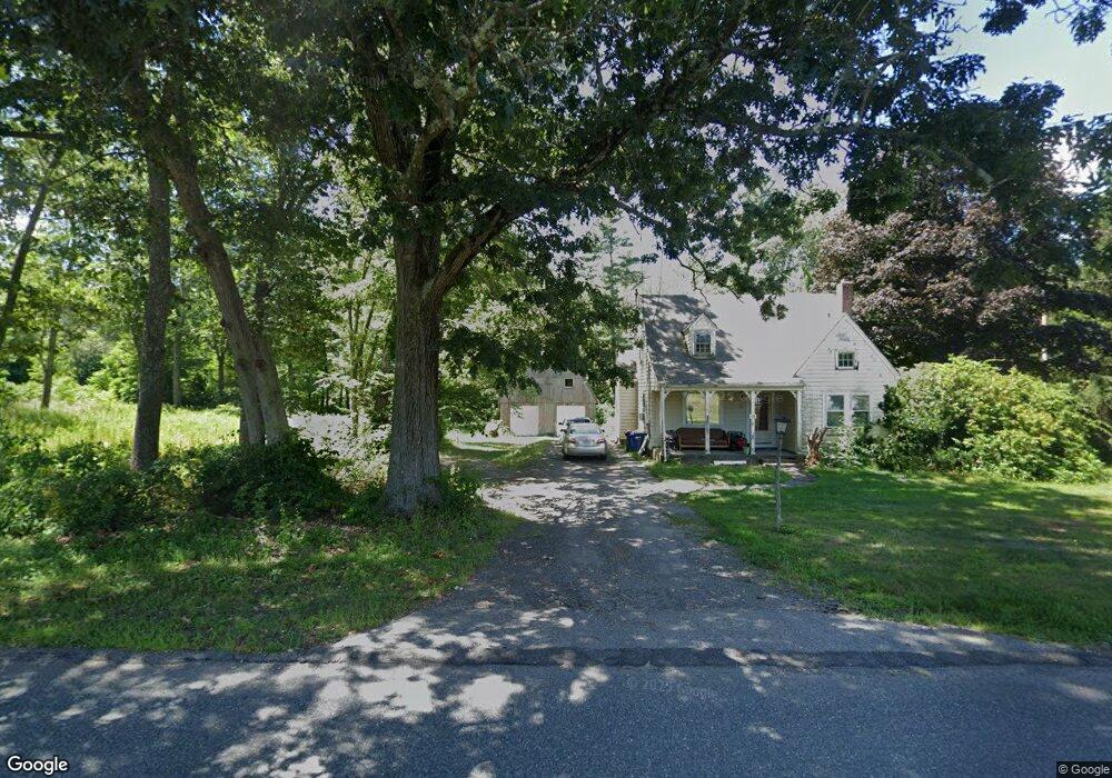
221 Chestnut St Seekonk, MA 02771
2
Beds
1
Bath
1,521
Sq Ft
1
Acres
About This Home
This home is located at 221 Chestnut St, Seekonk, MA 02771. 221 Chestnut St is a home located in Bristol County with nearby schools including Seekonk High School, St Margaret School, and The Wolf School.
Ownership History
Date
Name
Owned For
Owner Type
Purchase Details
Closed on
Jun 28, 2024
Sold by
Amaral Michael E Est and Ring
Bought by
Ring Edward R
Create a Home Valuation Report for This Property
The Home Valuation Report is an in-depth analysis detailing your home's value as well as a comparison with similar homes in the area
Home Values in the Area
Average Home Value in this Area
Purchase History
| Date | Buyer | Sale Price | Title Company |
|---|---|---|---|
| Ring Edward R | -- | None Available | |
| Ring Edward R | -- | None Available |
Source: Public Records
Tax History Compared to Growth
Tax History
| Year | Tax Paid | Tax Assessment Tax Assessment Total Assessment is a certain percentage of the fair market value that is determined by local assessors to be the total taxable value of land and additions on the property. | Land | Improvement |
|---|---|---|---|---|
| 2025 | -- | $388,100 | $179,500 | $208,600 |
| 2024 | -- | $372,300 | $179,500 | $192,800 |
| 2023 | $0 | $338,700 | $161,600 | $177,100 |
| 2022 | $0 | $313,300 | $156,800 | $156,500 |
| 2021 | $0 | $285,800 | $132,400 | $153,400 |
| 2020 | $0 | $276,700 | $132,400 | $144,300 |
| 2019 | $0 | $270,500 | $132,400 | $138,100 |
| 2018 | $0 | $258,900 | $127,600 | $131,300 |
| 2017 | $0 | $255,100 | $127,600 | $127,500 |
| 2016 | $3,705 | $253,300 | $127,600 | $125,700 |
| 2015 | $3,705 | $248,400 | $127,600 | $120,800 |
Source: Public Records
Map
Nearby Homes
- 62 Chestnut St
- 420 Chestnut St
- 39 John Alden Rd
- 442 Taunton Ave
- 524 County St
- 824 Taunton Ave
- 42 Tee Jay Dr
- 679 County St
- 349 County St
- 0 Patterson St Unit 73348933
- 25 Pimental Dr
- 181 Hope St
- 30 Rosemarie Dr
- 147 Olney St
- 0 Pleasant St
- 296 Fall River Ave
- 25 Lincoln St
- 0 Milton St Unit 72633661
- 12 Arthur St
- 224 Arcade Ave
- 203 Chestnut St
- 202 Chestnut St
- 228 Chestnut St
- 218 Chestnut St
- 245 Chestnut St
- 196 Chestnut St
- 248 Chestnut St
- 185 Chestnut St
- 233 Chestnut St
- 159R Chestnut St
- 267 Chestnut St
- 260 Chestnut St
- 238 Chestnut St
- 180 Chestnut St
- 272 Chestnut St
- 188 Briarbrook Dr
- 181 Chestnut St
- 172 Briarbrook Dr
- 275 Chestnut St
- 169 Chestnut St