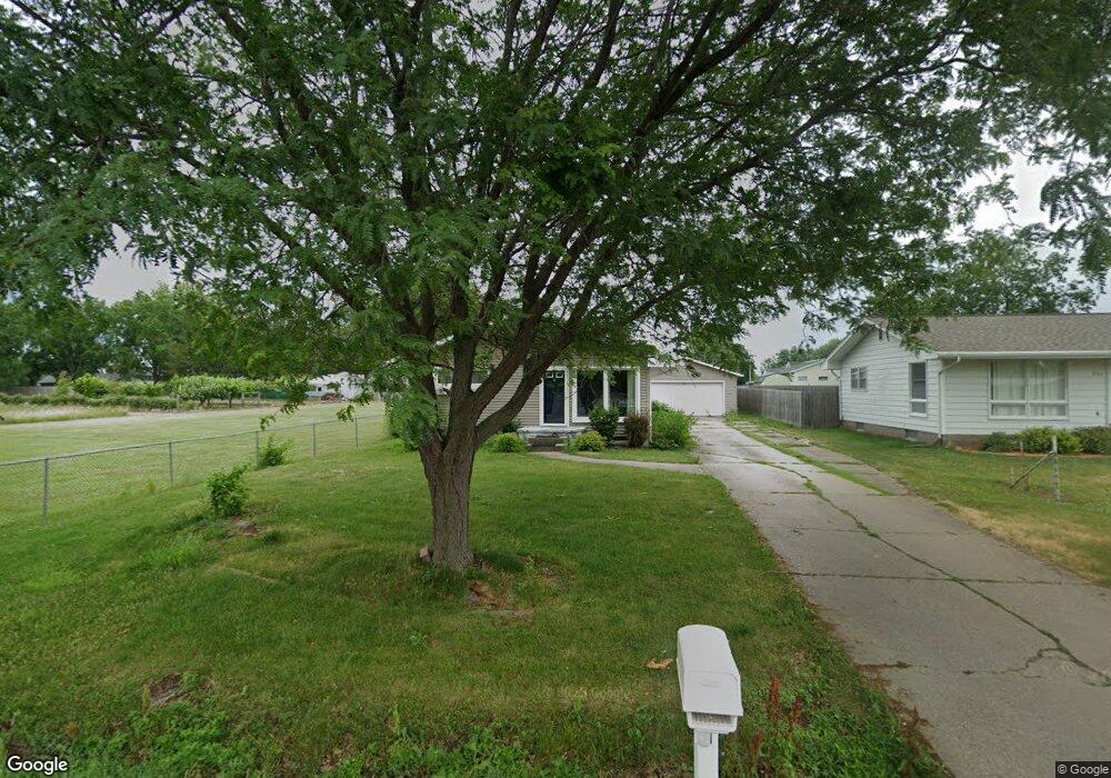
221 Cook St Muscatine, IA 52761
Estimated Value: $198,000 - $221,000
3
Beds
2
Baths
1,120
Sq Ft
$187/Sq Ft
Est. Value
About This Home
This home is located at 221 Cook St, Muscatine, IA 52761 and is currently estimated at $209,532, approximately $187 per square foot. 221 Cook St is a home located in Muscatine County with nearby schools including McKinley Elementary School, Susan Clark Junior High School, and Muscatine High School.
Ownership History
Date
Name
Owned For
Owner Type
Purchase Details
Closed on
May 2, 2014
Sold by
Hosmer Alison E and Hepker Joshua
Bought by
Ballenger Shannon M
Current Estimated Value
Home Financials for this Owner
Home Financials are based on the most recent Mortgage that was taken out on this home.
Original Mortgage
$105,600
Outstanding Balance
$80,480
Interest Rate
4.33%
Mortgage Type
New Conventional
Estimated Equity
$129,052
Purchase Details
Closed on
Nov 3, 2006
Sold by
Bohling Jeffrey W and Bohling Barbara A
Bought by
Beinke Zachary M and Beinke Alison E
Home Financials for this Owner
Home Financials are based on the most recent Mortgage that was taken out on this home.
Original Mortgage
$126,300
Interest Rate
6.45%
Mortgage Type
New Conventional
Create a Home Valuation Report for This Property
The Home Valuation Report is an in-depth analysis detailing your home's value as well as a comparison with similar homes in the area
Home Values in the Area
Average Home Value in this Area
Purchase History
| Date | Buyer | Sale Price | Title Company |
|---|---|---|---|
| Ballenger Shannon M | $132,000 | None Available | |
| Beinke Zachary M | $130,000 | None Available |
Source: Public Records
Mortgage History
| Date | Status | Borrower | Loan Amount |
|---|---|---|---|
| Open | Ballenger Shannon M | $105,600 | |
| Previous Owner | Beinke Zachary M | $126,300 |
Source: Public Records
Tax History Compared to Growth
Tax History
| Year | Tax Paid | Tax Assessment Tax Assessment Total Assessment is a certain percentage of the fair market value that is determined by local assessors to be the total taxable value of land and additions on the property. | Land | Improvement |
|---|---|---|---|---|
| 2025 | $3,186 | $185,820 | $20,980 | $164,840 |
| 2024 | $3,186 | $185,960 | $20,980 | $164,980 |
| 2023 | $3,026 | $184,281 | $20,946 | $163,335 |
| 2022 | $2,710 | $146,320 | $19,760 | $126,560 |
| 2021 | $2,710 | $141,820 | $19,760 | $122,060 |
| 2020 | $2,660 | $141,820 | $19,760 | $122,060 |
| 2019 | $2,590 | $125,760 | $0 | $0 |
| 2018 | $2,538 | $125,160 | $0 | $0 |
| 2017 | $2,538 | $118,950 | $0 | $0 |
Source: Public Records
Map
Nearby Homes
- 208 Fletcher Ave
- 1619 Devitt Ave
- 2207 Lucas St
- 1617 W Acre Dr
- 2109 Americana Ave
- 1143 Logan St
- PARCEL ID 0834280023 Dillaway St
- 1416 Duncan Dr
- 1507 Duncan Dr
- 3120 Linden Ln
- 1604 Duncan Dr
- 3103 Ginkgo Ln
- 0 High Street Parcel
- 2018 W Bay Dr
- 1506 Buell St
- 602 W Fulliam Ave
- CEDAR Plaza Parcel
- 2106 Clarabek St
- 2108 Clarabek St
- 518 Roscoe Ave