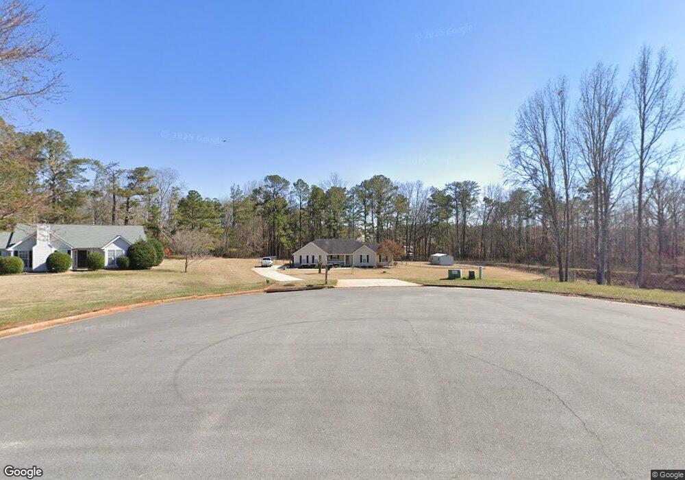
221 Ferguson Ave Locust Grove, GA 30248
Estimated Value: $251,000 - $266,000
3
Beds
2
Baths
1,460
Sq Ft
$178/Sq Ft
Est. Value
About This Home
This home is located at 221 Ferguson Ave, Locust Grove, GA 30248 and is currently estimated at $259,301, approximately $177 per square foot. 221 Ferguson Ave is a home located in Henry County with nearby schools including Locust Grove Elementary School, Locust Grove Middle School, and Locust Grove High School.
Ownership History
Date
Name
Owned For
Owner Type
Purchase Details
Closed on
Nov 19, 2007
Sold by
Holland Thomas and Holland Cumbie B
Bought by
Tanner James W and Tanner Jennie L
Current Estimated Value
Purchase Details
Closed on
Feb 6, 2004
Sold by
Holland Cumbie B
Bought by
Holland Cumbie B and Holland Thomas
Home Financials for this Owner
Home Financials are based on the most recent Mortgage that was taken out on this home.
Original Mortgage
$78,841
Interest Rate
5%
Mortgage Type
New Conventional
Purchase Details
Closed on
Feb 18, 1999
Sold by
Brenco Inc
Bought by
Barne Cumbie A
Home Financials for this Owner
Home Financials are based on the most recent Mortgage that was taken out on this home.
Original Mortgage
$82,000
Interest Rate
6.73%
Mortgage Type
New Conventional
Create a Home Valuation Report for This Property
The Home Valuation Report is an in-depth analysis detailing your home's value as well as a comparison with similar homes in the area
Home Values in the Area
Average Home Value in this Area
Purchase History
| Date | Buyer | Sale Price | Title Company |
|---|---|---|---|
| Tanner James W | $135,000 | -- | |
| Holland Cumbie B | -- | -- | |
| Barne Cumbie A | $102,500 | -- |
Source: Public Records
Mortgage History
| Date | Status | Borrower | Loan Amount |
|---|---|---|---|
| Previous Owner | Holland Cumbie B | $78,841 | |
| Previous Owner | Barne Cumbie A | $82,000 |
Source: Public Records
Tax History Compared to Growth
Tax History
| Year | Tax Paid | Tax Assessment Tax Assessment Total Assessment is a certain percentage of the fair market value that is determined by local assessors to be the total taxable value of land and additions on the property. | Land | Improvement |
|---|---|---|---|---|
| 2025 | $486 | $99,480 | $14,000 | $85,480 |
| 2024 | $486 | $92,840 | $14,000 | $78,840 |
| 2023 | $325 | $106,040 | $14,000 | $92,040 |
| 2022 | $478 | $81,280 | $14,000 | $67,280 |
| 2021 | $480 | $66,320 | $14,000 | $52,320 |
| 2020 | $480 | $59,680 | $12,000 | $47,680 |
| 2019 | $502 | $52,240 | $12,000 | $40,240 |
| 2018 | $489 | $49,920 | $10,800 | $39,120 |
| 2016 | $478 | $44,720 | $10,000 | $34,720 |
| 2015 | $461 | $41,520 | $10,000 | $31,520 |
| 2014 | $409 | $37,640 | $12,000 | $25,640 |
Source: Public Records
Map
Nearby Homes
- 231 Ferguson Ave
- 1064 Lear Dr
- 239 Ferguson Ave
- 565 Carleton Place
- 143 Massey Ln
- 269 Baumgard Way
- 188 Sophie Cir
- 150 Aster Ave
- Cali Plan at Cedar Ridge - Locust Grove Station
- Belfort Plan at Cedar Ridge - Locust Grove Station
- Galen Plan at Cedar Ridge - Locust Grove Station
- Hayden Plan at Cedar Ridge - Locust Grove Station
- Packard Plan at Cedar Ridge - Locust Grove Station
- Flora Plan at Cedar Ridge - Locust Grove Station
- Penwell Plan at Cedar Ridge - Locust Grove Station
- 380 Higgins Rd
- 501 Vervain Dr
- 198 Aster Ave
- 505 Vervain Dr
- 608 Lobelia Dr
- 219 Ferguson Ave
- 217 Ferguson Ave
- 2131 Theberton Trail Unit 267
- 2131 Theberton Trail
- 2129 Theberton Trail Unit 266
- 2129 Theberton Trail
- 1340 Elmstead Place
- 1340 Elmstead Place Unit 422
- 2133 Theberton Trail Unit 268
- 2133 Theberton Trail
- 1335 Elmstead Place Unit 1021
- 1335 Elmstead Place
- 222 Ferguson Ave
- 2127 Theberton Trail Unit 265
- 2127 Theberton Trail
- 215 Ferguson Ave
- 1320 Elmstead Place Unit Firefly
- 1320 Elmstead Place Unit Hawking
- 1320 Elmstead Place Unit Spectra
- 1320 Elmstead Place Unit Solstice