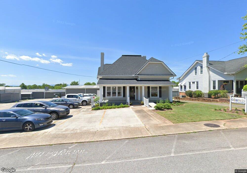
221 Foreacre St Cornelia, GA 30531
Estimated Value: $323,000 - $511,000
3
Beds
2
Baths
2,080
Sq Ft
$187/Sq Ft
Est. Value
About This Home
This home is located at 221 Foreacre St, Cornelia, GA 30531 and is currently estimated at $387,926, approximately $186 per square foot. 221 Foreacre St is a home located in Habersham County with nearby schools including Cornelia Elementary School, Wilbanks Middle School, and Habersham Success Academy.
Ownership History
Date
Name
Owned For
Owner Type
Purchase Details
Closed on
Oct 29, 2020
Sold by
Cody Dianne Reeves
Bought by
Gpm Llc
Current Estimated Value
Home Financials for this Owner
Home Financials are based on the most recent Mortgage that was taken out on this home.
Original Mortgage
$230,613
Outstanding Balance
$115,204
Interest Rate
2.8%
Mortgage Type
Commercial
Estimated Equity
$272,722
Create a Home Valuation Report for This Property
The Home Valuation Report is an in-depth analysis detailing your home's value as well as a comparison with similar homes in the area
Home Values in the Area
Average Home Value in this Area
Purchase History
| Date | Buyer | Sale Price | Title Company |
|---|---|---|---|
| Gpm Llc | $282,000 | -- | |
| Gpm Llc | -- | -- | |
| Gpm Llc | -- | -- |
Source: Public Records
Mortgage History
| Date | Status | Borrower | Loan Amount |
|---|---|---|---|
| Open | Gpm Llc | $230,613 | |
| Closed | Gpm Llc | $230,613 |
Source: Public Records
Tax History
| Year | Tax Paid | Tax Assessment Tax Assessment Total Assessment is a certain percentage of the fair market value that is determined by local assessors to be the total taxable value of land and additions on the property. | Land | Improvement |
|---|---|---|---|---|
| 2025 | $4,510 | $133,995 | $9,760 | $124,235 |
| 2024 | $4,232 | $163,068 | $10,632 | $152,436 |
| 2023 | $3,347 | $133,876 | $8,180 | $125,696 |
| 2022 | $3,017 | $115,712 | $8,180 | $107,532 |
| 2021 | $2,700 | $104,024 | $8,180 | $95,844 |
| 2020 | $1,393 | $51,804 | $11,136 | $40,668 |
| 2019 | $1,395 | $51,804 | $11,136 | $40,668 |
| 2018 | $1,384 | $51,804 | $11,136 | $40,668 |
| 2017 | $1,314 | $48,924 | $11,136 | $37,788 |
| 2016 | $1,276 | $122,310 | $11,136 | $37,788 |
| 2015 | $1,261 | $122,310 | $11,136 | $37,788 |
| 2014 | $1,273 | $121,210 | $11,136 | $37,348 |
| 2013 | -- | $48,484 | $11,136 | $37,348 |
Source: Public Records
Map
Nearby Homes
- 391 Yonah St
- 0 Irvin St
- 169 Short Ave
- 192 Summit St
- 109 Grove Park Dr
- 169 Esta St
- 952 Wayside St NW
- 142 Galloway St
- 125 Maple St
- 795 Wayside St
- 112 Galloway St
- 0 Chase Rd Unit 10658099
- 605 Chenocetah Dr
- 114 Sugar Creek Dr
- 170 Sequoyah Dr
- 240 Sugar Maple Dr
- 167 South St
- 133 Hillandale St
- 115 Wood St
- 952 Hoyt St NW
- 245 Foreacre St
- 218 Larkin St
- 232 Larkin St
- 271 Foreacre St
- 325 Oak St
- 320 Front St
- 241 Larkin St
- 275 Wyly St
- 1070 S Main St
- 102 Grant Place
- 1080 S Main St
- 1088 S Main St
- 1102 S Main St
- 1022 S Main St
- 1000 S Main St
- 0 Highway 105 Unit 55 3115037
- 306 Wyly St
- 1037 S Main St
- 1043 S Main St
- 151 Wells St
Your Personal Tour Guide
Ask me questions while you tour the home.