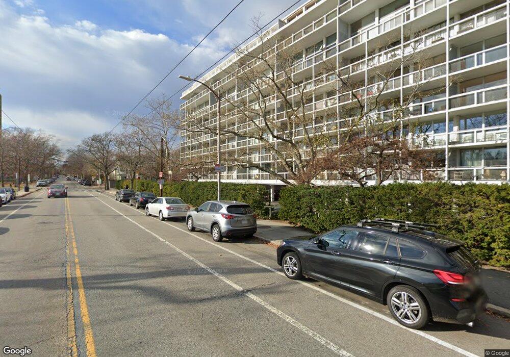
221 Mount Auburn St Unit 509 Cambridge, MA 02138
West Cambridge NeighborhoodEstimated Value: $703,067 - $1,237,000
1
Bed
1
Bath
671
Sq Ft
$1,301/Sq Ft
Est. Value
About This Home
This home is located at 221 Mount Auburn St Unit 509, Cambridge, MA 02138 and is currently estimated at $872,767, approximately $1,300 per square foot. 221 Mount Auburn St Unit 509 is a home located in Middlesex County with nearby schools including St Peter School, Shady Hill School, and Cambridge Montessori School.
Ownership History
Date
Name
Owned For
Owner Type
Purchase Details
Closed on
Sep 15, 2021
Sold by
Kapp Barbara R
Bought by
221 Mt Auburn St Nt
Current Estimated Value
Purchase Details
Closed on
Aug 4, 2004
Sold by
Blossom Rlty Llc
Bought by
Kapp Barbara R
Purchase Details
Closed on
Jul 2, 2003
Sold by
Stowe Donald
Bought by
Barbara Blossom Rlty L
Purchase Details
Closed on
Sep 27, 1999
Sold by
Stowe Elizabeth Est
Bought by
Stowe Donald V
Home Financials for this Owner
Home Financials are based on the most recent Mortgage that was taken out on this home.
Original Mortgage
$100,000
Interest Rate
8.1%
Mortgage Type
Purchase Money Mortgage
Purchase Details
Closed on
Jan 15, 1988
Sold by
Mcintyre Rhoda V
Bought by
Stowe Elizabeth F
Create a Home Valuation Report for This Property
The Home Valuation Report is an in-depth analysis detailing your home's value as well as a comparison with similar homes in the area
Home Values in the Area
Average Home Value in this Area
Purchase History
| Date | Buyer | Sale Price | Title Company |
|---|---|---|---|
| 221 Mt Auburn St Nt | -- | None Available | |
| Kapp Barbara R | -- | -- | |
| Barbara Blossom Rlty L | $393,000 | -- | |
| Stowe Donald V | $164,000 | -- | |
| Stowe Elizabeth F | $170,000 | -- |
Source: Public Records
Mortgage History
| Date | Status | Borrower | Loan Amount |
|---|---|---|---|
| Previous Owner | Stowe Elizabeth F | $100,000 |
Source: Public Records
Tax History Compared to Growth
Tax History
| Year | Tax Paid | Tax Assessment Tax Assessment Total Assessment is a certain percentage of the fair market value that is determined by local assessors to be the total taxable value of land and additions on the property. | Land | Improvement |
|---|---|---|---|---|
| 2025 | $4,397 | $692,500 | $0 | $692,500 |
| 2024 | $4,319 | $729,600 | $0 | $729,600 |
| 2023 | $4,136 | $705,800 | $0 | $705,800 |
| 2022 | $4,420 | $746,700 | $0 | $746,700 |
| 2021 | $4,433 | $757,800 | $0 | $757,800 |
| 2020 | $4,272 | $743,000 | $0 | $743,000 |
| 2019 | $4,090 | $688,500 | $0 | $688,500 |
| 2018 | $3,875 | $616,000 | $0 | $616,000 |
| 2017 | $3,774 | $581,500 | $0 | $581,500 |
| 2016 | $3,687 | $527,400 | $0 | $527,400 |
| 2015 | $3,479 | $444,900 | $0 | $444,900 |
| 2014 | $3,258 | $388,800 | $0 | $388,800 |
Source: Public Records
Map
Nearby Homes
- 20 Maynard Place
- 1010 Memorial Dr Unit 6G
- 15 Hubbard Park Rd
- 48 Hubbard Park Rd
- 32 Hawthorn St
- 988 Memorial Dr Unit 386
- 153 Brattle St
- 158 Brattle St
- 986 Memorial Dr Unit 404
- 984 Memorial Dr Unit 984-503
- 983 Memorial Dr Unit 502
- 3 Berkeley Place
- 172 Brattle St
- 12 Berkeley St
- 130 Mount Auburn St Unit 108
- 22 Concord Ave Unit 10
- 975 Memorial Dr Unit 209
- 975 Memorial Dr Unit 211
- 44 Garden St
- 52 Garden St Unit B2
- 221 Mount Auburn St Unit 801B
- 221 Mount Auburn St Unit 801A
- 221 Mount Auburn St Unit 510A
- 221 Mount Auburn St Unit 802
- 221 Mount Auburn St Unit 708
- 221 Mount Auburn St Unit 707
- 221 Mount Auburn St Unit 706
- 221 Mount Auburn St Unit 705
- 221 Mount Auburn St Unit 704
- 221 Mount Auburn St Unit 703
- 221 Mount Auburn St Unit 702
- 221 Mount Auburn St Unit 701
- 221 Mount Auburn St Unit 608
- 221 Mount Auburn St Unit 607
- 221 Mount Auburn St Unit 606
- 221 Mount Auburn St Unit 605
- 221 Mount Auburn St Unit 604
- 221 Mount Auburn St Unit 603
- 221 Mount Auburn St Unit 602
- 221 Mount Auburn St Unit 511