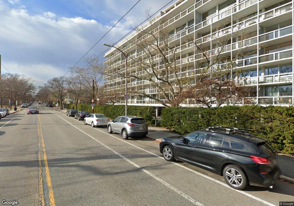
221 Mount Auburn St Unit 708 Cambridge, MA 02138
West Cambridge NeighborhoodEstimated Value: $1,386,000 - $1,668,000
2
Beds
2
Baths
1,260
Sq Ft
$1,227/Sq Ft
Est. Value
About This Home
This home is located at 221 Mount Auburn St Unit 708, Cambridge, MA 02138 and is currently estimated at $1,546,158, approximately $1,227 per square foot. 221 Mount Auburn St Unit 708 is a home located in Middlesex County with nearby schools including St Peter School, Shady Hill School, and Cambridge Montessori School.
Ownership History
Date
Name
Owned For
Owner Type
Purchase Details
Closed on
May 27, 1997
Sold by
Denny-Brown Sylvia
Bought by
Crompton Alfred W and Crompton Ann
Current Estimated Value
Home Financials for this Owner
Home Financials are based on the most recent Mortgage that was taken out on this home.
Original Mortgage
$215,100
Outstanding Balance
$29,767
Interest Rate
8.12%
Estimated Equity
$1,516,391
Create a Home Valuation Report for This Property
The Home Valuation Report is an in-depth analysis detailing your home's value as well as a comparison with similar homes in the area
Home Values in the Area
Average Home Value in this Area
Purchase History
| Date | Buyer | Sale Price | Title Company |
|---|---|---|---|
| Crompton Alfred W | $335,000 | -- |
Source: Public Records
Mortgage History
| Date | Status | Borrower | Loan Amount |
|---|---|---|---|
| Open | Crompton Alfred W | $215,100 |
Source: Public Records
Tax History Compared to Growth
Tax History
| Year | Tax Paid | Tax Assessment Tax Assessment Total Assessment is a certain percentage of the fair market value that is determined by local assessors to be the total taxable value of land and additions on the property. | Land | Improvement |
|---|---|---|---|---|
| 2025 | $10,254 | $1,614,800 | $0 | $1,614,800 |
| 2024 | $9,155 | $1,546,500 | $0 | $1,546,500 |
| 2023 | $8,768 | $1,496,200 | $0 | $1,496,200 |
| 2022 | $9,309 | $1,572,500 | $0 | $1,572,500 |
| 2021 | $9,333 | $1,595,300 | $0 | $1,595,300 |
| 2020 | $8,815 | $1,533,100 | $0 | $1,533,100 |
| 2019 | $8,444 | $1,421,600 | $0 | $1,421,600 |
| 2018 | $8,280 | $1,316,400 | $0 | $1,316,400 |
| 2017 | $8,007 | $1,233,800 | $0 | $1,233,800 |
| 2016 | $7,830 | $1,120,200 | $0 | $1,120,200 |
| 2015 | $7,401 | $946,400 | $0 | $946,400 |
| 2014 | $6,937 | $827,800 | $0 | $827,800 |
Source: Public Records
Map
Nearby Homes
- 20 Maynard Place
- 1010 Memorial Dr Unit 6G
- 1010 Memorial Dr Unit 7D&E
- 11 Brown St
- 15 Hubbard Park Rd
- 48 Hubbard Park Rd
- 32 Hawthorn St
- 988 Memorial Dr Unit 386
- 34 Ash St Unit 204
- 153 Brattle St
- 158 Brattle St
- 5 Brewer St Unit 5
- 985 Memorial Dr Unit 603
- 984 Memorial Dr Unit 984-503
- 983 Memorial Dr Unit 502
- 3 Berkeley Place
- 172 Brattle St
- 12 Ash Street Place
- 12 Berkeley St
- 130 Mount Auburn St Unit 310
- 221 Mount Auburn St Unit 801B
- 221 Mount Auburn St Unit 801A
- 221 Mount Auburn St Unit 510A
- 221 Mount Auburn St Unit 802
- 221 Mount Auburn St Unit 707
- 221 Mount Auburn St Unit 706
- 221 Mount Auburn St Unit 705
- 221 Mount Auburn St Unit 704
- 221 Mount Auburn St Unit 703
- 221 Mount Auburn St Unit 702
- 221 Mount Auburn St Unit 701
- 221 Mount Auburn St Unit 608
- 221 Mount Auburn St Unit 607
- 221 Mount Auburn St Unit 606
- 221 Mount Auburn St Unit 605
- 221 Mount Auburn St Unit 604
- 221 Mount Auburn St Unit 603
- 221 Mount Auburn St Unit 602
- 221 Mount Auburn St Unit 511
- 221 Mount Auburn St Unit 509