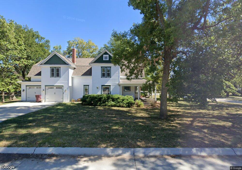
221 N 6th St Elmwood, NE 68349
Estimated Value: $398,093 - $570,000
3
Beds
3
Baths
2,177
Sq Ft
$226/Sq Ft
Est. Value
About This Home
This home is located at 221 N 6th St, Elmwood, NE 68349 and is currently estimated at $491,523, approximately $225 per square foot. 221 N 6th St is a home located in Cass County with nearby schools including Elmwood-Murdock Elementary School and Elmwood-Murdock Junior/Senior High School.
Ownership History
Date
Name
Owned For
Owner Type
Purchase Details
Closed on
Aug 16, 2024
Sold by
Brophy Jon and Brophy Abigail
Bought by
Brophy Jon
Current Estimated Value
Purchase Details
Closed on
Jan 8, 2020
Sold by
Brophy Jon and Brophy Abigail
Bought by
Brophy Jon and Brophy Abigail
Create a Home Valuation Report for This Property
The Home Valuation Report is an in-depth analysis detailing your home's value as well as a comparison with similar homes in the area
Home Values in the Area
Average Home Value in this Area
Purchase History
| Date | Buyer | Sale Price | Title Company |
|---|---|---|---|
| Brophy Jon | -- | 402 Title | |
| Brophy Jon | -- | None Available |
Source: Public Records
Tax History Compared to Growth
Tax History
| Year | Tax Paid | Tax Assessment Tax Assessment Total Assessment is a certain percentage of the fair market value that is determined by local assessors to be the total taxable value of land and additions on the property. | Land | Improvement |
|---|---|---|---|---|
| 2024 | $5,050 | $359,850 | $44,590 | $315,260 |
| 2023 | $6,236 | $351,971 | $39,691 | $312,280 |
| 2022 | $5,910 | $327,193 | $41,676 | $285,517 |
| 2021 | $5,422 | $296,601 | $24,451 | $272,150 |
| 2020 | $5,142 | $252,545 | $26,896 | $225,649 |
| 2019 | $4,711 | $229,586 | $24,451 | $205,135 |
| 2018 | $4,832 | $229,586 | $24,451 | $205,135 |
| 2017 | $4,029 | $190,761 | $24,451 | $166,310 |
| 2016 | $3,838 | $190,761 | $24,451 | $166,310 |
| 2015 | $3,593 | $181,878 | $26,488 | $155,390 |
| 2014 | $3,830 | $181,878 | $26,488 | $155,390 |
Source: Public Records
Map
Nearby Homes
- 301 E H St
- 1.13 Acres, E H St
- 209 E D St
- 204 S 2nd St
- 5103 322nd St
- 8206 310th St
- 35408 34 Hwy
- 501 E 1st St
- 105 Washington St
- TBD Tbd
- 815 S 358th St
- 116 Kansas St
- 125 S 1st St Unit 30
- 125 S 1st St Unit 6
- 14902 Adams St
- 1287 D Rd
- 0000 County Road D
- Lot 18 Eagles Landing
- Lot 20 Eagles Landing
- Lot 26 Eagles Landing