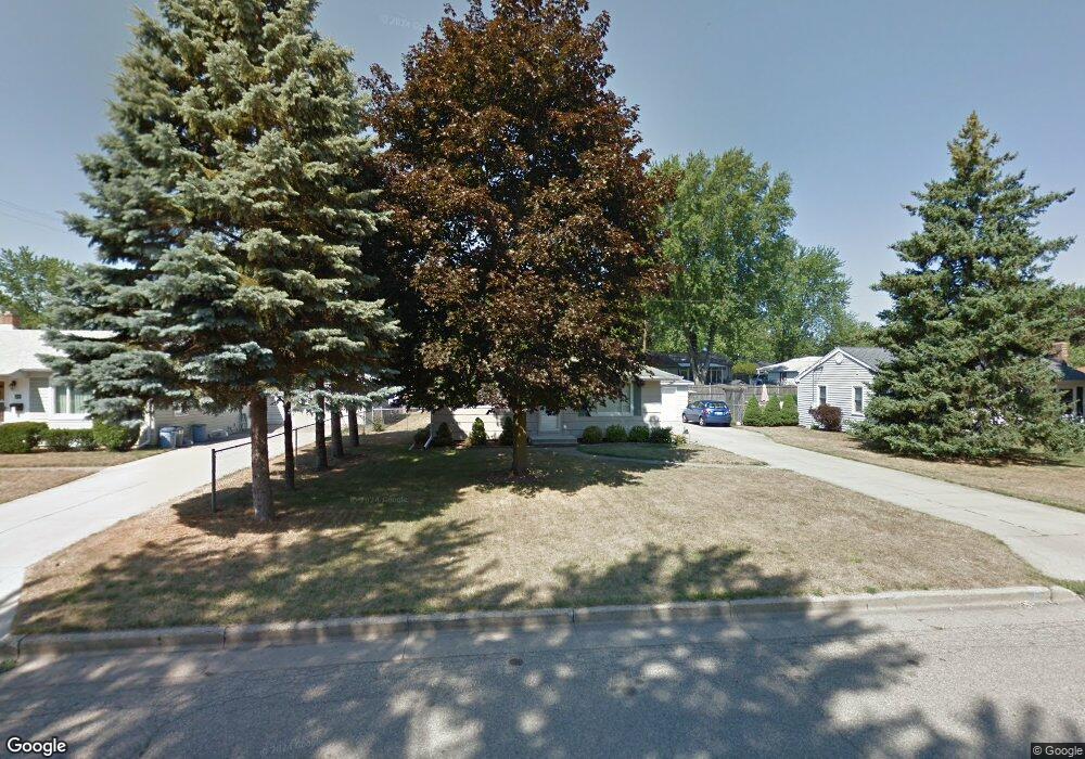
221 N Moorland Dr Battle Creek, MI 49015
Minges Brook Riverside NeighborhoodEstimated Value: $142,000 - $192,000
2
Beds
1
Bath
810
Sq Ft
$207/Sq Ft
Est. Value
About This Home
This home is located at 221 N Moorland Dr, Battle Creek, MI 49015 and is currently estimated at $167,307, approximately $206 per square foot. 221 N Moorland Dr is a home located in Calhoun County with nearby schools including Lakeview Middle School, Lakeview High School, and Arbor Academy.
Ownership History
Date
Name
Owned For
Owner Type
Purchase Details
Closed on
Sep 9, 2004
Sold by
Gogan Tracy L and Tracy L Gogan Living Trust
Bought by
Goy Matthew
Current Estimated Value
Home Financials for this Owner
Home Financials are based on the most recent Mortgage that was taken out on this home.
Original Mortgage
$72,000
Outstanding Balance
$35,789
Interest Rate
5.93%
Mortgage Type
Purchase Money Mortgage
Estimated Equity
$131,518
Purchase Details
Closed on
Dec 11, 2001
Sold by
Gogan Tracy L
Bought by
Gogan Trust Tracy L
Purchase Details
Closed on
May 31, 1996
Bought by
Saracina
Create a Home Valuation Report for This Property
The Home Valuation Report is an in-depth analysis detailing your home's value as well as a comparison with similar homes in the area
Home Values in the Area
Average Home Value in this Area
Purchase History
| Date | Buyer | Sale Price | Title Company |
|---|---|---|---|
| Goy Matthew | $90,000 | Chicago Title Of Michigan | |
| Gogan Trust Tracy L | -- | -- | |
| Saracina | $73,000 | -- |
Source: Public Records
Mortgage History
| Date | Status | Borrower | Loan Amount |
|---|---|---|---|
| Open | Goy Matthew | $72,000 |
Source: Public Records
Tax History Compared to Growth
Tax History
| Year | Tax Paid | Tax Assessment Tax Assessment Total Assessment is a certain percentage of the fair market value that is determined by local assessors to be the total taxable value of land and additions on the property. | Land | Improvement |
|---|---|---|---|---|
| 2025 | -- | $54,900 | $0 | $0 |
| 2024 | $1,753 | $51,071 | $0 | $0 |
| 2023 | $2,226 | $44,494 | $0 | $0 |
| 2022 | $1,585 | $39,052 | $0 | $0 |
| 2021 | $2,164 | $36,221 | $0 | $0 |
| 2020 | $2,140 | $35,580 | $0 | $0 |
| 2019 | $1,956 | $34,112 | $0 | $0 |
| 2018 | $1,956 | $33,526 | $3,281 | $30,245 |
| 2017 | $1,905 | $33,697 | $0 | $0 |
| 2016 | $1,900 | $30,896 | $0 | $0 |
| 2015 | $1,880 | $28,987 | $3,275 | $25,712 |
| 2014 | $1,880 | $29,880 | $3,275 | $26,605 |
Source: Public Records
Map
Nearby Homes
- 620 Meadow Dr
- 320 N Ridgeway Dr
- V/L Riverside Dr
- 175 S Ridgeway Dr
- 214 Morningside Dr
- 170 Frances Dr E
- 117 Meadow Dr
- 210 Briar Hill Dr
- 1227 Capital Ave SW
- 160 Lincoln Hill Dr
- 317 Country Club Terrace
- 1116 Lakeside Dr S
- 239 Brewer Dr S
- 1200 Lakeside Dr S
- 32 Golden Ave
- 618 Jennings Landing
- 245 Columbia Ave E
- 112 Darragh Dr
- 66 Wealthy
- 0 Jennings Landing
- 227 N Moorland Dr
- 215 N Moorland Dr
- 220 Clover Ln
- 233 N Moorland Dr
- 209 N Moorland Dr
- 214 Clover Ln
- 226 Clover Ln
- 220 N Moorland Dr
- 232 Clover Ln
- 214 N Moorland Dr
- 226 N Moorland Dr
- 720 Meadow Dr
- 203 N Moorland Dr
- 208 Clover Ln
- 232 N Moorland Dr
- 238 Clover Ln
- 202 Clover Ln
- 810 Meadow Dr
- 202 N Moorland Dr
- 209 Clover Ln