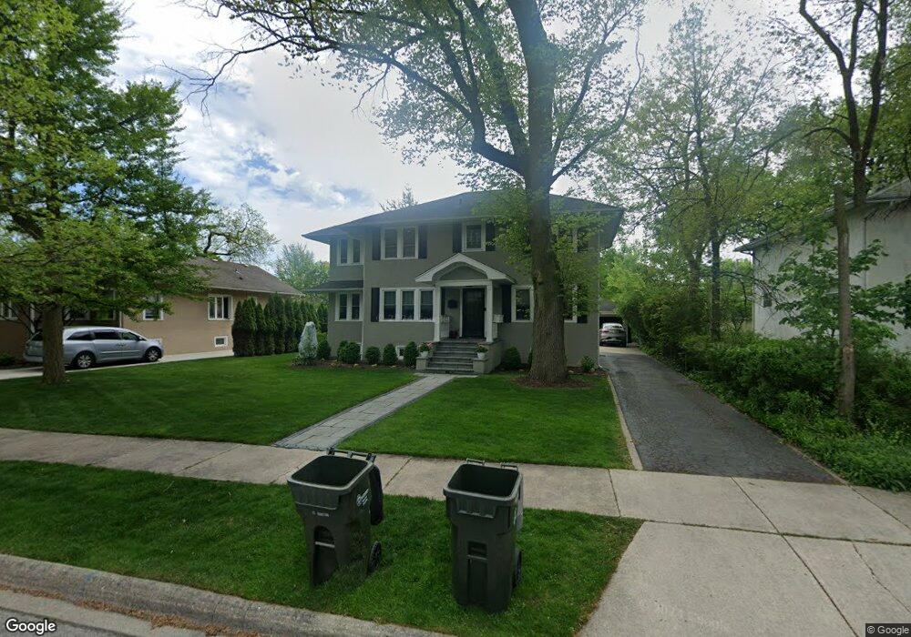
221 Olmsted Rd Riverside, IL 60546
Estimated Value: $584,000 - $671,000
3
Beds
1
Bath
1,926
Sq Ft
$333/Sq Ft
Est. Value
About This Home
This home is located at 221 Olmsted Rd, Riverside, IL 60546 and is currently estimated at $641,914, approximately $333 per square foot. 221 Olmsted Rd is a home located in Cook County with nearby schools including Central Elementary School, L J Hauser Jr High School, and Riverside Brookfield High School.
Ownership History
Date
Name
Owned For
Owner Type
Purchase Details
Closed on
Aug 11, 2014
Sold by
Novak Donald O and Novak Janet A
Bought by
Fakhoury Laith I and Fakhoury Allison M
Current Estimated Value
Home Financials for this Owner
Home Financials are based on the most recent Mortgage that was taken out on this home.
Original Mortgage
$372,400
Outstanding Balance
$284,060
Interest Rate
4.12%
Mortgage Type
New Conventional
Estimated Equity
$357,854
Purchase Details
Closed on
Dec 1, 2010
Sold by
Miller Roy A
Bought by
Miller Roy A and Busic Miller Karen
Home Financials for this Owner
Home Financials are based on the most recent Mortgage that was taken out on this home.
Original Mortgage
$100,000
Interest Rate
4.44%
Mortgage Type
Credit Line Revolving
Purchase Details
Closed on
Jul 9, 1996
Sold by
Miller Kathy L
Bought by
Miller Roy A
Purchase Details
Closed on
Sep 14, 1993
Sold by
Link Alice S and Link Mitchell
Bought by
Miller Roy A and Miller Kathy L
Home Financials for this Owner
Home Financials are based on the most recent Mortgage that was taken out on this home.
Original Mortgage
$176,600
Interest Rate
7.24%
Create a Home Valuation Report for This Property
The Home Valuation Report is an in-depth analysis detailing your home's value as well as a comparison with similar homes in the area
Home Values in the Area
Average Home Value in this Area
Purchase History
| Date | Buyer | Sale Price | Title Company |
|---|---|---|---|
| Fakhoury Laith I | $392,000 | Cti | |
| Miller Roy A | -- | Stewart Title Guaranty Co | |
| Miller Roy A | -- | -- | |
| Miller Roy A | $124,000 | -- |
Source: Public Records
Mortgage History
| Date | Status | Borrower | Loan Amount |
|---|---|---|---|
| Open | Fakhoury Laith I | $372,400 | |
| Previous Owner | Miller Roy A | $100,000 | |
| Previous Owner | Miller Roy A | $176,600 |
Source: Public Records
Tax History Compared to Growth
Tax History
| Year | Tax Paid | Tax Assessment Tax Assessment Total Assessment is a certain percentage of the fair market value that is determined by local assessors to be the total taxable value of land and additions on the property. | Land | Improvement |
|---|---|---|---|---|
| 2024 | $14,615 | $49,000 | $12,975 | $36,025 |
| 2023 | $14,652 | $49,000 | $12,975 | $36,025 |
| 2022 | $14,652 | $41,673 | $11,353 | $30,320 |
| 2021 | $14,112 | $41,673 | $11,353 | $30,320 |
| 2020 | $13,731 | $41,673 | $11,353 | $30,320 |
| 2019 | $12,835 | $39,895 | $10,380 | $29,515 |
| 2018 | $12,455 | $39,895 | $10,380 | $29,515 |
| 2017 | $12,072 | $39,895 | $10,380 | $29,515 |
| 2016 | $11,001 | $33,736 | $9,082 | $24,654 |
| 2015 | $11,609 | $33,736 | $9,082 | $24,654 |
| 2014 | $9,672 | $33,736 | $9,082 | $24,654 |
| 2013 | $9,358 | $35,256 | $9,082 | $26,174 |
Source: Public Records
Map
Nearby Homes
- 172 Olmsted Rd
- 7335 Oakwood Ave Unit P-10
- 7335 Oakwood Ave Unit P-12
- 7335 Oakwood Ave Unit P-8
- 7335 Oakwood Ave Unit P-11
- 7335 Oakwood Ave Unit P-14
- 7316 40th St Unit P-9
- 7316 40th St Unit P-10
- 7316 40th St Unit P-13
- 3515 S Harlem Ave Unit 1B
- 3731 Maple Ave
- 3816 Wisconsin Ave
- 269 Shenstone Rd
- 3829 Wisconsin Ave
- 7032 Pershing Rd
- 56 Forest Ave Unit 1N
- 7825 41st Place
- 78 Pine Ave
- 3900 Home Ave
- 4115 S Harlem Ave Unit GE
- 225 Olmsted Rd
- 229 Olmsted Rd
- 233 Olmsted Rd
- 248 Blackhawk Rd
- 250 Blackhawk Rd
- 240 Blackhawk Rd
- 205 Olmsted Rd
- 256 Blackhawk Rd
- 238 Blackhawk Rd
- 260 Blackhawk Rd
- 237 Olmsted Rd
- 236 Blackhawk Rd
- 199 Olmsted Rd
- 264 Blackhawk Rd
- 220 Olmsted Rd
- 216 Olmsted Rd
- 224 Olmsted Rd
- 212 Olmsted Rd
- 241 Olmsted Rd