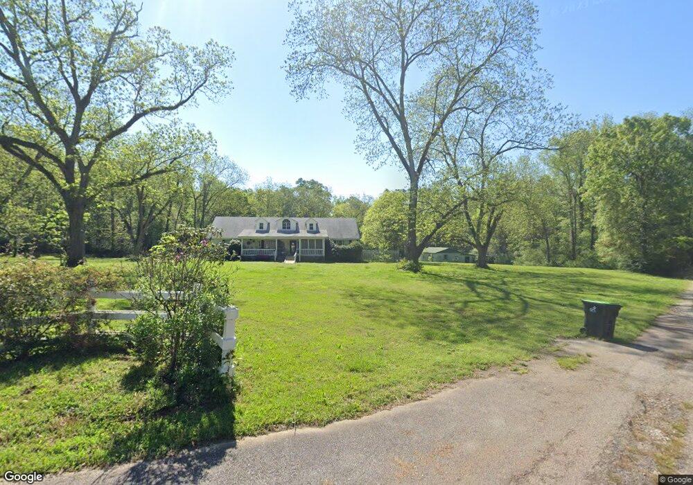
221 Pryor Rd Thomaston, GA 30286
Estimated Value: $286,000 - $414,000
3
Beds
2
Baths
1,820
Sq Ft
$182/Sq Ft
Est. Value
About This Home
This home is located at 221 Pryor Rd, Thomaston, GA 30286 and is currently estimated at $330,905, approximately $181 per square foot. 221 Pryor Rd is a home located in Upson County with nearby schools including Upson-Lee South Elementary School, Upson-Lee North Elementary School, and Upson-Lee Middle School.
Ownership History
Date
Name
Owned For
Owner Type
Purchase Details
Closed on
Aug 18, 2006
Sold by
Not Provided
Bought by
Prue John E and Prue Mary F
Current Estimated Value
Home Financials for this Owner
Home Financials are based on the most recent Mortgage that was taken out on this home.
Original Mortgage
$189,900
Outstanding Balance
$113,827
Interest Rate
6.73%
Mortgage Type
New Conventional
Estimated Equity
$217,078
Create a Home Valuation Report for This Property
The Home Valuation Report is an in-depth analysis detailing your home's value as well as a comparison with similar homes in the area
Home Values in the Area
Average Home Value in this Area
Purchase History
| Date | Buyer | Sale Price | Title Company |
|---|---|---|---|
| Prue John E | $199,900 | -- |
Source: Public Records
Mortgage History
| Date | Status | Borrower | Loan Amount |
|---|---|---|---|
| Open | Prue John E | $189,900 |
Source: Public Records
Tax History Compared to Growth
Tax History
| Year | Tax Paid | Tax Assessment Tax Assessment Total Assessment is a certain percentage of the fair market value that is determined by local assessors to be the total taxable value of land and additions on the property. | Land | Improvement |
|---|---|---|---|---|
| 2024 | $2,570 | $100,038 | $17,494 | $82,544 |
| 2023 | $2,496 | $95,231 | $17,494 | $77,737 |
| 2022 | $2,086 | $77,223 | $14,061 | $63,162 |
| 2021 | $1,849 | $70,152 | $14,061 | $56,091 |
| 2020 | $1,877 | $66,547 | $12,979 | $53,568 |
| 2019 | $1,922 | $62,729 | $12,979 | $49,750 |
| 2018 | $1,923 | $62,729 | $12,979 | $49,750 |
| 2017 | $1,904 | $56,620 | $12,979 | $43,641 |
| 2016 | $1,846 | $54,022 | $10,816 | $43,206 |
| 2015 | $1,847 | $54,022 | $10,816 | $43,206 |
| 2014 | $2,125 | $62,048 | $11,872 | $50,176 |
Source: Public Records
Map
Nearby Homes
- 145 Apple Rd
- 668 Mountain View Dr
- 259 Bonanza Dr
- 124 Brookfield Dr
- 781 N Delray Rd
- 561 Jugtown Rd
- 297 Bishop Rd
- 0 Daniel Rd Unit 10644862
- 3854 Us Hwy 19
- 206 Shannon Ct
- 205 Willow Rd
- 0 Stewart Rd
- 307 Pardue Dr
- 0 Tyler Ln
- 328 Rain Valley Cir
- 121 Sheppard Rd
- 325 Rain Valley Cir
- 508 Heath Dr
- 121 David Dr
- 2540 Hannahs Mill Rd
- 223 Pryor Rd
- 61 Pryor Rd
- 110 N Delray Rd
- 3038 McCorkles Curve Rd
- 302 N Delray Rd
- 108 N Delray Rd
- 162 N Delray Rd
- 3098 Pryor Rd
- 192 N Delray Rd
- 0 Pryor Rd Unit 8105730
- 0 Pryor Rd Unit 8105648
- 0 Pryor Rd Unit 8246638
- 0 Pryor Rd Unit 6746881
- 0 Pryor Rd Unit 6655412
- 0 Pryor Rd Unit 8609184
- 3007 McCorkles Curve Rd
- 3019 McCorkles Curve Rd
- 3087 McCorkles Curve Rd
- 3045 McCorkles Curve Rd
- 326 N Delray Rd