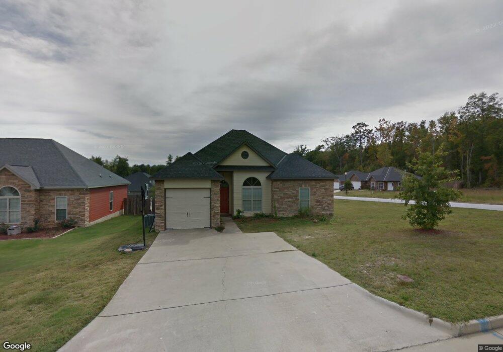
221 Rie Ct Columbus, GA 31907
Eastern Columbus NeighborhoodEstimated Value: $204,000 - $230,860
3
Beds
2
Baths
1,682
Sq Ft
$131/Sq Ft
Est. Value
About This Home
This home is located at 221 Rie Ct, Columbus, GA 31907 and is currently estimated at $220,215, approximately $130 per square foot. 221 Rie Ct is a home located in Muscogee County with nearby schools including Dawson Elementary School, East Columbus Magnet Academy, and Kendrick High School.
Ownership History
Date
Name
Owned For
Owner Type
Purchase Details
Closed on
Nov 19, 2020
Sold by
Florence Eddie
Bought by
Florence Eddie and Florence Jireh M
Current Estimated Value
Purchase Details
Closed on
Dec 10, 2019
Sold by
Gmat Legal Title Trust 2013 1
Bought by
Florence Eddie
Home Financials for this Owner
Home Financials are based on the most recent Mortgage that was taken out on this home.
Original Mortgage
$125,000
Interest Rate
3.7%
Mortgage Type
VA
Purchase Details
Closed on
Mar 5, 2019
Sold by
Walls Cherrese
Bought by
Us Bank National Association Trustee and Gmat Legal Title Trust 2013 1
Purchase Details
Closed on
Nov 20, 2007
Sold by
Robert Ashley Builder Llc
Bought by
Walls Lonnie and Walls Cherrese
Home Financials for this Owner
Home Financials are based on the most recent Mortgage that was taken out on this home.
Original Mortgage
$175,742
Interest Rate
6.36%
Mortgage Type
FHA
Create a Home Valuation Report for This Property
The Home Valuation Report is an in-depth analysis detailing your home's value as well as a comparison with similar homes in the area
Home Values in the Area
Average Home Value in this Area
Purchase History
| Date | Buyer | Sale Price | Title Company |
|---|---|---|---|
| Florence Eddie | -- | -- | |
| Florence Eddie | $125,000 | -- | |
| Us Bank National Association Trustee | -- | -- | |
| Walls Lonnie | $178,500 | None Available |
Source: Public Records
Mortgage History
| Date | Status | Borrower | Loan Amount |
|---|---|---|---|
| Previous Owner | Florence Eddie | $125,000 | |
| Previous Owner | Walls Lonnie | $175,742 |
Source: Public Records
Tax History Compared to Growth
Tax History
| Year | Tax Paid | Tax Assessment Tax Assessment Total Assessment is a certain percentage of the fair market value that is determined by local assessors to be the total taxable value of land and additions on the property. | Land | Improvement |
|---|---|---|---|---|
| 2025 | $306 | $78,056 | $13,384 | $64,672 |
| 2024 | $306 | $78,056 | $13,384 | $64,672 |
| 2023 | $307 | $78,056 | $13,384 | $64,672 |
| 2022 | $2,284 | $55,928 | $13,384 | $42,544 |
| 2021 | $2,115 | $51,804 | $13,384 | $38,420 |
| 2020 | $2,042 | $50,000 | $13,160 | $36,840 |
| 2019 | $2,372 | $60,208 | $13,384 | $46,824 |
| 2018 | $2,372 | $60,208 | $13,384 | $46,824 |
| 2017 | $2,381 | $60,208 | $13,384 | $46,824 |
| 2016 | $2,391 | $71,228 | $15,200 | $56,028 |
| 2015 | $958 | $71,228 | $15,200 | $56,028 |
| 2014 | $2,398 | $71,228 | $15,200 | $56,028 |
| 2013 | -- | $71,228 | $15,200 | $56,028 |
Source: Public Records
Map
Nearby Homes
- 100 R C Allen Dr
- 31 R C Allen Dr
- 5021 Shirley Ann Dr
- 300 Jefferson Dr
- 5003 Shirley Ann Dr
- 4846 Maplewood Dr
- 4930 Capricorn Ct
- 59 Apollo Dr
- 5235 Vincent Dr
- 4965 Brightstar Ln
- 4917 Brightstar Ln
- 4801 Allen St
- 4201 Valley Crest Dr
- 780 Honey Do Ct
- 418 Henson Ave
- 4516 Sims St
- 391 & 401 Victoria Dr
- 558 Wilder Dr
- 4534 Sentry St
- 4408 Walking Stick Way
- 217 Rie Ct
- 300 Ella Ct
- 296 Ella Ct
- 213 Rie Ct Unit 35
- 213 Rie Ct
- 77 Rc Allen Dr Unit 3
- 77 Rc Allen Dr
- 77 R C Allen Dr
- 81 R C Allen Dr
- 73 Rc Allen Dr Unit 4
- 73 Rc Allen Dr
- 81 Rc Allen Dr
- 73 R C Allen Dr
- 222 Rie Ct
- 69 R C Allen Dr
- 218 Rie Ct
- 69 Rc Allen Dr
- 0 Ella Ct Unit 8294180
- 0 Ella Ct Unit 8692842
- 0 Ella Ct Unit 8407322