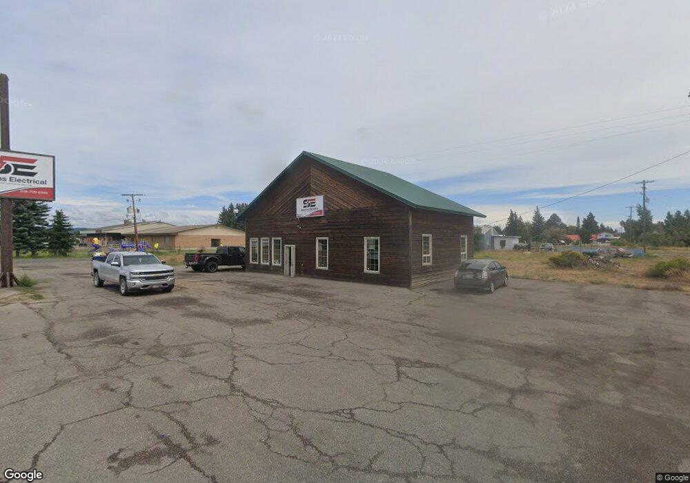
221 S Highway 20 Ashton, ID 83420
--
Bed
2
Baths
1,333
Sq Ft
0.64
Acres
About This Home
This home is located at 221 S Highway 20, Ashton, ID 83420. 221 S Highway 20 is a home located in Fremont County with nearby schools including Ashton Elementary School and North Fremont Junior/Senior High School.
Ownership History
Date
Name
Owned For
Owner Type
Purchase Details
Closed on
Apr 29, 2024
Sold by
Tsoumas Jim D S
Bought by
Sessions Electrical Inc
Home Financials for this Owner
Home Financials are based on the most recent Mortgage that was taken out on this home.
Original Mortgage
$200,000
Outstanding Balance
$197,163
Interest Rate
6.82%
Mortgage Type
New Conventional
Purchase Details
Closed on
Oct 17, 2018
Sold by
Big Impact Investments Llc
Bought by
Tsoumas Jim D S
Home Financials for this Owner
Home Financials are based on the most recent Mortgage that was taken out on this home.
Original Mortgage
$139,000
Interest Rate
4.6%
Mortgage Type
New Conventional
Purchase Details
Closed on
Jun 20, 2013
Sold by
Vanderbeek Hans and Vanderbeek Jody
Bought by
Big Impact Investments Llc
Purchase Details
Closed on
Jul 10, 2006
Sold by
Creek Alex Craig
Bought by
Vanderbeek Hans and Vanderbeek Jody
Create a Home Valuation Report for This Property
The Home Valuation Report is an in-depth analysis detailing your home's value as well as a comparison with similar homes in the area
Home Values in the Area
Average Home Value in this Area
Purchase History
| Date | Buyer | Sale Price | Title Company |
|---|---|---|---|
| Sessions Electrical Inc | -- | Flying S Title And Escrow | |
| Tsoumas Jim D S | -- | Alliance Title & Escrow Corp | |
| Big Impact Investments Llc | -- | None Available | |
| Vanderbeek Hans | -- | -- |
Source: Public Records
Mortgage History
| Date | Status | Borrower | Loan Amount |
|---|---|---|---|
| Open | Sessions Electrical Inc | $200,000 | |
| Previous Owner | Tsoumas Jim D S | $139,000 |
Source: Public Records
Tax History Compared to Growth
Tax History
| Year | Tax Paid | Tax Assessment Tax Assessment Total Assessment is a certain percentage of the fair market value that is determined by local assessors to be the total taxable value of land and additions on the property. | Land | Improvement |
|---|---|---|---|---|
| 2025 | $2,107 | $176,440 | $59,800 | $116,640 |
| 2024 | $2,107 | $176,440 | $59,800 | $116,640 |
| 2023 | $1,853 | $149,224 | $59,800 | $89,424 |
| 2022 | $2,348 | $135,590 | $59,800 | $75,790 |
| 2021 | $2,241 | $104,404 | $46,046 | $58,358 |
| 2020 | $2,295 | $104,404 | $46,046 | $58,358 |
| 2019 | $2,262 | $104,404 | $46,046 | $58,358 |
| 2018 | $2,319 | $104,404 | $46,046 | $58,358 |
| 2017 | $23 | $104,404 | $46,046 | $58,358 |
| 2016 | $2,241 | $104,404 | $46,046 | $58,358 |
| 2015 | $2,328 | $104,404 | $0 | $0 |
| 2014 | $1,994 | $104,404 | $0 | $0 |
| 2013 | $1,994 | $104,404 | $0 | $0 |
Source: Public Records
Map
Nearby Homes
- L2 BLK 1 E 1300 Rd N
- 417 Main St
- 1189 N Sunflower Ln
- 511 Id-47
- 641 Fremont St
- 137 Spruce St
- 540 N 4th St Unit 4
- 540 N 4th St Unit 2
- 540 N 4th St Unit 3
- 268 10th St
- 885 Maple St
- LOTS 1-3 E 1300 Rd N
- 1413 U S 20
- 3660 E 1312 N
- TBD Annies Landing
- 1331 N 3687 E
- 3706 E 1300 Rd N
- 3660 E 1100 N
- 3656 Fishermans Dr
- TBD Fishermans Dr