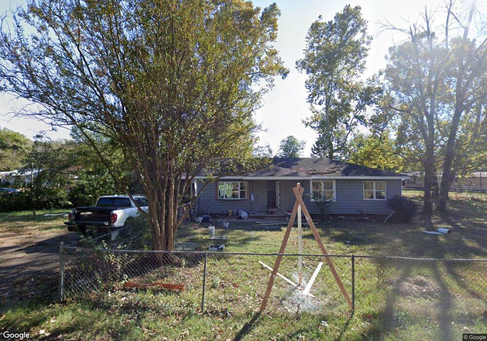
221 Starr Dr Hot Springs National Park, AR 71901
Estimated Value: $135,000 - $228,000
3
Beds
1
Bath
1,372
Sq Ft
$129/Sq Ft
Est. Value
About This Home
This home is located at 221 Starr Dr, Hot Springs National Park, AR 71901 and is currently estimated at $176,345, approximately $128 per square foot. 221 Starr Dr is a home located in Garland County with nearby schools including Lakeside Primary School, Lakeside Intermediate School, and Lakeside Middle School.
Ownership History
Date
Name
Owned For
Owner Type
Purchase Details
Closed on
May 13, 2020
Sold by
Halley Anthony and Halley Jennifer
Bought by
Brown Properties Of Hot Springs Inc
Current Estimated Value
Purchase Details
Closed on
Feb 24, 2006
Sold by
Not Provided
Bought by
Rose David R and Rose Sharon J
Purchase Details
Closed on
Jun 30, 2005
Sold by
Not Provided
Bought by
Rose David W and Rose Sharon J
Purchase Details
Closed on
Jul 11, 1990
Sold by
Not Provided
Bought by
Rose David W and Rose Sharon J
Create a Home Valuation Report for This Property
The Home Valuation Report is an in-depth analysis detailing your home's value as well as a comparison with similar homes in the area
Home Values in the Area
Average Home Value in this Area
Purchase History
| Date | Buyer | Sale Price | Title Company |
|---|---|---|---|
| Brown Properties Of Hot Springs Inc | $17,780 | Garland County Title Company | |
| Halley Anthony | $65,000 | Garland County Title Co | |
| Rose David R | -- | -- | |
| Rose David W | -- | -- | |
| Rose David W | $15,000 | -- |
Source: Public Records
Tax History Compared to Growth
Tax History
| Year | Tax Paid | Tax Assessment Tax Assessment Total Assessment is a certain percentage of the fair market value that is determined by local assessors to be the total taxable value of land and additions on the property. | Land | Improvement |
|---|---|---|---|---|
| 2025 | $554 | $25,370 | $5,960 | $19,410 |
| 2024 | $1,139 | $25,370 | $5,960 | $19,410 |
| 2023 | $963 | $25,370 | $5,960 | $19,410 |
| 2022 | $993 | $25,370 | $5,960 | $19,410 |
| 2021 | $915 | $17,880 | $3,980 | $13,900 |
| 2020 | $540 | $17,880 | $3,980 | $13,900 |
| 2019 | $435 | $17,880 | $3,980 | $13,900 |
| 2018 | $435 | $17,880 | $3,980 | $13,900 |
| 2017 | $738 | $17,880 | $3,980 | $13,900 |
| 2016 | $839 | $17,060 | $6,350 | $10,710 |
| 2015 | $275 | $17,060 | $6,350 | $10,710 |
| 2014 | $248 | $14,494 | $3,969 | $10,525 |
Source: Public Records
Map
Nearby Homes
- xxx Rivermist Point
- 3505 Malvern Rd
- 132 Indian Springs Rd
- 000 Hays St
- 248 Elmwood Dr
- 183 Hays St
- 106 Lecroy Rd
- 102 Willman Square
- 836 Shady Heights Rd
- Lot 18 Lance Cir
- 197 Catherine Heights Rd Unit B
- 197 Catherine Heights Rd
- 137 Parkshores Cir
- 812 Shady Heights Rd
- 149 Parkshores Cir
- 126 Lance Cir
- 122 Lance Cir
- 159 Catherine Heights Rd
- 285 Wilson Lake Ln
- 270 Scroggins Terrace
- 101 Warren St
- 110 Irwin Cir
- 140 Warren St
- 120 Warren St
- 199 Starr Dr
- 155 Warren St
- 0 Starr Dr Unit 17031399
- 0 Starr Dr Unit 18000558
- 196 Starr Dr
- 140 Irwin Point Unit includes 143 Warren
- 140 Irwin Point Unit 143 Warren St.
- 188 Starr Dr
- 175 Irwin Cir
- 160 Irwin Cir
- 175 Starr Dr
- 180 Starr Dr
- 176 Starr Dr
- 170 Starr Dr
- 3547 Malvern Rd
- 160 Starr Dr