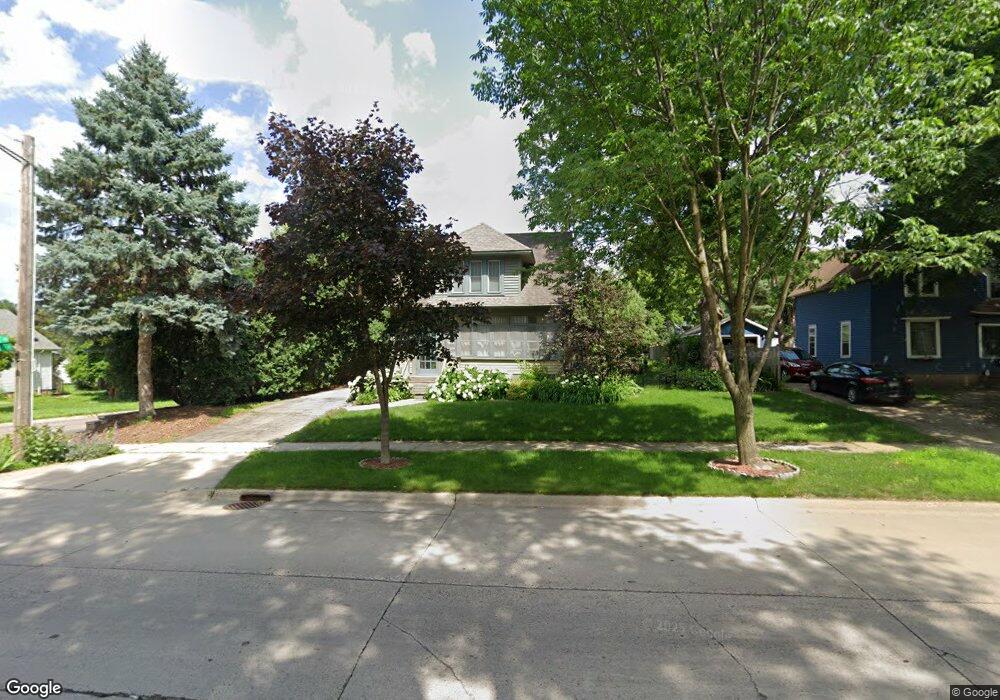
221 State Ave Owatonna, MN 55060
Estimated Value: $290,000 - $328,000
3
Beds
3
Baths
2,133
Sq Ft
$142/Sq Ft
Est. Value
About This Home
This home is located at 221 State Ave, Owatonna, MN 55060 and is currently estimated at $302,464, approximately $141 per square foot. 221 State Ave is a home located in Steele County with nearby schools including Wilson Elementary School, Owatonna Middle School, and Owatonna Senior High School.
Ownership History
Date
Name
Owned For
Owner Type
Purchase Details
Closed on
Nov 3, 2015
Sold by
Simon Jon L and Simon Beverly A
Bought by
Clay Christine M
Current Estimated Value
Home Financials for this Owner
Home Financials are based on the most recent Mortgage that was taken out on this home.
Original Mortgage
$176,000
Outstanding Balance
$138,197
Interest Rate
3.74%
Mortgage Type
VA
Estimated Equity
$164,267
Create a Home Valuation Report for This Property
The Home Valuation Report is an in-depth analysis detailing your home's value as well as a comparison with similar homes in the area
Home Values in the Area
Average Home Value in this Area
Purchase History
| Date | Buyer | Sale Price | Title Company |
|---|---|---|---|
| Clay Christine M | $176,000 | -- |
Source: Public Records
Mortgage History
| Date | Status | Borrower | Loan Amount |
|---|---|---|---|
| Open | Clay Christine M | $176,000 |
Source: Public Records
Tax History Compared to Growth
Tax History
| Year | Tax Paid | Tax Assessment Tax Assessment Total Assessment is a certain percentage of the fair market value that is determined by local assessors to be the total taxable value of land and additions on the property. | Land | Improvement |
|---|---|---|---|---|
| 2025 | $3,948 | $288,500 | $30,100 | $258,400 |
| 2024 | $3,690 | $281,000 | $26,900 | $254,100 |
| 2023 | $3,592 | $255,600 | $22,200 | $233,400 |
| 2022 | $3,112 | $238,600 | $20,900 | $217,700 |
| 2021 | $2,924 | $190,120 | $18,620 | $171,500 |
| 2020 | $2,864 | $178,066 | $18,620 | $159,446 |
| 2019 | $2,634 | $168,462 | $18,620 | $149,842 |
| 2018 | $2,478 | $165,130 | $17,052 | $148,078 |
| 2017 | $2,318 | $156,506 | $16,170 | $140,336 |
| 2016 | $1,704 | $148,764 | $16,170 | $132,594 |
| 2015 | -- | $0 | $0 | $0 |
| 2014 | -- | $0 | $0 | $0 |
Source: Public Records
Map
Nearby Homes
- 420 Fairview St
- 468 Mound St
- 116 Selby Ave
- 206 Selby Ave
- 360 Thomas Ave
- 421 S Oak Ave
- 625 Linn Ave
- 640 Lemond Rd
- 231 E Pearl St
- 540 Allan Ave
- 919 Mosher Ave
- 916 Linn Ave SW
- 604 S Elm Ave
- 234 E School St
- 316 E Pearl St
- 248 E School St
- 819 819 S Cedar Ave
- 819 S Cedar Ave
- 1015 Grandview Ave
- xxx Kilworth Dr NW
- 215 State Ave
- 303 State Ave
- 222 Highland Ave
- 216 Highland Ave
- 466 Fairview St
- 304 Highland Ave Unit Upstairs
- 311 State Ave
- 460 Fairview St
- 310 Highland Ave
- 456 Fairview St
- 313 State Ave
- 316 Highland Ave
- 222 State Ave
- 123 State Ave
- 223 Highland Ave
- 329 State Ave
- 314 State Ave
- 217 Highland Ave
- 128 State Ave
- 446 Fairview St