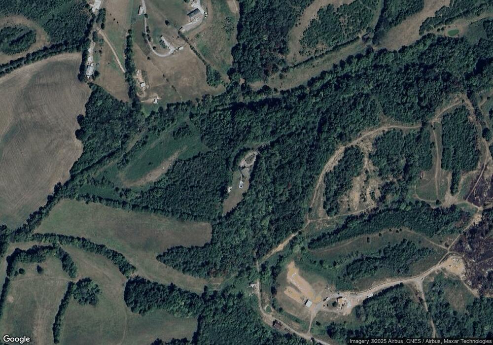
221 That A Way Newport, TN 37821
Estimated Value: $341,000 - $400,783
--
Bed
2
Baths
1,664
Sq Ft
$223/Sq Ft
Est. Value
About This Home
This home is located at 221 That A Way, Newport, TN 37821 and is currently estimated at $371,696, approximately $223 per square foot. 221 That A Way is a home located in Cocke County with nearby schools including Centerview Elementary School and Cocke County High School.
Ownership History
Date
Name
Owned For
Owner Type
Purchase Details
Closed on
Jul 20, 2012
Sold by
Deutsche Bank National Tru
Bought by
Sutton Ronnie T and Sutton Lori S
Current Estimated Value
Home Financials for this Owner
Home Financials are based on the most recent Mortgage that was taken out on this home.
Original Mortgage
$100,215
Outstanding Balance
$68,882
Interest Rate
3.58%
Mortgage Type
Cash
Estimated Equity
$302,814
Purchase Details
Closed on
Oct 20, 2011
Sold by
Stamper William D
Bought by
Deutsche Bank National Trust C and C/O American Home Mtg Servicin
Purchase Details
Closed on
Mar 3, 2005
Sold by
Breece Madonna R Et Vir
Bought by
Stamper William D
Home Financials for this Owner
Home Financials are based on the most recent Mortgage that was taken out on this home.
Original Mortgage
$141,100
Interest Rate
8.25%
Mortgage Type
Cash
Purchase Details
Closed on
Apr 7, 1998
Bought by
Breece Madonna R
Create a Home Valuation Report for This Property
The Home Valuation Report is an in-depth analysis detailing your home's value as well as a comparison with similar homes in the area
Home Values in the Area
Average Home Value in this Area
Purchase History
| Date | Buyer | Sale Price | Title Company |
|---|---|---|---|
| Sutton Ronnie T | $117,900 | -- | |
| Deutsche Bank National Trust C | $137,953 | -- | |
| Stamper William D | $169,950 | -- | |
| Breece Madonna R | $500 | -- |
Source: Public Records
Mortgage History
| Date | Status | Borrower | Loan Amount |
|---|---|---|---|
| Open | Sutton Ronnie T | $100,215 | |
| Previous Owner | Breece Madonna R | $141,100 |
Source: Public Records
Tax History Compared to Growth
Tax History
| Year | Tax Paid | Tax Assessment Tax Assessment Total Assessment is a certain percentage of the fair market value that is determined by local assessors to be the total taxable value of land and additions on the property. | Land | Improvement |
|---|---|---|---|---|
| 2024 | $1,132 | $44,200 | $10,350 | $33,850 |
| 2023 | $1,132 | $44,200 | $10,350 | $33,850 |
| 2022 | $1,134 | $44,200 | $10,350 | $33,850 |
| 2021 | $1,134 | $44,200 | $10,350 | $33,850 |
| 2020 | $1,134 | $44,200 | $10,350 | $33,850 |
| 2019 | $1,061 | $37,475 | $6,650 | $30,825 |
| 2018 | $1,061 | $37,475 | $6,650 | $30,825 |
| 2017 | $1,087 | $37,475 | $6,650 | $30,825 |
| 2016 | $970 | $37,475 | $6,650 | $30,825 |
| 2015 | $1,067 | $37,475 | $6,650 | $30,825 |
| 2014 | $1,067 | $37,475 | $6,650 | $30,825 |
| 2013 | $1,067 | $44,475 | $9,700 | $34,775 |
Source: Public Records
Map
Nearby Homes
- 2128 Holt Town Rd
- 00 Henry Rd
- 836 Fowlers Ridge Rd
- Lots 6 & 7 Corn Hollow Rd
- Lot 7 Corn Hollow Rd
- Lot 6 Corn Hollow Rd
- 0 Corn Hollow Rd
- 0 Buford Rd
- 2600 Moore Ridge Rd
- Tbd1 Briar Thicket Rd
- 2395 Howard Rd
- 3441 Glendale Rd
- 1570 River Path
- 1559 River Path
- 5715 Fishing Rod Ln
- 1555 River Path Unit 36
- 1555 River Path
- 1558 River Path
- 1540 River Path
- 1515 River Path Unit 46
- 219 That A Way
- 529 Keisling Rd
- 495 Keisling Rd
- 487 Keisling Rd
- 520 Keisling Rd
- 510 Keisling Rd
- 481 Keisling Rd
- 2955 Point Pleasant Rd
- 3060 Point Pleasant Rd
- 441 Keisling Rd
- 2939 Point Pleasant Rd
- 3035 High Point Rd
- 540 Turner Ridge Rd
- 2945 Point Pleasant Rd
- 570 Turner Ridge Rd
- 2931 Point Pleasant Rd
- 3033 High Point Rd
- 29391 Point Pleasant Rd
- 29399 Point Pleasant Rd
- 412 Keisling Rd
